
| Distance / Altitude | Location | Report Date / Time | Live Weather | Wind | Gusts | Temp. | Visibility | Cloud |
|---|---|---|---|---|---|---|---|---|
| 39 km NE / 91 m | LA Roche -Sur -Yon (France) | 2026-07-05 17:00 local (2026/07/05 15:00 GMT) | - | light winds from the N (7 km/h at 350) | — | 18 | - - - | |
| 40 km NE / 347 m | La Roche sur-Yon Aerodrome/Les Ajoncs Airport (France) | 2026-07-05 16:30 local (2026/07/05 14:30 GMT) | - | light winds from the N.(Wind varies from 290 to 060 degs) (13 km/h at 350) | — | 0.0 | ||
| 41 km SE / 5 m | Ile de Ré (PSL LOIX) (France) | 2026-07-05 17:00 local (2026/07/05 15:00 GMT) | - | strong winds from the WNW (39 km/h at 291) | 26°C | - | - - 0 | |
| 46 km W / 32 m | L Ile D Yeu (France) | 2026-07-05 17:00 local (2026/07/05 15:00 GMT) | no report | wind obs. (7 kph from 30 degs) was rejected (- km/h at -) | 20°C | - | - - - | |
| 59 km SSE / 23 m | Pointe DE Chassiron (France) | 2026-07-05 17:00 local (2026/07/05 15:00 GMT) | no report | wind obs. (7 kph from 260 degs) was rejected (- km/h at -) | 20°C | - | - - - | |
| 59 km SE / 18 m | La Rochelle Aeroport Ile de Ré (France) | 2026-07-05 17:00 local (2026/07/05 15:00 GMT) | no report | light winds from the NW (11 km/h at 320) | 19°C | 35 | - - - | |
| 66 km SE / 217 m | La Rochelle/Île de Ré Airport (France) | 2026-07-05 16:30 local (2026/07/05 14:30 GMT) | - | moderate winds from the WNW (28 km/h at 300) | — | 0.0 | ||
| 74 km NNE / 26 m | Nantes -Bouguenais (France) | 2026-07-05 16:30 local (2026/07/05 14:30 GMT) | - | light winds from the N (7 km/h at 350) | — | 10 | - - - | |
| 75 km ESE / 19 m | Saint-Médard-d'Aunis wx (France) | 2026-07-05 17:02 local (2026/07/05 15:02 GMT) | dry | light winds from the NW (19 km/h at 309) | 33°C | - | - - 0 | |
| 76 km NNE / 216 m | Nantes Atlantique Airport (France) | 2026-07-05 16:30 local (2026/07/05 14:30 GMT) | - | light winds from the NNE.(Wind varies from 290 to 100 degs) (9 km/h at 30) | — | 0.0 |
| Contours: | Roads & Rivers: | Select a
tide station / surf break / city |
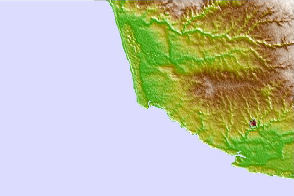
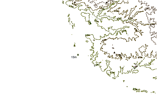
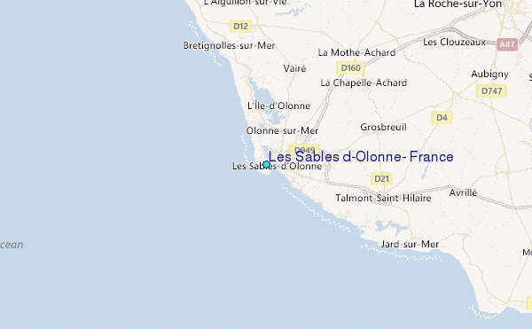
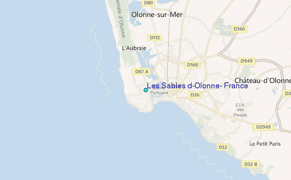
Use this relief map to navigate to tide stations, surf breaks and cities that are in the area of Les Sables d'Olonne, France.
Other Nearby Locations' tide tables and tide charts to Les Sables d'Olonne, France:
click location name for more details
 Surf breaks close to Les Sables d'Olonne, France:
|
||
|---|---|---|
| Closest surf break | La Baie Des Sables | 1 mi |
| Second closest surf break | L'Aubraie | 1 mi |
| Third closest surf break | Tanchet | 2 mi |
| Fourth closest surf break | Sauveterre | 3 mi |
| Fifth closest surf break | Les Dunes | 4 mi |


 Nearest
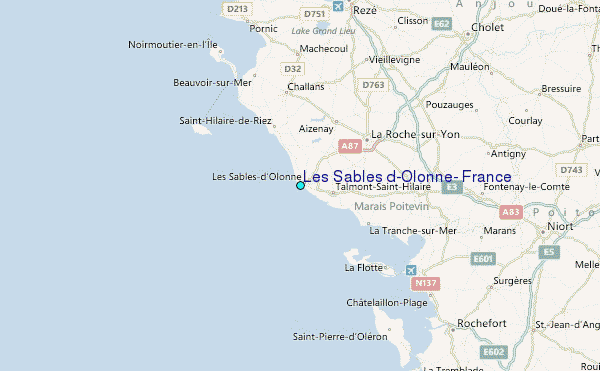