
| Distance / Altitude | Location | Report Date / Time | Live Weather | Wind | Gusts | Temp. | Visibility | Cloud |
|---|---|---|---|---|---|---|---|---|
| 13 km SW / 3 m | BUOY-PMAF1 (Marine) | 2026-07-23 21:00 local (2026/07/24 01:00 GMT) | - (- km/h at -) | 31°C | - | |||
| 15 km SW / 3 m | BUOY-MTBF1 (Marine) | 2026-07-23 21:00 local (2026/07/24 01:00 GMT) | moderate winds from the NNE (22 km/h at 20) | 30°C | 10.9 | |||
| 17 km NW / 212 m | MacDill Air Force Base/Tampa Airport (Florida) | 2026-07-23 20:20 local (2026/07/24 00:20 GMT) | Light rain | light winds from the NW (11 km/h at 320) | 31°C | 13 | few scattered broken | |
| 18 km WNW / 0 m | lightning 7km SE of Gandy (United States) | 2026-07-23 21:50 local (2026/07/24 01:50 GMT) | Thunderstorm | (- km/h at -) | — | |||
| 19 km W / 218 m | St Peters/Albert Whitted Airport (Florida) | 2026-07-23 19:53 local (2026/07/23 23:53 GMT) | Clear | light winds from the NNW (19 km/h at 340) | 32°C | 16 | ||
| 19 km W / 2 m | lightning 6km ESE of Saint Petersburg (United States) | 2026-07-23 21:50 local (2026/07/24 01:50 GMT) | Thunderstorm | (- km/h at -) | — | |||
| 19 km W / 3 m | BUOY-SAPF1 (Marine) | 2026-07-23 21:00 local (2026/07/24 01:00 GMT) | light winds from the N (13 km/h at 360) | 31°C | - | |||
| 20 km NW / 3 m | BUOY-OPTF1 (Marine) | 2026-07-23 21:00 local (2026/07/24 01:00 GMT) | light winds from the N (18 km/h at 360) | 30°C | - | |||
| 22 km NNE / 15 m | SHIP4032 (Marine) | 2026-07-23 20:00 local (2026/07/24 00:00 GMT) | - (- km/h at -) | — | - km | |||
| 22 km NNE / 3 m | SHIP6599 (Marine) | 2026-07-23 19:00 local (2026/07/23 23:00 GMT) | - (- km/h at -) | 33°C | - |
| Contours: | Roads & Rivers: | Select a
tide station / surf break / city |
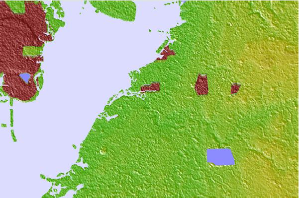
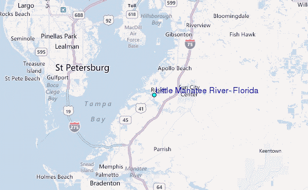
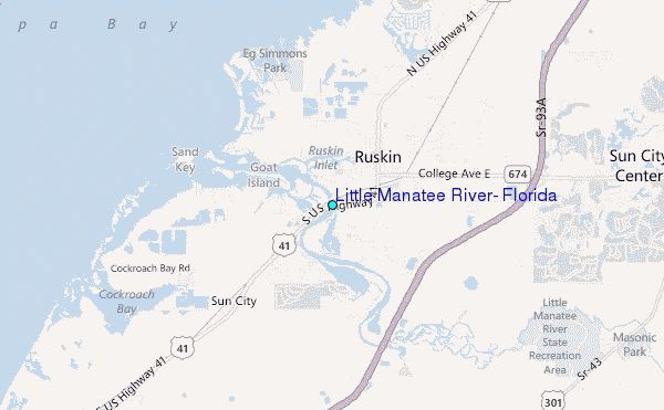
Use this relief map to navigate to tide stations, surf breaks and cities that are in the area of Little Manatee River, Florida.
Other Nearby Locations' tide tables and tide charts to Little Manatee River, Florida:
click location name for more details
 Surf breaks close to Little Manatee River, Florida:
|
||
|---|---|---|
| Closest surf break | Upham Beach | 19 mi |
| Second closest surf break | Sunset Beach | 19 mi |
| Third closest surf break | Anna Maria Island | 21 mi |
| Fourth closest surf break | Anna Maria Key | 22 mi |
| Fifth closest surf break | Holmes Beach Pier | 22 mi |


 Nearest
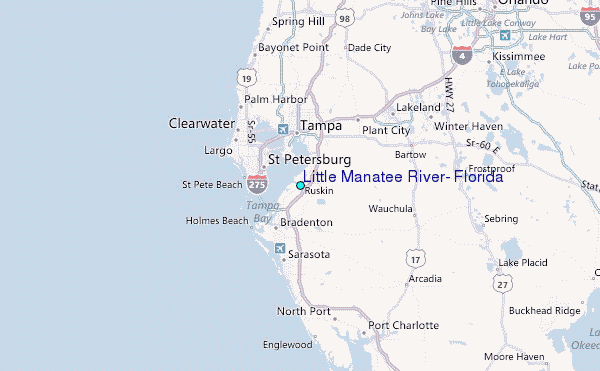