
| Distance / Altitude | Location | Report Date / Time | Live Weather | Wind | Gusts | Temp. | Visibility | Cloud |
|---|---|---|---|---|---|---|---|---|
| 15 km SSE / 3 m | BUOY-SJSN4 (Marine) | 2026-06-23 22:48 local (2026/06/24 02:48 GMT) | light winds from the NW (13 km/h at 320) | — | - | |||
| 21 km WNW / 3 m | BUOY-DELD1 (Marine) | 2026-06-23 22:48 local (2026/06/24 02:48 GMT) | light winds from the WNW (11 km/h at 300) | — | - | |||
| 27 km S / 17 m | Delaware Airpark Dover-Cheswold (Delaware) (Delaware) | 2026-06-23 22:35 local (2026/06/24 02:35 GMT) | - | light winds from the W (7 km/h at 270) | 17°C | 16 | ||
| 29 km NW / 216 m | Wilmington Airport (Delaware) | 2026-06-23 21:51 local (2026/06/24 01:51 GMT) | Clear | light winds from the NW (9 km/h at 320) | 18°C | 16 | ||
| 32 km ESE / 218 m | Millville Airport (New Jersey) | 2026-06-23 21:54 local (2026/06/24 01:54 GMT) | - | light winds from the NW (6 km/h at 310) | 18°C | 16 | few | |
| 33 km W / 3 m | BUOY-CHCM2 (Marine) | 2026-06-23 22:48 local (2026/06/24 02:48 GMT) | calm (2 km/h at 200) | — | - | |||
| 35 km S / 218 m | Dover Air Force Base Airport (Delaware) | 2026-06-23 21:55 local (2026/06/24 01:55 GMT) | Clear | light winds from the WNW (6 km/h at 300) | 19°C | 16 | ||
| 36 km WNW / 24 m | Newark (Delaware) | 2026-06-23 22:19 local (2026/06/24 02:19 GMT) | dry | calm (0 km/h at 287) | 19°C | - | - - 0 | |
| 37 km N / 6 m | Logan Township (New Jersey) | 2026-06-23 23:10 local (2026/06/24 03:10 GMT) | dry | calm (0 km/h at 321) | 18°C | - | - - 0 | |
| 38 km S / 3 m | BUOY-DRSD1 (Marine) | 2026-06-23 22:30 local (2026/06/24 02:30 GMT) | - (0 km/h at -) | 18°C | - |
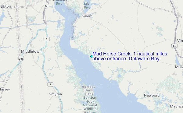
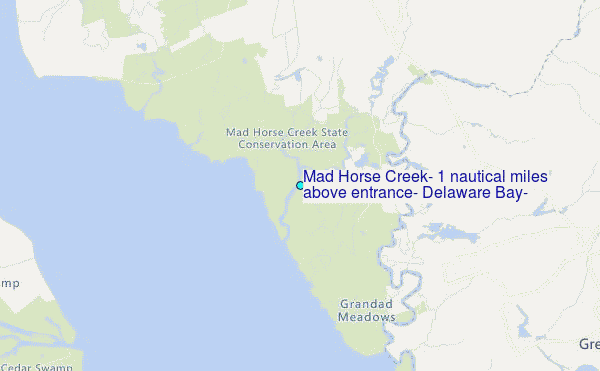
Choose Mad Horse Creek, 1 nautical miles above entrance, Delaware Bay, Delaware Location Map Zoom:
| Contours: | Roads & Rivers: | Select a
tide station / surf break / city |
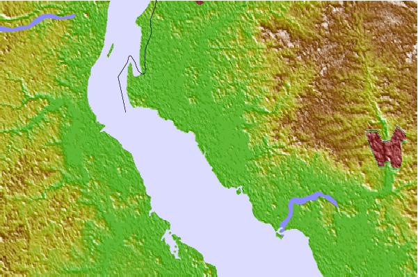

Use this relief map to navigate to tide stations, surf breaks and cities that are in the area of Mad Horse Creek, 1 nautical miles above entrance, Delaware Bay, Delaware.
Other Nearby Locations' tide tables and tide charts to Mad Horse Creek, 1 nautical miles above entrance, Delaware Bay, Delaware:
click location name for more details
 Surf breaks close to Mad Horse Creek, 1 nautical miles above entrance, Delaware Bay, Delaware:
|
||
|---|---|---|
| Closest surf break | Broadway | 44 mi |
| Second closest surf break | The Cove Cape May | 44 mi |
| Third closest surf break | Chodes | 45 mi |
| Fourth closest surf break | 52nd Street | 45 mi |
| Fifth closest surf break | 47th Street | 45 mi |


 Nearest
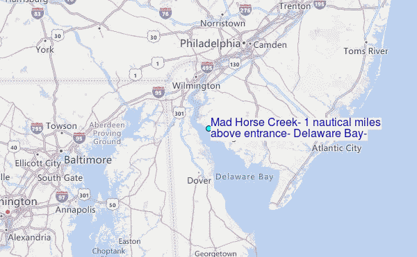