
| Distance / Altitude | Location | Report Date / Time | Live Weather | Wind | Gusts | Temp. | Visibility | Cloud |
|---|---|---|---|---|---|---|---|---|
| 34 km SSW / 5 m | Saint -Laurent (France) | 2026-07-09 21:00 local (2026/07/10 00:00 GMT) | no report | - (- km/h at -) | 24°C | - | - | |
| 95 km NW / 15 m | ASCATB306E6N (Marine) | 2026-07-09 20:56 local (2026/07/09 23:56 GMT) | moderate winds from the NE (24 km/h at 51) | — | - km | |||
| 107 km NNE / 15 m | ASCATB306E7N (Marine) | 2026-07-09 20:56 local (2026/07/09 23:56 GMT) | moderate winds from the ENE (24 km/h at 57) | — | - km | |||
| 122 km NE / 15 m | ASCATB307E6N (Marine) | 2026-07-09 20:56 local (2026/07/09 23:56 GMT) | moderate winds from the ENE (22 km/h at 56) | — | - km | |||
| 133 km ESE / 9 m | Cayenne (French Guiana) | 2026-07-09 21:00 local (2026/07/10 00:00 GMT) | no report | calm (0 km/h at 270) | 26°C | - | - | |
| 161 km E / 15 m | ASCATB308E5N (Marine) | 2026-07-09 20:56 local (2026/07/09 23:56 GMT) | moderate winds from the ENE (23 km/h at 61) | — | - km | |||
| 183 km ESE / 9 m | Cayenne Matoury (France) | 2026-07-09 21:00 local (2026/07/10 00:00 GMT) | no report | calm (4 km/h at 360) | 24°C | 30 | - | |
| 183 km ESE / 211 m | Cayenne/Rochambeau Airport (Guiana) | 2026-07-09 20:30 local (2026/07/09 23:30 GMT) | - | light winds from the SE.(Wind varies from 090 to 160 degs) (6 km/h at 130) | — | 0.0 | ||
| 189 km NE / 15 m | ASCATB307E7N (Marine) | 2026-07-09 20:56 local (2026/07/09 23:56 GMT) | moderate winds from the ENE (21 km/h at 70) | — | - km | |||
| 191 km ESE / 90 m | St Hilaire du Rorota (French Guiana) | 2026-07-09 21:00 local (2026/07/10 00:00 GMT) | - | fresh winds from the SE (33 km/h at 135) | 27°C | - | - - 0 |
| Contours: | Roads & Rivers: | Select a
tide station / surf break / city |
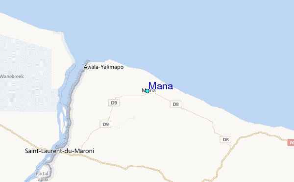
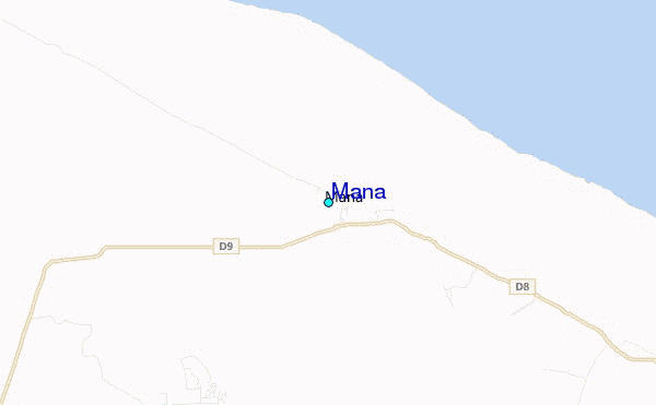
Use this relief map to navigate to tide stations, surf breaks and cities that are in the area of Mana.
Other Nearby Locations' tide tables and tide charts to Mana:
click location name for more details
 Surf breaks close to Mana:
|
||
|---|---|---|
| Closest surf break | Saint Joseph (Iles du Salut) | 86 mi |
| Second closest surf break | Ilet du Novotel | 114 mi |
| Third closest surf break | Anse de Rémire (L'apcat) | 117 mi |
| Fourth closest surf break | Mahury | 119 mi |
| Fifth closest surf break | La Mère | 122 mi |


 Nearest
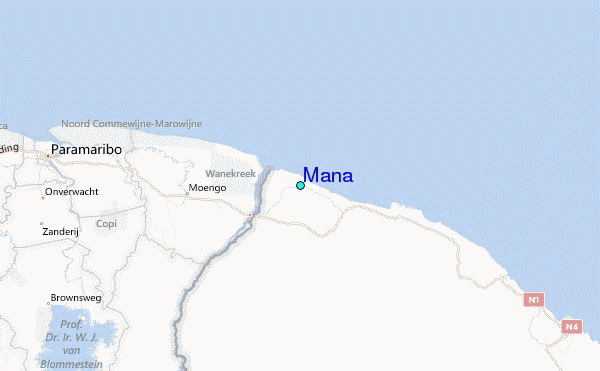