
| Distance / Altitude | Location | Report Date / Time | Live Weather | Wind | Gusts | Temp. | Visibility | Cloud |
|---|---|---|---|---|---|---|---|---|
| 2 km SSW / 3 m | Mariehamn West Harbour (Finland) | 2026-07-09 21:00 local (2026/07/09 18:00 GMT) | no report | wind obs. (25 kph from 200 degs) was rejected (- km/h at -) | 15°C | - | - | |
| 4 km W / 219 m | Mariehamn/Åland Islands Airport (Finland) | 2026-07-09 21:20 local (2026/07/09 18:20 GMT) | - | light winds from the N.(Wind varies from 310 to 010 degs) (15 km/h at 350) | — | 0.0 | ||
| 4 km WNW / 6 m | Jomala Mariehamn Airport (Finland) | 2026-07-09 21:00 local (2026/07/09 18:00 GMT) | no report | wind obs. (22 kph from 190 degs) was rejected (- km/h at -) | 16°C | 60 | - | |
| 16 km S / 10 m | Lemland Nyhamn (Finland) | 2026-07-09 21:00 local (2026/07/09 18:00 GMT) | no report | wind obs. (32 kph from 200 degs) was rejected (- km/h at -) | 14°C | 30 | - | |
| 19 km E / 12 m | Lumparland Langnas Harbour (Finland) | 2026-07-09 21:00 local (2026/07/09 18:00 GMT) | no report | wind obs. (22 kph from 200 degs) was rejected (- km/h at -) | 17°C | - | - | |
| 49 km SSW / 15 m | Soderarm (Sweden) | 2026-07-09 21:00 local (2026/07/09 18:00 GMT) | no report | wind obs. (25 kph from 210 degs) was rejected (- km/h at -) | 15°C | 45 | - | |
| 70 km SSE / 16 m | Kokar Bogskar (Finland) | 2026-07-09 21:00 local (2026/07/09 18:00 GMT) | no report | wind obs. (32 kph from 210 degs) was rejected (- km/h at -) | 13°C | - | - | |
| 78 km S / 14 m | Svenska Hogarna A (Sweden) | 2026-07-09 21:00 local (2026/07/09 18:00 GMT) | no report | wind obs. (32 kph from 210 degs) was rejected (- km/h at -) | 17°C | 70 | - - - | |
| 80 km SW / 16 m | Svanberga (Sweden) | 2026-07-09 21:00 local (2026/07/09 18:00 GMT) | no report | wind obs. (7 kph from 190 degs) was rejected (- km/h at -) | 19°C | 35 | - | |
| 83 km SSE / 15 m | ASCATB20E59N (Marine) | 2026-07-09 20:27 local (2026/07/09 17:27 GMT) | fresh winds from the NNW (30 km/h at 345) | — | - km |
| Contours: | Roads & Rivers: | Select a
tide station / surf break / city |
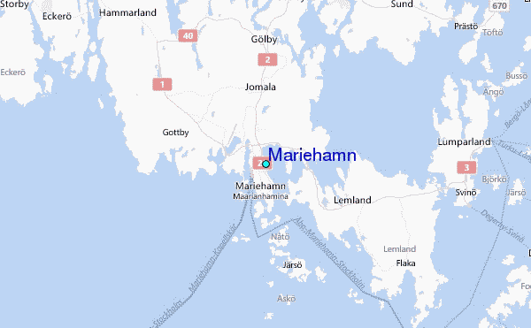
Use this relief map to navigate to tide stations, surf breaks and cities that are in the area of Mariehamn.
Other Nearby Locations' tide tables and tide charts to Mariehamn:
click location name for more details
 Surf breaks close to Mariehamn:
|
||
|---|---|---|
| Closest surf break | Sikhjalma | 78 mi |
| Second closest surf break | Tulliniemi (Hanko) | 104 mi |
| Third closest surf break | Ristna Hiiumaa Island | 109 mi |
| Fourth closest surf break | Toro | 114 mi |
| Fifth closest surf break | Yyteri Bay | 114 mi |


 Nearest
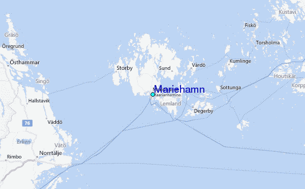