
| Distance / Altitude | Location | Report Date / Time | Live Weather | Wind | Gusts | Temp. | Visibility | Cloud |
|---|---|---|---|---|---|---|---|---|
| 12 km ESE / 76 m | Lake Stevens wx (United States) | 2026-06-23 19:02 local (2026/06/24 02:02 GMT) | dry | calm (2 km/h at 215) | 28°C | - | - - 0 | |
| 12 km ENE / 120 m | Getchell wx (United States) | 2026-06-23 20:14 local (2026/06/24 03:14 GMT) | dry | calm (0 km/h at 137) | 26°C | - | - - 0 | |
| 14 km NNE / 197 m | Arlington Municipal Airport (Washington) | 2026-06-23 18:56 local (2026/06/24 01:56 GMT) | Clear | light winds from the WNW (17 km/h at 300) | 29°C | 16 | ||
| 15 km S / 218 m | Everett Airport (Washington) | 2026-06-23 18:53 local (2026/06/24 01:53 GMT) | Clear | light winds from the NNW (9 km/h at 330) | 27°C | 16 | ||
| 16 km NNE / 43 m | Portage Green Mobile Home Court wx (United States) | 2026-06-23 20:00 local (2026/06/24 03:00 GMT) | dry | calm (3 km/h at 307) | 28°C | - | - - 0 | |
| 18 km N / 22 m | Arlington Junction wx (United States) | 2026-06-23 20:06 local (2026/06/24 03:06 GMT) | dry | calm (2 km/h at 289) | 27°C | - | - - 0 | |
| 22 km ESE / 239 m | Lake Roesiger wx (United States) | 2026-06-23 19:35 local (2026/06/24 02:35 GMT) | dry | calm (0 km/h at 117) | 28°C | - | - - 0 | |
| 22 km SE / 196 m | Snohomish (Washington) | 2026-06-23 19:32 local (2026/06/24 02:32 GMT) | dry | calm (3 km/h at 215) | 27°C | - | - - 0 | |
| 29 km SSE / 137.2 m | Woodinville (Washington) | 2026-06-23 19:42 local (2026/06/24 02:42 GMT) | dry | calm (2 km/h at 150) | 28°C | - | - - 0 | |
| 30 km W / 15 m | SHIP5679 (Marine) | 2026-06-23 19:00 local (2026/06/24 02:00 GMT) | - (- km/h at -) | — | - km |
Choose Marysville, Quilceda Creek, Washington Location Map Zoom:
| Contours: | Roads & Rivers: | Select a
tide station / surf break / city |
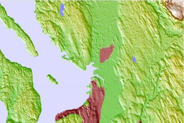
Use this relief map to navigate to tide stations, surf breaks and cities that are in the area of Marysville, Quilceda Creek, Washington.
Other Nearby Locations' tide tables and tide charts to Marysville, Quilceda Creek, Washington:
click location name for more details
 Surf breaks close to Marysville, Quilceda Creek, Washington:
|
||
|---|---|---|
| Closest surf break | Fort. Ebey | 29 mi |
| Second closest surf break | Super green | 50 mi |
| Third closest surf break | Elwha | 63 mi |
| Fourth closest surf break | Crescent | 70 mi |
| Fifth closest surf break | Whiskey Creek | 73 mi |


 Nearest