
| Distance / Altitude | Location | Report Date / Time | Live Weather | Wind | Gusts | Temp. | Visibility | Cloud |
|---|---|---|---|---|---|---|---|---|
| 3 km SSE / 1 m | thunderstorm affecting Roseland (United States) | 2026-07-28 13:16 local (2026/07/28 17:16 GMT) | Thunderstorm | (- km/h at -) | — | |||
| 6 km S / 6 m | Sebastian Airport (Florida) (Florida) | 2026-07-28 14:35 local (2026/07/28 18:35 GMT) | Thunderstorm - in the vicinity | moderate winds from the S (24 km/h at 180) | — | 16 | ||
| 8 km S / 7 m | Sebastian (Florida) | 2026-07-28 14:05 local (2026/07/28 18:05 GMT) | dry | calm (5 km/h at 180) | 30°C | - | - - 0 | |
| 8 km SSE / 14 m | Sebastian (Florida) | 2026-07-28 15:21 local (2026/07/28 19:21 GMT) | dry | calm (5 km/h at 214) | 26°C | - | - - 0 | |
| 10 km SE / 1 m | lightning 5km ENE of Sebastian (United States) | 2026-07-28 13:47 local (2026/07/28 17:47 GMT) | Thunderstorm | (- km/h at -) | — | |||
| 12 km SSE / 6 m | Palm Lake Club Mobile Home Park wx (United States) | 2026-07-28 15:26 local (2026/07/28 19:26 GMT) | dry | wind obs. (6 kph from 198 degs) was rejected (- km/h at -) | 25°C | - | - - 0 | |
| 13 km NW / 0 m | lightning 4km E of Malabar (United States) | 2026-07-28 14:31 local (2026/07/28 18:31 GMT) | Thunderstorm | (- km/h at -) | — | |||
| 13 km S / 7 m | Vero Beach (Florida) | 2026-07-28 15:04 local (2026/07/28 19:04 GMT) | dry | calm (2 km/h at 239) | 27°C | - | - - 0 | |
| 15 km SE / 1 m | Wabasso Beach wx (United States) | 2026-07-28 15:09 local (2026/07/28 19:09 GMT) | dry | wind obs. (6 kph from 72 degs) was rejected (- km/h at -) | 26°C | - | - - 0 | |
| 15 km SE / 2 m | Wabasso Beach wx (United States) | 2026-07-28 15:01 local (2026/07/28 19:01 GMT) | dry | wind obs. (8 kph from 72 degs) was rejected (- km/h at -) | 26°C | - | - - 0 |
| Contours: | Roads & Rivers: | Select a
tide station / surf break / city |
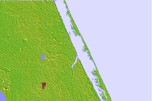
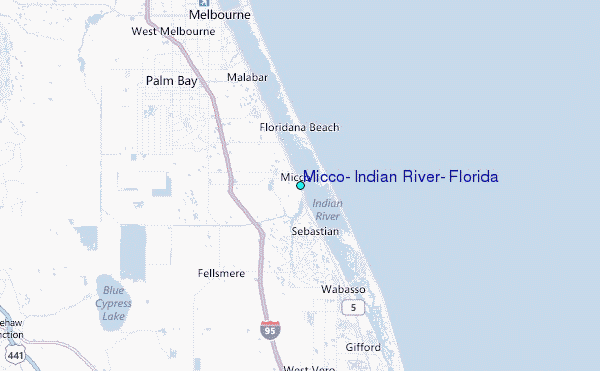
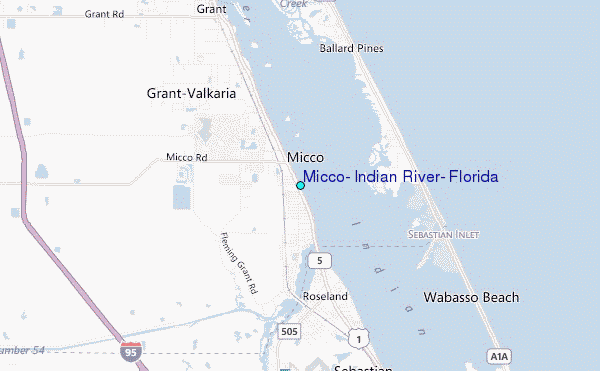
Use this relief map to navigate to tide stations, surf breaks and cities that are in the area of Micco, Indian River, Florida.
Other Nearby Locations' tide tables and tide charts to Micco, Indian River, Florida:
click location name for more details
 Surf breaks close to Micco, Indian River, Florida:
|
||
|---|---|---|
| Closest surf break | Chernobyl | 2 mi |
| Second closest surf break | Long Point | 2 mi |
| Third closest surf break | Sebastian Inlet-First Peak | 2 mi |
| Fourth closest surf break | Sebastian Inlet-Second Peak | 3 mi |
| Fifth closest surf break | Sebastian Inlet-Third Peak | 3 mi |


 Nearest
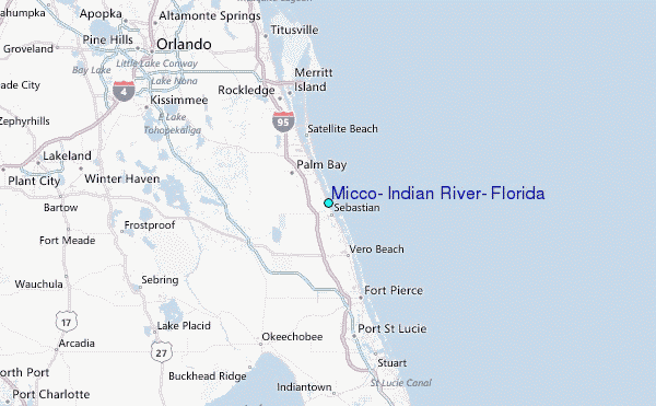