
| Distance / Altitude | Location | Report Date / Time | Live Weather | Wind | Gusts | Temp. | Visibility | Cloud |
|---|---|---|---|---|---|---|---|---|
| 9 km NE / 0 m | lightning 19km NE of Milford (United States) | 2026-07-27 05:01 local (2026/07/27 09:01 GMT) | Thunderstorm | (- km/h at -) | — | |||
| 11 km NW / 1 m | lightning 13km ENE of Riverview (United States) | 2026-07-27 05:01 local (2026/07/27 09:01 GMT) | Thunderstorm | (- km/h at -) | — | |||
| 17 km NW / 0 m | lightning 12km E of Highland Acres (United States) | 2026-07-27 05:01 local (2026/07/27 09:01 GMT) | Thunderstorm | (- km/h at -) | — | |||
| 17 km SE / 0 m | lightning 9km NNW of Lewes (United States) | 2026-07-27 05:02 local (2026/07/27 09:02 GMT) | Thunderstorm | (- km/h at -) | — | |||
| 18 km ENE / 3 m | BUOY-BRND1 (Marine) | 2026-07-27 03:48 local (2026/07/27 07:48 GMT) | moderate winds from the SW (22 km/h at 220) | 23°C | - | |||
| 19 km WNW / 3 m | BUOY-DRSD1 (Marine) | 2026-07-27 03:30 local (2026/07/27 07:30 GMT) | calm (4 km/h at 240) | 20°C | - | |||
| 20 km E / 0 m | lightning 12km WSW of North Cape May (United States) | 2026-07-27 05:02 local (2026/07/27 09:02 GMT) | Thunderstorm | (- km/h at -) | — | |||
| 23 km WNW / 218 m | Dover Air Force Base Airport (Delaware) | 2026-07-27 03:37 local (2026/07/27 07:37 GMT) | - | light winds from the WSW.(Wind varies from 014 to 049 degs) (17 km/h at 250) | — | 0.0 | - - - | |
| 23 km NE / 0 m | lightning 18km WNW of Villas (United States) | 2026-07-27 04:31 local (2026/07/27 08:31 GMT) | Thunderstorm | (- km/h at -) | — | |||
| 23 km SSE / 6 m | Lewes (Delaware) | 2026-07-27 04:02 local (2026/07/27 08:02 GMT) | dry | calm (0 km/h at 52) | 14°C | - | - - 0 |

Choose Mispillion River entrance, Delaware Bay, Delaware Location Map Zoom:
| Contours: | Roads & Rivers: | Select a
tide station / surf break / city |
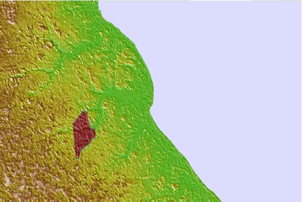

Use this relief map to navigate to tide stations, surf breaks and cities that are in the area of Mispillion River entrance, Delaware Bay, Delaware.
Other Nearby Locations' tide tables and tide charts to Mispillion River entrance, Delaware Bay, Delaware:
click location name for more details
 Surf breaks close to Mispillion River entrance, Delaware Bay, Delaware:
|
||
|---|---|---|
| Closest surf break | Naval Jetties | 17 mi |
| Second closest surf break | The Cove Delaware | 17 mi |
| Third closest surf break | Broadway | 21 mi |
| Fourth closest surf break | Rehoboth Main | 21 mi |
| Fifth closest surf break | The Cove Cape May | 21 mi |


 Nearest