
| Distance / Altitude | Location | Report Date / Time | Live Weather | Wind | Gusts | Temp. | Visibility | Cloud |
|---|---|---|---|---|---|---|---|---|
| 53 km SW / 15 m | Mangawhai Heads (New Zealand) | 2026-07-10 10:29 local (2026/07/09 22:29 GMT) | Dry | wind obs. (7 kph from 225 degs) was rejected (- km/h at -) | 14°C | - | - - - | |
| 53 km SE / 11 m | Oruawharo (New Zealand) | 2026-07-10 10:34 local (2026/07/09 22:34 GMT) | Dry | wind obs. (2 kph from 135 degs) was rejected (- km/h at -) | 13°C | - | - - - | |
| 56 km WSW / 6 m | Marsden Point (New Zealand) | 2026-07-10 10:40 local (2026/07/09 22:40 GMT) | Dry | moderate winds from the S (20 km/h at 180) | 14°C | - | - - - | |
| 57 km SW / 125 m | Te Arai (New Zealand) | 2026-07-10 10:30 local (2026/07/09 22:30 GMT) | Dry | light winds from the S (6 km/h at 180) | 14°C | - | - - - | |
| 60 km WSW / 11 m | IWHANG354 (New Zealand) | 2026-07-10 10:30 local (2026/07/09 22:30 GMT) | Dry | wind obs. (7 kph from 225 degs) was rejected (- km/h at -) | 15°C | - | - - - | |
| 60 km SSE / 48 m | Channel Island (New Zealand) | 2026-07-10 10:40 local (2026/07/09 22:40 GMT) | No weather report | wind obs. (48 kph from 225 degs) was rejected (- km/h at -) | 11°C | - | - - - | |
| 61 km W / 10 m | Pacific Bay (New Zealand) | 2026-07-10 10:31 local (2026/07/09 22:31 GMT) | Dry | light winds from the SE (9 km/h at 135) | 14°C | - | - - - | |
| 61 km W / 4 m | Tutukaka Harbour Automatic Weather Station (New Zealand) | 2026-07-10 10:40 local (2026/07/09 22:40 GMT) | No weather report | fresh winds from the SW (31 km/h at 225) | — | - | - - - | |
| 65 km S / 72 m | CBSandspit (New Zealand) | 2026-07-10 10:32 local (2026/07/09 22:32 GMT) | Dry | wind obs. (2 kph from 0 degs) was rejected (- km/h at -) | 15°C | - | - - - | |
| 70 km W / 25 m | Whangarei Aero Automatic Weather Station (New Zealand) | 2026-07-10 10:40 local (2026/07/09 22:40 GMT) | Recent light rain | light winds from the SW (15 km/h at 225) | 14°C | - | - - - |
| Contours: | Roads & Rivers: | Select a
tide station / surf break / city |
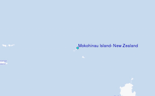
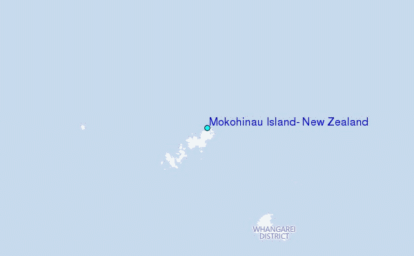
Use this relief map to navigate to tide stations, surf breaks and cities that are in the area of Mokohinau Island, New Zealand.
Other Nearby Locations' tide tables and tide charts to Mokohinau Island, New Zealand:
click location name for more details
 Surf breaks close to Mokohinau Island, New Zealand:
|
||
|---|---|---|
| Closest surf break | Okiwi - Whangapoua Estuary | 24 mi |
| Second closest surf break | Awana | 30 mi |
| Third closest surf break | Goat Island Reef | 31 mi |
| Fourth closest surf break | Kaitoke Beach | 31 mi |
| Fifth closest surf break | Black Swamp | 32 mi |


 Nearest
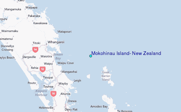