
| Distance / Altitude | Location | Report Date / Time | Live Weather | Wind | Gusts | Temp. | Visibility | Cloud |
|---|---|---|---|---|---|---|---|---|
| 21 km WSW / 218 m | Westerly Airport (Rhode Island) | 2026-06-23 21:53 local (2026/06/24 01:53 GMT) | Light rain | calm (0 km/h at 0) | 19°C | 13 | broken broken | |
| 22 km S / 211 m | Block Island Airport (Rhode Island) | 2026-06-23 21:56 local (2026/06/24 01:56 GMT) | Light rain | calm (0 km/h at 0) | 17°C | 13 | broken overcast | |
| 24 km NE / 3 m | BUOY-NWPR1 (Marine) | 2026-06-23 22:48 local (2026/06/24 02:48 GMT) | calm (4 km/h at 210) | — | - | |||
| 28 km NNE / 273 m | Nort Kingston/Quonset State Airport (Rhode Island) | 2026-06-23 21:50 local (2026/06/24 01:50 GMT) | Light rain | calm (0 km/h at 0) | 19°C | 16 | scattered broken overcast | |
| 29 km NE / 218 m | Newport Airport (Rhode Island) | 2026-06-23 21:53 local (2026/06/24 01:53 GMT) | Light rain | calm (0 km/h at 0) | 18°C | 11 | overcast | |
| 29 km NNE / 3 m | BUOY-PDVR1 (Marine) | 2026-06-23 22:48 local (2026/06/24 02:48 GMT) | - (0 km/h at -) | — | - | |||
| 34 km NE / 3 m | BUOY-PRUR1 (Marine) | 2026-06-23 22:30 local (2026/06/24 02:30 GMT) | - (- km/h at -) | 19°C | - | |||
| 35 km NNE / 3 m | BUOY-PTCR1 (Marine) | 2026-06-23 22:48 local (2026/06/24 02:48 GMT) | - (0 km/h at -) | — | - | |||
| 35 km NNE / 3 m | BUOY-NAXR1 (Marine) | 2026-06-23 22:00 local (2026/06/24 02:00 GMT) | calm (2 km/h at 230) | 18°C | - | |||
| 40 km NNE / 218 m | Providence/Theodore Francis Green State Airport (Rhode Island) | 2026-06-23 22:27 local (2026/06/24 02:27 GMT) | Light rain | calm (0 km/h at 0) | 19°C | 14 | broken broken overcast |
| Contours: | Roads & Rivers: | Select a
tide station / surf break / city |
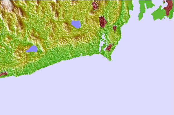
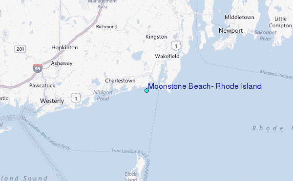
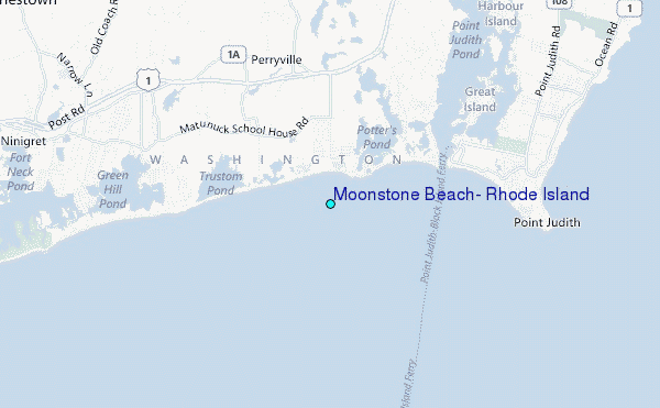
Use this relief map to navigate to tide stations, surf breaks and cities that are in the area of Moonstone Beach, Rhode Island.
Other Nearby Locations' tide tables and tide charts to Moonstone Beach, Rhode Island:
click location name for more details
 Surf breaks close to Moonstone Beach, Rhode Island:
|
||
|---|---|---|
| Closest surf break | Matunuck-The point | 1 mi |
| Second closest surf break | Matunuck-Trestles | 1 mi |
| Third closest surf break | Matunuck | 1 mi |
| Fourth closest surf break | Matunuck-Deep Hole | 1 mi |
| Fifth closest surf break | K38 and 39 | 2 mi |


 Nearest
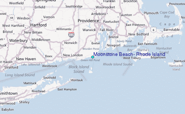