
| Distance / Altitude | Location | Report Date / Time | Live Weather | Wind | Gusts | Temp. | Visibility | Cloud |
|---|---|---|---|---|---|---|---|---|
| 279 km E / 232 m | Marambio Airport (Seymour Island) (Antarctica) | 2026-07-09 15:00 local (2026/07/09 18:00 GMT) | Dry and partly cloudy | strong winds from the SSW (43 km/h at 210) | -14°C | 10.0 | few scattered | |
| 336 km NNE / 48 m | Centro Met. Antártico Presidente Eduardo Frei (Antarctica) | 2026-07-09 15:00 local (2026/07/09 18:00 GMT) | no report | wind obs. (115 kph from 270 degs) was rejected (- km/h at -) | -4°C | - | - | |
| 337 km NNE / 45 m | Teniente R. Marsh Airport (Chile) | 2026-07-09 15:00 local (2026/07/09 18:00 GMT) | Dry and partly cloudy | strong winds from the WSW (50 km/h at 250) | -1°C | 10.0 | broken broken | |
| 343 km NNE / 52 m | Dinamet (Antarctica (ay)) | 2026-07-09 15:00 local (2026/07/09 18:00 GMT) | no report | moderate winds from the WNW (22 km/h at 300) | -3°C | - | - | |
| 1137 km NW / 14 m | Guardiamarina Airport (Chile) | 2026-07-09 15:00 local (2026/07/09 18:00 GMT) | no report | wind obs. (43 kph from 260 degs) was rejected (- km/h at -) | -1°C | - | - | |
| 1137 km NW / 14 m | Puerto Williams (Chile) | 2026-07-09 15:00 local (2026/07/09 18:00 GMT) | Dry and partly cloudy | light winds from the W (13 km/h at 260) | 5°C | 10.0 | few broken broken | |
| 1163 km NW / 204 m | Ushuaia Naval Base Airport (Argentina) | 2026-07-09 15:00 local (2026/07/09 18:00 GMT) | Dry and partly cloudy | fresh winds from the WSW (33 km/h at 250) | 4°C | 10.0 | scattered | |
| 1264 km NW / 102 m | Rio Grande Airport (Argentina) | 2026-07-09 15:00 local (2026/07/09 18:00 GMT) | Dry and partly cloudy | moderate winds from the W (28 km/h at 270) | — | 0.0 | few scattered - | |
| 1362 km NW / 42 m | Capitan Fuentes Martinez Airport (Chile) | 2026-07-09 15:00 local (2026/07/09 18:00 GMT) | Dry and partly cloudy | light winds from the SW (19 km/h at 230) | 5°C | 10.0 | few scattered broken | |
| 1384 km NW / 61 m | Punta Arenas Unidad Aeropolicial (Chile) | 2026-07-09 15:00 local (2026/07/09 18:00 GMT) | - | wind obs. (40 kph from 260 degs) was rejected (- km/h at -) | — | - | - |
| Contours: | Roads & Rivers: | Select a
tide station / surf break / city |
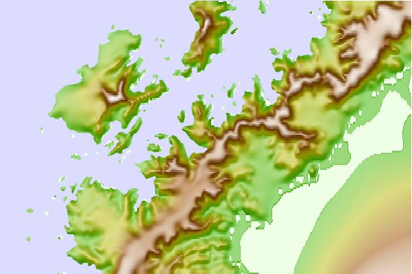
Use this relief map to navigate to tide stations, surf breaks and cities that are in the area of Neko, Antarctica.
Other Nearby Locations' tide tables and tide charts to Neko, Antarctica:
click location name for more details
 Surf breaks close to Neko, Antarctica:
|
||
|---|---|---|
| Closest surf break | Río Grande | 784 mi |
| Second closest surf break | Bertha's Beach | 902 mi |
| Third closest surf break | Surf Bay | 920 mi |
| Fourth closest surf break | Elephant Beach | 937 mi |
| Fifth closest surf break | Cow Bay | 938 mi |


 Nearest