
| Distance / Altitude | Location | Report Date / Time | Live Weather | Wind | Gusts | Temp. | Visibility | Cloud |
|---|---|---|---|---|---|---|---|---|
| 55 km NW / 140 m | Bellenden Ker wx (Australia) | 2026-06-22 15:32 local (2026/06/22 05:32 GMT) | dry | wind obs. (10 kph from 202 degs) was rejected (- km/h at -) | 23°C | - | - - 0 | |
| 101 km NW / 218 m | Cairns Airport (Australia) | 2026-06-22 14:30 local (2026/06/22 04:30 GMT) | Dry and cloudy | fresh winds from the SSE (30 km/h at 160) | 24°C | 10.0 | overcast overcast | |
| 116 km WNW / 400 m | Mareeba (Australia) | 2026-06-22 15:36 local (2026/06/22 05:36 GMT) | dry | light winds from the S (8 km/h at 171) | 22°C | - | - - 0 | |
| 183 km SSE / 218 m | Townsville Airport (Australia) | 2026-06-22 14:30 local (2026/06/22 04:30 GMT) | - | moderate winds from the ENE (28 km/h at 60) | 26°C | 10.0 | few | |
| 198 km SSE / 29 m | Townsville (Australia) | 2026-06-22 15:11 local (2026/06/22 05:11 GMT) | dry | calm (0 km/h at ) | 16°C | - | - - 0 | |
| 256 km SSE / 14 m | Home Hill (Australia) | 2026-06-22 15:21 local (2026/06/22 05:21 GMT) | dry | calm (2 km/h at 106) | 26°C | - | - - 0 | |
| 415 km SE / 216 m | Hamilton Island (Australia) | 2026-06-22 14:30 local (2026/06/22 04:30 GMT) | Dry and partly cloudy | strong winds from the SSE (39 km/h at 150) | 21°C | 10.0 | no cloud overcast broken | |
| 493 km SE / 54 m | Eton wx (Australia) | 2026-06-22 15:35 local (2026/06/22 05:35 GMT) | dry | light winds from the ESE (14 km/h at 108) | 24°C | - | - - 0 | |
| 519 km SE / 308 m | Shinfield wx (Australia) | 2026-06-22 15:34 local (2026/06/22 05:34 GMT) | dry | calm (3 km/h at 315) | 25°C | - | - - 0 | |
| 545 km SE / 123 m | Mount Christian wx (Australia) | 2026-06-22 15:34 local (2026/06/22 05:34 GMT) | dry | wind obs. (6 kph from 248 degs) was rejected (- km/h at -) | 24°C | - | - - 0 |
| Contours: | Roads & Rivers: | Select a
tide station / surf break / city |
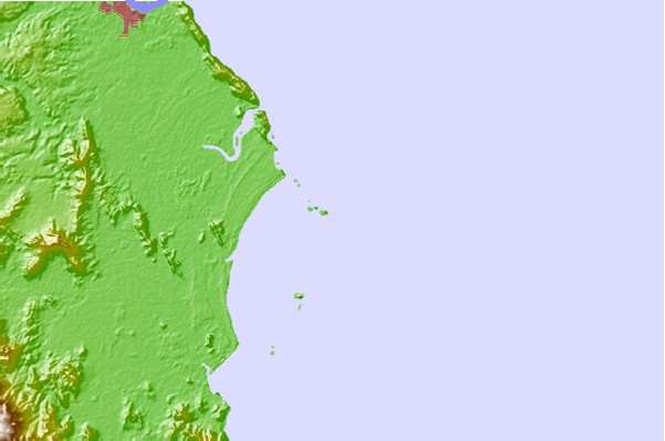
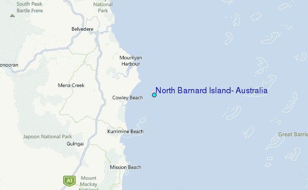
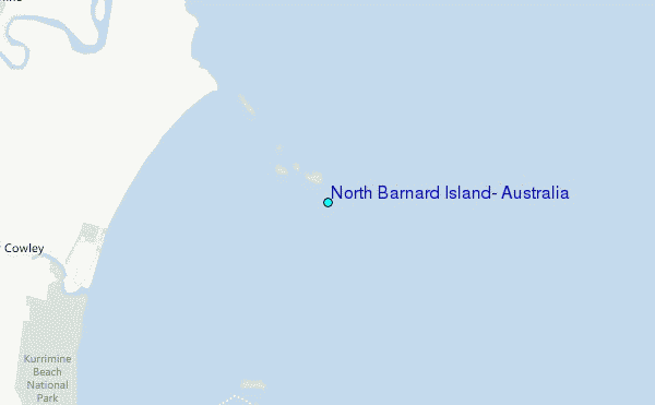
Use this relief map to navigate to tide stations, surf breaks and cities that are in the area of North Barnard Island, Australia.
Other Nearby Locations' tide tables and tide charts to North Barnard Island, Australia:
click location name for more details
 Surf breaks close to North Barnard Island, Australia:
|
||
|---|---|---|
| Closest surf break | Eimeo Point | 303 mi |
| Second closest surf break | Dolphin Heads | 303 mi |
| Third closest surf break | Lamberts Beach | 307 mi |
| Fourth closest surf break | North Wall Mackay Harbour Beach | 308 mi |
| Fifth closest surf break | South Wall Mackay Harbour | 310 mi |


 Nearest
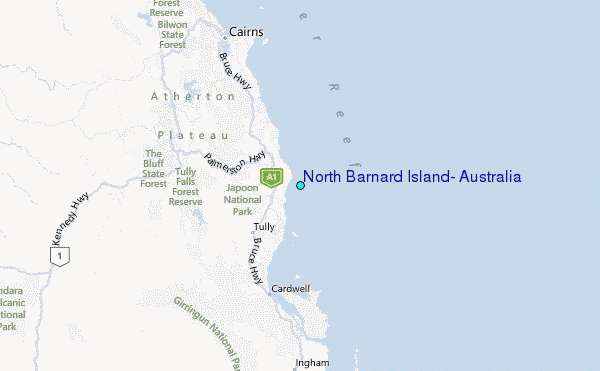