
| Distance / Altitude | Location | Report Date / Time | Live Weather | Wind | Gusts | Temp. | Visibility | Cloud |
|---|---|---|---|---|---|---|---|---|
| 54 km NE / 214 m | Learmouth Airport (Australia) | 2026-06-22 12:30 local (2026/06/22 04:30 GMT) | Dry and partly cloudy | light winds from the NE (13 km/h at 40) | 23°C | 10.0 | no cloud | |
| 565 km ENE / 218 m | Port Hedland International Airport (Australia) | 2026-06-22 12:30 local (2026/06/22 04:30 GMT) | Dry and partly cloudy | moderate winds from the NE (20 km/h at 50) | 27°C | 10.0 | no cloud | |
| 698 km S / 37 m | Geraldton Airport (Australia) | 2026-06-22 12:30 local (2026/06/22 04:30 GMT) | Dry and partly cloudy | moderate winds from the NE (20 km/h at 50) | 22°C | 10.0 | no cloud | |
| 698 km S / 37 m | Geraldton Airport (Australia) | 2026-06-22 12:30 local (2026/06/22 04:30 GMT) | Dry and partly cloudy | moderate winds from the NE (20 km/h at 50) | 22°C | 10.0 | no cloud overcast - | |
| 1027 km ENE / 218 m | Broome Airport (Australia) | 2026-06-22 12:30 local (2026/06/22 04:30 GMT) | Dry and partly cloudy | light winds from the SE (15 km/h at 140) | 28°C | 10.0 | no cloud | |
| 1034 km SSE / 215 m | Pearce Australian Air Force Base (Australia) | 2026-06-22 12:30 local (2026/06/22 04:30 GMT) | Dry and partly cloudy | calm (0 km/h at 0) | 20°C | 10.0 | scattered broken - | |
| 1046 km S / 43 m | Greenwood wx (Australia) | 2026-06-22 13:01 local (2026/06/22 05:01 GMT) | dry | calm (0 km/h at 244) | 22°C | - | - - 0 | |
| 1048 km S / 65 m | Alexander Heights wx (Australia) | 2026-06-22 13:43 local (2026/06/22 05:43 GMT) | dry | calm (3 km/h at 282) | 14°C | - | - - 0 | |
| 1051 km SSE / 38 m | Ballajura (Australia) | 2026-06-22 13:28 local (2026/06/22 05:28 GMT) | dry | calm (0 km/h at 322) | 19°C | - | - - 0 | |
| 1054 km SSE / 81 m | Beechboro wx (Australia) | 2026-06-22 12:48 local (2026/06/22 04:48 GMT) | - | - (- km/h at ) | 21°C | - | - - 0 |
| Contours: | Roads & Rivers: | Select a
tide station / surf break / city |
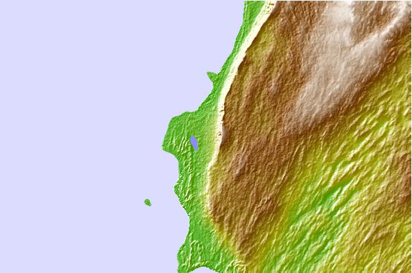
Use this relief map to navigate to tide stations, surf breaks and cities that are in the area of Norwegian Bay, Australia.
Other Nearby Locations' tide tables and tide charts to Norwegian Bay, Australia:
click location name for more details
 Surf breaks close to Norwegian Bay, Australia:
|
||
|---|---|---|
| Closest surf break | Lighthouse Bombie | 52 mi |
| Second closest surf break | Dunes | 60 mi |
| Third closest surf break | Gnaraloo | 83 mi |
| Fourth closest surf break | Turtles | 98 mi |
| Fifth closest surf break | Red Bluff | 103 mi |


 Nearest