
| Distance / Altitude | Location | Report Date / Time | Live Weather | Wind | Gusts | Temp. | Visibility | Cloud |
|---|---|---|---|---|---|---|---|---|
| 1146 km S / 3 m | Nukunonu Aws (Tokelau) | 2026-07-10 07:00 local (2026/07/09 19:00 GMT) | no report | wind obs. (9 kph from 130 degs) was rejected (- km/h at -) | 29°C | - | - - - | |
| 1330 km S / 3 m | SHIP8375 (Marine) | 2026-07-10 08:00 local (2026/07/09 20:00 GMT) | light winds from the NW (15 km/h at 310) | 28°C | - | |||
| 1351 km E / 3 m | Kiritimati Airport (Christmas Island) (Kiribati) | 2026-07-10 07:00 local (2026/07/09 19:00 GMT) | - | calm (4 km/h at 10) | 26°C | |||
| 1375 km SSE / 7 m | Pukapuka IS (Samoa) | 2026-07-10 07:00 local (2026/07/09 19:00 GMT) | - | light winds from the NE (7 km/h at 50) | — | |||
| 1456 km SSE / 9 m | Nassau Airport (Cook Islands) | 2026-07-10 07:00 local (2026/07/09 19:00 GMT) | - | light winds from the NNE (6 km/h at 30) | 30°C | |||
| 1323 km S / 15 m | SHIP5446 (Marine) | 2026-07-10 08:00 local (2026/07/09 20:00 GMT) | light winds from the NW (14.76 km/h at 310) | 29°C | - km | |||
| 1323 km S / 15 m | SHIP3565 (Marine) | 2026-07-10 06:00 local (2026/07/09 18:00 GMT) | light winds from the WNW (14.76 km/h at 290) | 29°C | - km | |||
| 1323 km S / 15 m | SHIP7859 (Marine) | 2026-07-10 06:00 local (2026/07/09 18:00 GMT) | light winds from the WNW (14.76 km/h at 290) | 29°C | - km | |||
| 1334 km S / 3 m | SHIP5337 (Marine) | 2026-07-10 06:00 local (2026/07/09 18:00 GMT) | light winds from the WNW (15 km/h at 300) | 28°C | - | |||
| 1334 km S / 15 m | SHIP3901 (Marine) | 2026-07-10 06:00 local (2026/07/09 18:00 GMT) | light winds from the WNW (16.56 km/h at 290) | 29°C | - km |

Choose Ocean Island, Gilbert Islands, Kiribati Location Map Zoom:
| Contours: | Roads & Rivers: | Select a
tide station / surf break / city |

Use this relief map to navigate to tide stations, surf breaks and cities that are in the area of Ocean Island, Gilbert Islands, Kiribati.
Other Nearby Locations' tide tables and tide charts to Ocean Island, Gilbert Islands, Kiribati:
click location name for more details
 Surf breaks close to Ocean Island, Gilbert Islands, Kiribati:
|
||
|---|---|---|
| Closest surf break | Utua Mamao (Atafu) | 681 mi |
| Second closest surf break | English Channel Left (Fanning Island) | 734 mi |
| Third closest surf break | Malama Lefts | 1012 mi |
| Fourth closest surf break | The Leap | 1025 mi |
| Fifth closest surf break | The Wharf | 1025 mi |


 Nearest
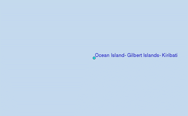