
| Distance / Altitude | Location | Report Date / Time | Live Weather | Wind | Gusts | Temp. | Visibility | Cloud |
|---|---|---|---|---|---|---|---|---|
| 34 km NW / 210 m | Tapachula Airport (Mexico) | 2026-07-09 12:40 local (2026/07/09 18:40 GMT) | Dry and partly cloudy | light winds from the SW (9 km/h at 220) | 35°C | 8 | scattered broken | |
| 43 km NW / 118 m | Tapachula- Chis (Mexico) | 2026-07-09 12:00 local (2026/07/09 18:00 GMT) | no report | wind obs. (7 kph from 160 degs) was rejected (- km/h at -) | 23°C | 15 | - - - | |
| 53 km E / 367 m | Retalhuleu Airport/ (Guatemala) | 2026-07-09 13:00 local (2026/07/09 19:00 GMT) | Dry and partly cloudy | light winds from the SSE (11 km/h at 160) | 35°C | 10.0 | broken | |
| 63 km ENE / 950 m | Guatemala (Guatemala) | 2026-07-09 13:24 local (2026/07/09 19:24 GMT) | dry | calm (0 km/h at 67) | — | - | - - 0 | |
| 65 km ENE / 1000 m | Guatemala (Guatemala) | 2026-07-09 13:26 local (2026/07/09 19:26 GMT) | dry | calm (0 km/h at 354) | 26°C | - | - - 0 | |
| 68 km ENE / 1400 m | Guatemala (Guatemala) | 2026-07-09 13:00 local (2026/07/09 19:00 GMT) | dry | calm (0 km/h at 5) | 22°C | - | - - 0 | |
| 68 km ENE / 1410 m | Guatemala (Guatemala) | 2026-07-09 13:25 local (2026/07/09 19:25 GMT) | dry | calm (0 km/h at 194) | 22°C | - | - - 0 | |
| 80 km ENE / 2465 m | Quezaltenango Airport (Guatemala) | 2026-07-09 12:00 local (2026/07/09 18:00 GMT) | - | wind obs. (28 kph from 360 degs) was rejected (- km/h at -) | — | 0.0 | ||
| 100 km ENE / 2492 m | Chotacaj wx (Guatemala) | 2026-07-09 13:27 local (2026/07/09 19:27 GMT) | dry | wind obs. (13 kph from 0 degs) was rejected (- km/h at -) | 19°C | - | - - 0 | |
| 119 km NE / 1907 m | Huehuetenango Airport (Guatemala) | 2026-07-09 12:00 local (2026/07/09 18:00 GMT) | Dry and partly cloudy | calm (0 km/h at 0) | 23°C | 10.0 | scattered broken |
| Contours: | Roads & Rivers: | Select a
tide station / surf break / city |
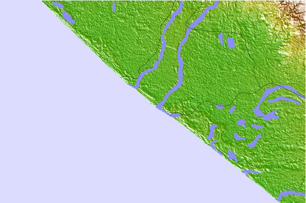
Use this relief map to navigate to tide stations, surf breaks and cities that are in the area of Ocos.
Other Nearby Locations' tide tables and tide charts to Ocos:
click location name for more details
 Surf breaks close to Ocos:
|
||
|---|---|---|
| Closest surf break | Tilapa | 2 mi |
| Second closest surf break | Ocos | 4 mi |
| Third closest surf break | Champerico | 14 mi |
| Fourth closest surf break | Tulate | 33 mi |
| Fifth closest surf break | Puerto Madero | 53 mi |


 Nearest