
| Distance / Altitude | Location | Report Date / Time | Live Weather | Wind | Gusts | Temp. | Visibility | Cloud |
|---|---|---|---|---|---|---|---|---|
| 1 km S / 0 m | Olongapo/Subic Bay Airport (Philippines) | 2026-07-10 02:00 local (2026/07/09 18:00 GMT) | Thunderstorm heavy rain thunderstorm | light winds from the N (11 km/h at 1) | 27°C | 0.0 | few broken overcast | |
| 49 km WNW / 0 m | lightning 4km SW of Panan (Philippines) | 2026-07-10 01:03 local (2026/07/09 17:03 GMT) | Thunderstorm | (- km/h at -) | — | |||
| 50 km NE / 584 m | Angeles/Pampanga Airport (Philippines) | 2026-07-10 02:00 local (2026/07/09 18:00 GMT) | - | wind obs. (7 kph from 140 degs) was rejected (- km/h at -) | 28°C | 10.0 | few | |
| 50 km NE / 155 m | Clark AB (Philippines) | 2026-07-10 02:00 local (2026/07/09 18:00 GMT) | - | wind obs. (18 kph from 180 degs) was rejected (- km/h at -) | — | 15 | - - - | |
| 55 km W / 0 m | lightning 26km WSW of Cabangan (Philippines) | 2026-07-10 02:33 local (2026/07/09 18:33 GMT) | Thunderstorm | (- km/h at -) | — | |||
| 66 km NW / 5 m | Iba (Philippines) | 2026-07-10 02:00 local (2026/07/09 18:00 GMT) | thunderstorm but no precipitation falling at station | wind obs. (18 kph from 220 degs) was rejected (- km/h at -) | 32°C | 20 | - | |
| 72 km NW / 33 m | thunderstorm affecting Amungan (Philippines) | 2026-07-10 01:03 local (2026/07/09 17:03 GMT) | Thunderstorm | (- km/h at -) | — | |||
| 77 km ESE / 2 m | Sangley Point (Philippines) | 2026-07-10 02:00 local (2026/07/09 18:00 GMT) | no report | wind obs. (18 kph from 90 degs) was rejected (- km/h at -) | 32°C | 10 | - - - | |
| 84 km ESE / 217 m | Ninoy Aquino International Airport (Manila) (Philippines) | 2026-07-10 02:00 local (2026/07/09 18:00 GMT) | Dry and partly cloudy | moderate winds from the W (24 km/h at 260) | 29°C | 10.0 | scattered broken broken | |
| 85 km ESE / 39 m | Science Garden (Philippines) | 2026-07-10 02:00 local (2026/07/09 18:00 GMT) | rain showers | calm (4 km/h at 140) | 30°C | 8 | - - - |
| Contours: | Roads & Rivers: | Select a
tide station / surf break / city |
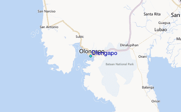
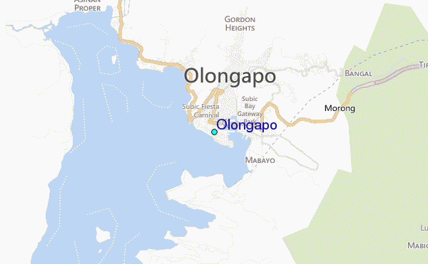
Use this relief map to navigate to tide stations, surf breaks and cities that are in the area of Olongapo.
Other Nearby Locations' tide tables and tide charts to Olongapo:
click location name for more details
 Surf breaks close to Olongapo:
|
||
|---|---|---|
| Closest surf break | Baler - Charlie's Point | 108 mi |
| Second closest surf break | Baler - Lindy's Point | 108 mi |
| Third closest surf break | Baler - Sabang | 108 mi |
| Fourth closest surf break | Cobra Reef - Cemento | 109 mi |
| Fifth closest surf break | Malaking Gasang (Baler) | 116 mi |


 Nearest
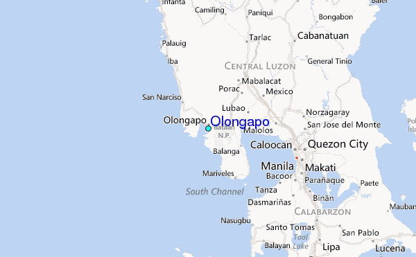