
| Distance / Altitude | Location | Report Date / Time | Live Weather | Wind | Gusts | Temp. | Visibility | Cloud |
|---|---|---|---|---|---|---|---|---|
| 1 km NW / 24 m | Stewart Island (New Zealand) | 2026-07-10 13:00 local (2026/07/10 01:00 GMT) | Dry | wind obs. (6 kph from 315 degs) was rejected (- km/h at -) | 8°C | - | - - - | |
| 1 km ESE / 25 m | Sails Ashore Lodge (New Zealand) | 2026-07-10 13:30 local (2026/07/10 01:30 GMT) | Dry | wind obs. (7 kph from 270 degs) was rejected (- km/h at -) | 9°C | - | - - - | |
| 31 km ENE / 52 m | Ruapuke Island (New Zealand) | 2026-07-10 13:40 local (2026/07/10 01:40 GMT) | No weather report | light winds from the W (15 km/h at 270) | — | - | - - - | |
| 41 km NNE / 13 m | Greenhills (New Zealand) | 2026-07-10 13:30 local (2026/07/10 01:30 GMT) | Dry | calm (2 km/h at 45) | 7°C | - | - - - | |
| 51 km NW / 15 m | SHIP3230 (Marine) | 2026-07-10 12:00 local (2026/07/10 00:00 GMT) | moderate winds from the E (27.720000000000002 km/h at 80) | 6°C | 8.1 km | |||
| 51 km NW / 15 m | SHIP1770 (Marine) | 2026-07-10 12:00 local (2026/07/10 00:00 GMT) | moderate winds from the E (27.720000000000002 km/h at 80) | 6°C | 8.1 km | |||
| 51 km NW / 15 m | SHIP6043 (Marine) | 2026-07-10 12:00 local (2026/07/10 00:00 GMT) | moderate winds from the E (27.720000000000002 km/h at 80) | 6°C | 8.1 km | |||
| 54 km NW / 3 m | Centre Island - Southland (New Zealand) | 2026-07-10 13:40 local (2026/07/10 01:40 GMT) | No weather report | calm (4 km/h at 270) | — | - | - - - | |
| 55 km NNE / 16 m | Tisbury (New Zealand) | 2026-07-10 13:00 local (2026/07/10 01:00 GMT) | Dry | wind obs. (11 kph from 315 degs) was rejected (- km/h at -) | 7°C | - | - - - | |
| 57 km NNE / 9 m | Georgetown wx (New Zealand) | 2026-07-10 13:46 local (2026/07/10 01:46 GMT) | dry | calm (2 km/h at 154) | 7°C | - | - - 0 |
| Contours: | Roads & Rivers: | Select a
tide station / surf break / city |
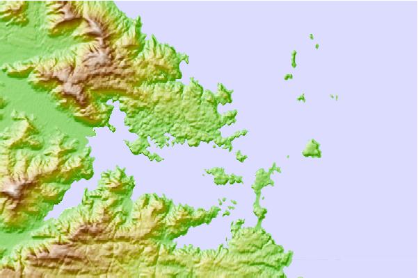
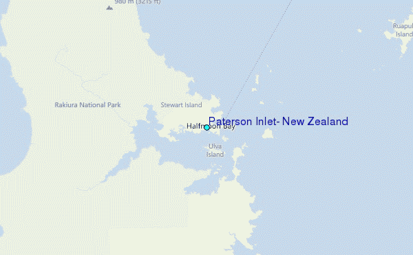
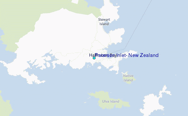
Use this relief map to navigate to tide stations, surf breaks and cities that are in the area of Paterson Inlet, New Zealand.
Other Nearby Locations' tide tables and tide charts to Paterson Inlet, New Zealand:
click location name for more details
 Surf breaks close to Paterson Inlet, New Zealand:
|
||
|---|---|---|
| Closest surf break | Stewart Island - Saber Reef | 25 mi |
| Second closest surf break | Oreti Beach | 32 mi |
| Third closest surf break | Mitchell's Bay | 36 mi |
| Fourth closest surf break | Nicks Point | 37 mi |
| Fifth closest surf break | Colac Bay | 39 mi |


 Nearest
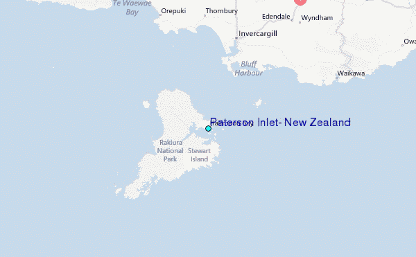