
| Distance / Altitude | Location | Report Date / Time | Live Weather | Wind | Gusts | Temp. | Visibility | Cloud |
|---|---|---|---|---|---|---|---|---|
| 154 km N / 3079 m | Huaraz Anta/Comandante FAP Germán Arias Graziani Airport (Peru) | 2026-07-09 13:00 local (2026/07/09 18:00 GMT) | - | light winds from the NE.(Wind varies from 020 to 120 degs) (15 km/h at 40) | — | 0.0 | ||
| 163 km SSE / 34 m | Lima Jorge Chávez International Airport (Peru) | 2026-07-09 13:00 local (2026/07/09 18:00 GMT) | Dry and cloudy | moderate winds from the S (22 km/h at 170) | 23°C | 10.0 | few overcast | |
| 178 km SSE / 361 m | La Molina wx (Peru) | 2026-07-09 14:17 local (2026/07/09 19:17 GMT) | dry | calm (0 km/h at 202) | 22°C | - | - - 0 | |
| 188 km NW / 3 m | Chimbote/Teniente FAP Jaime Montreuil Morales Airport (Peru) | 2026-07-09 13:00 local (2026/07/09 18:00 GMT) | Dry and cloudy | moderate winds from the SSW (26 km/h at 200) | 23°C | 10.0 | overcast | |
| 240 km ENE / 3571 m | Huánuco/Alférez FAP David Figueroa Fernandini Airport (Peru) | 2026-07-09 13:00 local (2026/07/09 18:00 GMT) | - | moderate winds from the ENE (28 km/h at 60) | — | 10.0 | few - - | |
| 267 km NE / 609 m | Tingo Maria Airport (Peru) | 2026-07-09 13:00 local (2026/07/09 18:00 GMT) | Dry and partly cloudy | wind obs. (6 kph from 150 degs) was rejected (- km/h at -) | 29°C | 10.0 | scattered broken - | |
| 279 km ESE / 3812 m | Jauja Airport (Peru) | 2026-07-09 13:00 local (2026/07/09 18:00 GMT) | Dry and partly cloudy | light winds from the S.(Wind varies from 030 to 240 degs) (9 km/h at 180) | 18°C | 10.0 | scattered | |
| 320 km NW / 215 m | Trujillo Airport (Peru) | 2026-07-09 13:00 local (2026/07/09 18:00 GMT) | Dry and partly cloudy | wind obs. (17 kph from 170 degs) was rejected (- km/h at -) | 23°C | 9.0 | broken | |
| 369 km SSE / 15 m | SHIP3957 (Marine) | 2026-07-09 12:00 local (2026/07/09 17:00 GMT) | light winds from the SSW (9.360000000000001 km/h at 210) | 19°C | 8.1 km | |||
| 369 km SSE / 15 m | SHIP6872 (Marine) | 2026-07-09 12:00 local (2026/07/09 17:00 GMT) | light winds from the SSW (9.360000000000001 km/h at 210) | 19°C | 8.1 km |
| Contours: | Roads & Rivers: | Select a
tide station / surf break / city |
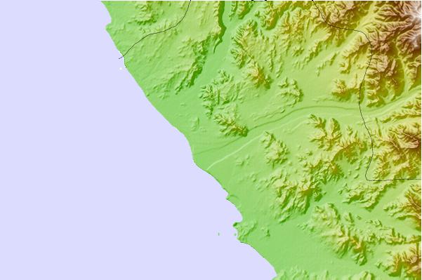
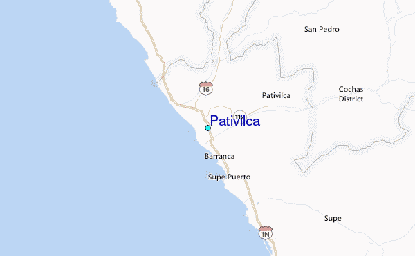
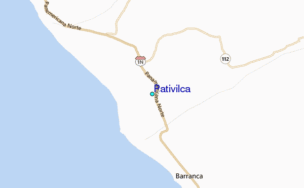
Use this relief map to navigate to tide stations, surf breaks and cities that are in the area of Pativilca.
Other Nearby Locations' tide tables and tide charts to Pativilca:
click location name for more details
 Surf breaks close to Pativilca:
|
||
|---|---|---|
| Closest surf break | Bermejo | 12 mi |
| Second closest surf break | Punta Gaviotas | 26 mi |
| Third closest surf break | Polvorin | 37 mi |
| Fourth closest surf break | Paraiso | 37 mi |
| Fifth closest surf break | Salinas | 42 mi |


 Nearest
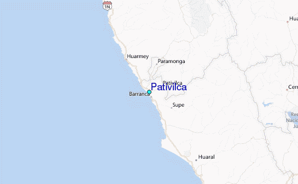