
| Distance / Altitude | Location | Report Date / Time | Live Weather | Wind | Gusts | Temp. | Visibility | Cloud |
|---|---|---|---|---|---|---|---|---|
| 345 km E / 4 m | Port Price wx (Australia) | 2026-06-21 03:42 local (2026/06/20 18:12 GMT) | dry | calm (5 km/h at 248) | 9°C | - | - - 0 | |
| 394 km NE / 218 m | Woomera Air Force Base Airport (Australia) | 2026-06-21 03:00 local (2026/06/20 17:30 GMT) | Dry and partly cloudy | light winds from the S (13 km/h at 190) | 6°C | 10.0 | no cloud | |
| 402 km ESE / 10 m | Waterloo Corner (Australia) | 2026-06-21 03:12 local (2026/06/20 17:42 GMT) | dry | - (- km/h at ) | — | - | - - 0 | |
| 406 km ESE / 218 m | Adelaide International Airport (Australia) | 2026-06-21 03:00 local (2026/06/20 17:30 GMT) | Dry and partly cloudy | calm (0 km/h at 0) | 6°C | 10.0 | few broken | |
| 407 km E / 292 m | Salter Springs wx (Australia) | 2026-06-21 03:31 local (2026/06/20 18:01 GMT) | dry | light winds from the ESE (6 km/h at 107) | 7°C | - | - - 0 | |
| 409 km ESE / 62 m | Halletts Cove wx (Australia) | 2026-06-21 03:32 local (2026/06/20 18:02 GMT) | dry | light winds from the E (8 km/h at 90) | 8°C | - | - - 0 | |
| 409 km ENE / 317 m | Hammond (Australia) | 2026-06-21 03:54 local (2026/06/20 18:24 GMT) | dry | calm (0 km/h at 0) | 3°C | - | - - 0 | |
| 411 km ESE / 105 m | Hallett Cove (Australia) | 2026-06-21 04:00 local (2026/06/20 18:30 GMT) | dry | calm (3 km/h at 180) | 8°C | - | - - 0 | |
| 414 km ESE / 48 m | Westbourne Park (Australia) | 2026-06-21 03:49 local (2026/06/20 18:19 GMT) | dry | calm (0 km/h at 263) | 7°C | - | - - 0 | |
| 414 km ESE / 80 m | Adelaide (Australia) | 2026-06-21 03:59 local (2026/06/20 18:29 GMT) | dry | calm (2 km/h at 105) | 7°C | - | - - 0 |
| Contours: | Roads & Rivers: | Select a
tide station / surf break / city |
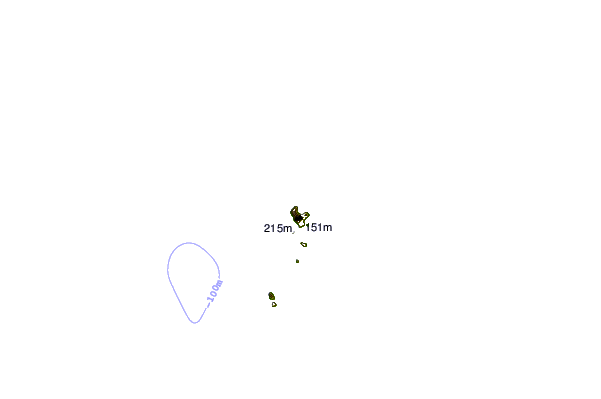
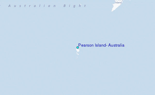
Use this relief map to navigate to tide stations, surf breaks and cities that are in the area of Pearson Island, Australia.
Other Nearby Locations' tide tables and tide charts to Pearson Island, Australia:
click location name for more details
 Surf breaks close to Pearson Island, Australia:
|
||
|---|---|---|
| Closest surf break | Blackfellows | 39 mi |
| Second closest surf break | Baird Bay Reef | 52 mi |
| Third closest surf break | Sheringa Beach | 53 mi |
| Fourth closest surf break | Venus Bay | 53 mi |
| Fifth closest surf break | Searcy Bay and Point Labatt | 55 mi |


 Nearest
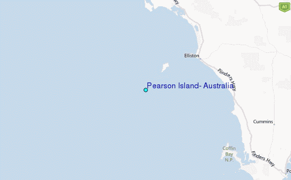