
| Distance / Altitude | Location | Report Date / Time | Live Weather | Wind | Gusts | Temp. | Visibility | Cloud |
|---|---|---|---|---|---|---|---|---|
| 6 km NW / 3 m | Wilbur-by-the-Sea wx (United States) | 2026-07-26 06:02 local (2026/07/26 10:02 GMT) | dry | - (- km/h at ) | — | - | - - 0 | |
| 17 km WNW / 11 m | Daytona Beach (Florida) | 2026-07-26 05:47 local (2026/07/26 09:47 GMT) | dry | light winds from the NNE (10 km/h at 15) | 26°C | - | - - 0 | |
| 17 km WNW / 13 m | Daytona Beach (Florida) | 2026-07-26 06:37 local (2026/07/26 10:37 GMT) | dry | calm (0 km/h at 242) | 26°C | - | - - 0 | |
| 17 km WNW / 219 m | Daytona Beach Airport (Florida) | 2026-07-26 04:53 local (2026/07/26 08:53 GMT) | - | light winds from the SSW (6 km/h at 200) | 25°C | 16 | few | |
| 27 km NNE / 3 m | BUOY-41069 (Marine) | 2026-07-26 04:08 local (2026/07/26 08:08 GMT) | light winds from the SW (14 km/h at 230) | 27°C | - | |||
| 27 km NNE / 3 m | BUOY-41070 (Marine) | 2026-07-26 05:03 local (2026/07/26 09:03 GMT) | - (- km/h at -) | — | - | |||
| 34 km WSW / 24 m | Deland Airport (Florida) (Florida) | 2026-07-26 05:30 local (2026/07/26 09:30 GMT) | Clear | light winds from the SW (7 km/h at 230) | 26°C | 16 | ||
| 36 km SW / 45 m | Orange City (Florida) | 2026-07-26 06:37 local (2026/07/26 10:37 GMT) | dry | calm (0 km/h at 285) | 25°C | - | - - 0 | |
| 38 km SSW / 5 m | Enterprise (Florida) | 2026-07-26 06:14 local (2026/07/26 10:14 GMT) | dry | calm (0 km/h at 303) | 26°C | - | - - 0 | |
| 38 km SSW / 16 m | Paradise Lakes Travel Trailer Park wx (United States) | 2026-07-26 06:16 local (2026/07/26 10:16 GMT) | dry | - (- km/h at ) | — | - | - - 0 |
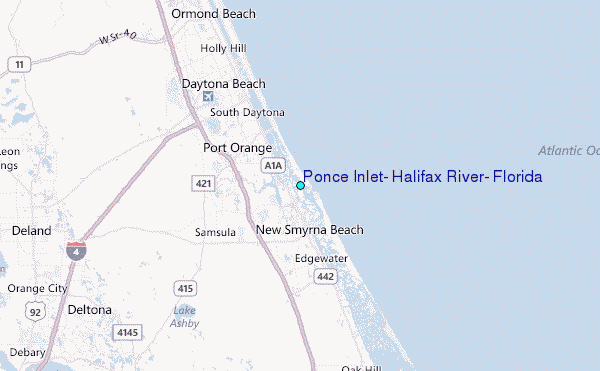
Choose Ponce Inlet, Halifax River, Florida Location Map Zoom:
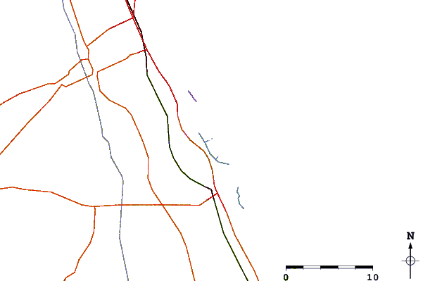
| Contours: | Roads & Rivers: | Select a
tide station / surf break / city |


Use this relief map to navigate to tide stations, surf breaks and cities that are in the area of Ponce Inlet, Halifax River, Florida.
Other Nearby Locations' tide tables and tide charts to Ponce Inlet, Halifax River, Florida:
click location name for more details
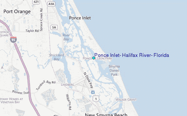
 Surf breaks close to Ponce Inlet, Halifax River, Florida:
|
||
|---|---|---|
| Closest surf break | Pon. Inlet | 1 mi |
| Second closest surf break | New Smyrna Inlet | 2 mi |
| Third closest surf break | Sunglow Pier | 2 mi |
| Fourth closest surf break | Flagler Avenue | 5 mi |
| Fifth closest surf break | Main Street Pier | 5 mi |


 Nearest
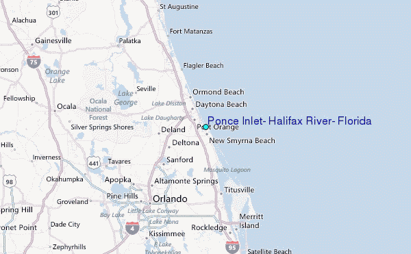