
| Distance / Altitude | Location | Report Date / Time | Live Weather | Wind | Gusts | Temp. | Visibility | Cloud |
|---|---|---|---|---|---|---|---|---|
| 16 km ESE / 466 m | Puerto Plata IN Airport (Dominican Republic) | 2026-07-09 15:00 local (2026/07/09 19:00 GMT) | Dry and partly cloudy | light winds from the SSE (19 km/h at 150) | 30°C | 10.0 | few scattered | |
| 39 km S / 209 m | Santiago International Airport (Dominican Republic) | 2026-07-09 15:15 local (2026/07/09 19:15 GMT) | Dry and partly cloudy | moderate winds from the E (26 km/h at 80) | 31°C | 10.0 | few scattered broken | |
| 44 km WNW / 3 m | SHIP2949 (Marine) | 2026-07-09 14:00 local (2026/07/09 18:00 GMT) | near gales from the E (52 km/h at 90) | 28°C | 20.4 | |||
| 45 km SSW / 64 m | Mao (Dominican Republic) | 2026-07-09 15:47 local (2026/07/09 19:47 GMT) | dry | light winds from the SE (14 km/h at 146) | 30°C | - | - - 0 | |
| 46 km SE / 270 m | thunderstorm affecting Veragua Arriba (Dominican Republic) | 2026-07-09 13:46 local (2026/07/09 17:46 GMT) | Thunderstorm | (- km/h at -) | — | |||
| 44 km WNW / 15 m | SHIP3912 (Marine) | 2026-07-09 14:00 local (2026/07/09 18:00 GMT) | near gales from the E (51.84 km/h at 90) | 28°C | 17.7 km | |||
| 44 km WNW / 15 m | SHIP6491 (Marine) | 2026-07-09 14:00 local (2026/07/09 18:00 GMT) | near gales from the E (51.84 km/h at 90) | 28°C | 17.7 km | |||
| 44 km WNW / 15 m | SHIP2335 (Marine) | 2026-07-09 14:00 local (2026/07/09 18:00 GMT) | near gales from the E (51.84 km/h at 90) | 28°C | 17.7 km | |||
| 44 km WNW / 3 m | SHIP1108 (Marine) | 2026-07-09 14:00 local (2026/07/09 18:00 GMT) | near gales from the E (52 km/h at 90) | 28°C | 20.4 | |||
| 44 km WNW / 3 m | SHIP5570 (Marine) | 2026-07-09 14:00 local (2026/07/09 18:00 GMT) | near gales from the E (52 km/h at 90) | 28°C | 20.4 |
| Contours: | Roads & Rivers: | Select a
tide station / surf break / city |
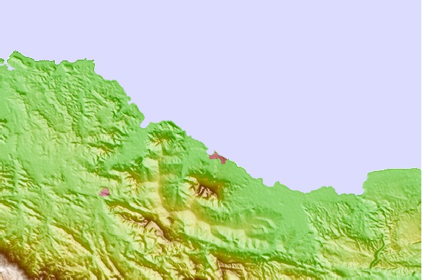
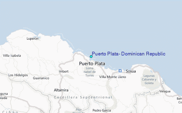
Use this relief map to navigate to tide stations, surf breaks and cities that are in the area of Puerto Plata, Dominican Republic.
Other Nearby Locations' tide tables and tide charts to Puerto Plata, Dominican Republic:
click location name for more details
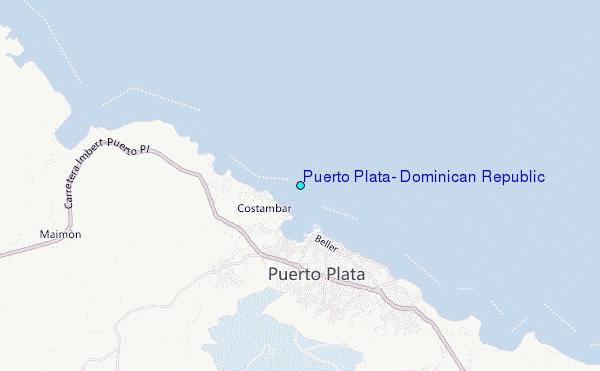
 Surf breaks close to Puerto Plata, Dominican Republic:
|
||
|---|---|---|
| Closest surf break | La Puntilla (Puerto Plata) | 1 mi |
| Second closest surf break | Coffee Break | 1 mi |
| Third closest surf break | Tea Break | 4 mi |
| Fourth closest surf break | El Canal | 12 mi |
| Fifth closest surf break | Encuentro | 12 mi |


 Nearest
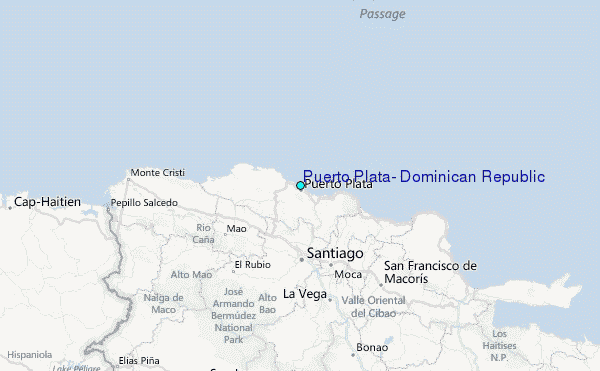