
| Distance / Altitude | Location | Report Date / Time | Live Weather | Wind | Gusts | Temp. | Visibility | Cloud |
|---|---|---|---|---|---|---|---|---|
| 108 km NW / 215 m | Trujillo Airport (Peru) | 2026-07-09 18:00 local (2026/07/09 23:00 GMT) | Dry and partly cloudy | wind obs. (13 kph from 150 degs) was rejected (- km/h at -) | 22°C | 9.0 | few broken | |
| 208 km N / 2934 m | Cajamarca/Major General FAP Armando Revoredo Iglesias Airport (Peru) | 2026-07-09 18:00 local (2026/07/09 23:00 GMT) | - | wind obs. (7 kph from 130 degs) was rejected (- km/h at -) | — | 10.0 | scattered broken broken | |
| 278 km NW / 212 m | Chiclayo/Capitán FAP José A. Quiñones Gonzales International Airport (Peru) | 2026-07-09 18:00 local (2026/07/09 23:00 GMT) | Dry and partly cloudy | moderate winds from the S (22 km/h at 190) | 24°C | 10.0 | broken | |
| 334 km ESE / 3571 m | Huánuco/Alférez FAP David Figueroa Fernandini Airport (Peru) | 2026-07-09 17:00 local (2026/07/09 22:00 GMT) | - | fresh winds from the ENE (30 km/h at 60) | — | 10.0 | few scattered - | |
| 374 km SSE / 34 m | Lima Jorge Chávez International Airport (Peru) | 2026-07-09 18:00 local (2026/07/09 23:00 GMT) | Dry and cloudy | light winds from the S (19 km/h at 170) | 21°C | 10.0 | scattered overcast | |
| 377 km NE / 601 m | Tarapoto Airport (Peru) | 2026-07-09 18:00 local (2026/07/09 23:00 GMT) | - | light winds from the NNE.(Wind varies from 360 to 060 degs) (13 km/h at 30) | 30°C | 10.0 | few | |
| 389 km SSE / 361 m | La Molina wx (Peru) | 2026-07-09 19:17 local (2026/07/10 00:17 GMT) | dry | calm (0 km/h at 202) | 19°C | - | - - 0 | |
| 452 km E / 22 m | Pucallpa Airport (Peru) | 2026-07-09 18:00 local (2026/07/09 23:00 GMT) | Dry and partly cloudy | calm (4 km/h at 360) | 28°C | 10.0 | scattered | |
| 464 km SE / 3812 m | Jauja Airport (Peru) | 2026-07-09 18:00 local (2026/07/09 23:00 GMT) | Light rain | moderate winds from the W (20 km/h at 270) | 8°C | 10.0 | overcast | |
| 474 km NW / 1 m | Piura/Capitán FAP Guillermo Concha Iberico International Airport (Peru) | 2026-07-09 18:00 local (2026/07/09 23:00 GMT) | - | light winds from the SW (19 km/h at 230) | — | 0.0 |
| Contours: | Roads & Rivers: | Select a
tide station / surf break / city |
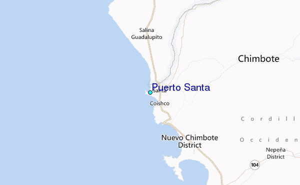
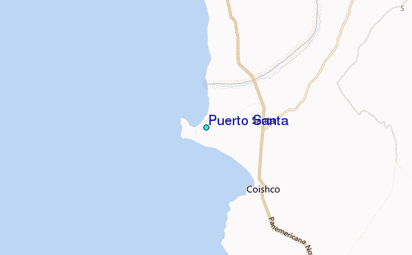
Use this relief map to navigate to tide stations, surf breaks and cities that are in the area of Puerto Santa.
Other Nearby Locations' tide tables and tide charts to Puerto Santa:
click location name for more details
 Surf breaks close to Puerto Santa:
|
||
|---|---|---|
| Closest surf break | Puerto Mori | 44 mi |
| Second closest surf break | Las Gramas | 55 mi |
| Third closest surf break | Playa Grande | 58 mi |
| Fourth closest surf break | Salaverry Harbour | 58 mi |
| Fifth closest surf break | El Camotal | 64 mi |


 Nearest
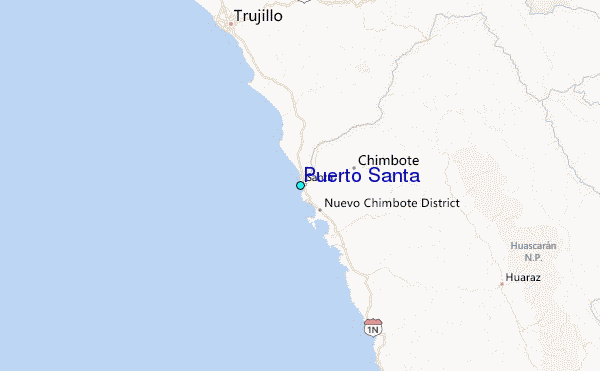