
| Distance / Altitude | Location | Report Date / Time | Live Weather | Wind | Gusts | Temp. | Visibility | Cloud |
|---|---|---|---|---|---|---|---|---|
| 48 km S / 190 m | Manta/Eloy Alfaro International Airport (Ecuador) | 2026-07-09 14:00 local (2026/07/09 19:00 GMT) | Dry and partly cloudy | light winds from the W.(Wind varies from 260 to 320 degs) (11 km/h at 280) | 31°C | 10.0 | few - - | |
| 99 km ESE / 10 m | Gen Rivadeneira Airport (Ecuador) | 2026-07-09 14:00 local (2026/07/09 19:00 GMT) | Dry and partly cloudy | wind obs. (15 kph from 290 degs) was rejected (- km/h at -) | 32°C | 10.0 | scattered scattered | |
| 183 km SSE / 211 m | Guayaquil/José Joaquín de Olmedo International Airport (Ecuador) | 2026-07-09 14:00 local (2026/07/09 19:00 GMT) | Dry and partly cloudy | light winds from the SSE (15 km/h at 160) | 31°C | 10.0 | scattered | |
| 188 km S / 8 m | Salinas/Gen Ulpi Airport (Ecuador) | 2026-07-09 14:00 local (2026/07/09 19:00 GMT) | Dry and partly cloudy | moderate winds from the SSW (22 km/h at 210) | 28°C | 10.0 | few scattered - | |
| 198 km E / 3200 m | Latacunga (Ecuador) | 2026-07-09 13:37 local (2026/07/09 18:37 GMT) | dry | light winds from the ESE (18 km/h at 120) | 17°C | - | - - 0 | |
| 206 km E / 2768 m | Latacunga/Cotopaxi Airport (Ecuador) | 2026-07-09 14:00 local (2026/07/09 19:00 GMT) | Dry and partly cloudy | moderate winds from the S (28 km/h at 180) | 17°C | 10.0 | broken | |
| 218 km ESE / 2520 m | Ambato Aeropuerto (Ecuador) | 2026-07-09 14:00 local (2026/07/09 19:00 GMT) | Dry and partly cloudy | light winds from the SE (9 km/h at 140) | 19°C | 10.0 | broken - - | |
| 227 km ESE / 2796 m | Riobamba/Chimborazo Airport (Ecuador) | 2026-07-09 14:00 local (2026/07/09 19:00 GMT) | - | wind obs. (26 kph from 20 degs) was rejected (- km/h at -) | — | 10.0 | broken - - | |
| 238 km ENE / 2400 m | Quito New International Airport (Ecuador) | 2026-07-09 14:00 local (2026/07/09 19:00 GMT) | Dry and partly cloudy | wind obs. (24 kph from 340 degs) was rejected (- km/h at -) | 26°C | 10.0 | broken | |
| 280 km ENE / 2952 m | AEP Yuracrucito (Ecuador) | 2026-07-09 15:00 local (2026/07/09 20:00 GMT) | - | strong winds from the SE (41 km/h at 127) | 20°C | - | - - 0 |
| Contours: | Roads & Rivers: | Select a
tide station / surf break / city |
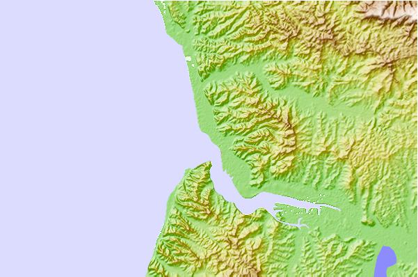
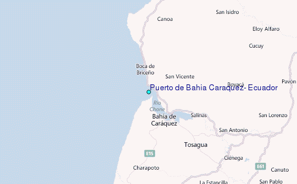
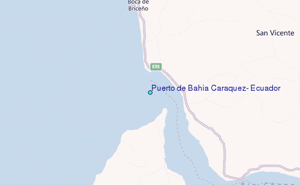
Use this relief map to navigate to tide stations, surf breaks and cities that are in the area of Puerto de Bahia Caraquez, Ecuador.
Other Nearby Locations' tide tables and tide charts to Puerto de Bahia Caraquez, Ecuador:
click location name for more details
 Surf breaks close to Puerto de Bahia Caraquez, Ecuador:
|
||
|---|---|---|
| Closest surf break | Frente A Bahia | 2 mi |
| Second closest surf break | Canoa | 3 mi |
| Third closest surf break | La Bellaca | 4 mi |
| Fourth closest surf break | La Mesita | 8 mi |
| Fifth closest surf break | Cabo Pasado | 15 mi |


 Nearest
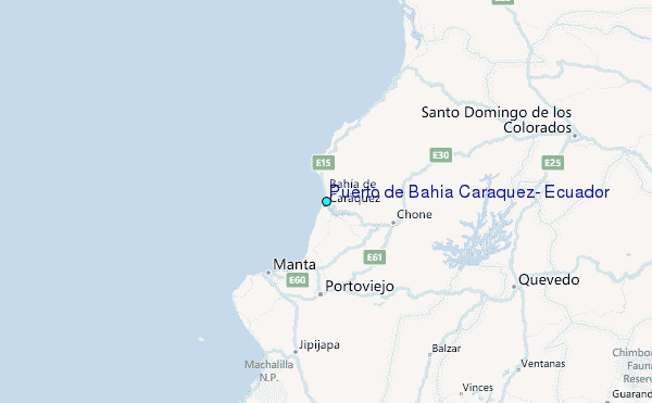