
| Distance / Altitude | Location | Report Date / Time | Live Weather | Wind | Gusts | Temp. | Visibility | Cloud |
|---|---|---|---|---|---|---|---|---|
| 140 km S / 0 m | lightning 25km NNE of Runaway Bay (Jamaica) | 2026-07-09 13:32 local (2026/07/09 17:32 GMT) | Thunderstorm | (- km/h at -) | — | |||
| 142 km NE / 208 m | Holguin Airport (Cuba) | 2026-07-09 13:50 local (2026/07/09 17:50 GMT) | Dry and partly cloudy | fresh winds from the E (30 km/h at 80) | 34°C | 9.0 | few broken | |
| 156 km E / 209 m | Santiago De Cuba Airport (Cuba) | 2026-07-09 13:50 local (2026/07/09 17:50 GMT) | - | moderate winds from the SE.(Wind varies from 090 to 170 degs) (20 km/h at 130) | 32°C | 9.0 | few | |
| 167 km S / 193 m | Sangster/Montego Bay Airport (Jamaica) | 2026-07-09 14:00 local (2026/07/09 18:00 GMT) | Dry and partly cloudy | fresh winds from the E (30 km/h at 90) | 33°C | 10.0 | scattered few | |
| 177 km NW / 212 m | Camaguey/Ignacio Agramonte Internationa Airport (Cuba) | 2026-07-09 13:50 local (2026/07/09 17:50 GMT) | Dry and partly cloudy | moderate winds from the E.(Wind varies from 060 to 130 degs) (22 km/h at 90) | 35°C | 9.0 | broken | |
| 197 km NW / 83 m | lightning 19km NW of Camaguey (Cuba) | 2026-07-09 15:32 local (2026/07/09 19:32 GMT) | Thunderstorm | (- km/h at -) | — | |||
| 203 km SW / 0 m | lightning 155km NW of Lucea (Jamaica) | 2026-07-09 14:03 local (2026/07/09 18:03 GMT) | Thunderstorm | (- km/h at -) | — | |||
| 204 km WSW / 0 m | lightning 170km SW of Santa Cruz del Sur (Cuba) | 2026-07-09 13:33 local (2026/07/09 17:33 GMT) | Thunderstorm | (- km/h at -) | — | |||
| 219 km NW / 70 m | lightning 16km NW of Florida (Cuba) | 2026-07-09 16:02 local (2026/07/09 20:02 GMT) | Thunderstorm | (- km/h at -) | — | |||
| 220 km E / 203 m | Guantanamo Bay Airport (Cuba) | 2026-07-09 13:51 local (2026/07/09 17:51 GMT) | - | strong winds from the E (43 km/h at 90) | 33°C | 14 | few few |
| Contours: | Roads & Rivers: | Select a
tide station / surf break / city |
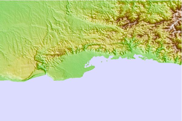
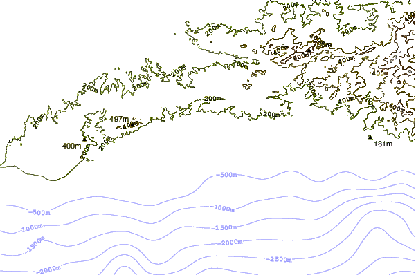
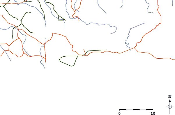
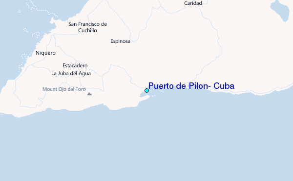
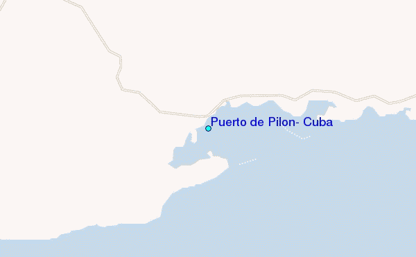
Use this relief map to navigate to tide stations, surf breaks and cities that are in the area of Puerto de Pilón, Cuba.
Other Nearby Locations' tide tables and tide charts to Puerto de Pilon, Cuba:
click location name for more details
 Surf breaks close to Puerto de Pilon, Cuba:
|
||
|---|---|---|
| Closest surf break | Discovery Bay | 99 mi |
| Second closest surf break | Runaway Bay | 99 mi |
| Third closest surf break | Peenie Wally | 124 mi |
| Fourth closest surf break | Navy Island | 131 mi |
| Fifth closest surf break | Winnifred Beach | 134 mi |


 Nearest