
| Distance / Altitude | Location | Report Date / Time | Live Weather | Wind | Gusts | Temp. | Visibility | Cloud |
|---|---|---|---|---|---|---|---|---|
| 6 km NNE / 3 m | BUOY-SAXG1 (Marine) | 2026-06-23 02:00 local (2026/06/23 06:00 GMT) | light winds from the SSW (13 km/h at 200) | 25°C | - | |||
| 19 km SSW / 217 m | Brunswick Golden Isles Airport (Georgia) | 2026-06-23 01:35 local (2026/06/23 05:35 GMT) | Clear | light winds from the WSW (9 km/h at 240) | 24°C | 16 | ||
| 25 km S / 218 m | Brunswick Airport (Georgia) | 2026-06-23 01:35 local (2026/06/23 05:35 GMT) | Clear | light winds from the SW (13 km/h at 220) | 26°C | 16 | ||
| 44 km E / 3 m | Grays Reef Buoy (Marine) | 2026-06-23 02:30 local (2026/06/23 06:30 GMT) | - (22 km/h at -) | 28°C | - | |||
| 56 km W / 33 m | Jesup/Wayne County Airport (Georgia) | 2026-06-23 01:30 local (2026/06/23 05:30 GMT) | Clear | calm (0 km/h at 0) | 23°C | 16 | ||
| 59 km NW / 214 m | Fort Stewart/Wright Army Airfield Airport (Georgia) | 2026-06-23 00:55 local (2026/06/23 04:55 GMT) | Clear | light winds from the SW (13 km/h at 230) | 25°C | 16 | ||
| 67 km S / 3 m | BUOY-KBMG1 (Marine) | 2026-06-23 02:18 local (2026/06/23 06:18 GMT) | - (- km/h at -) | — | - | |||
| 70 km E / 15 m | SHIP6924 (Marine) | 2026-06-23 01:00 local (2026/06/23 05:00 GMT) | moderate winds from the SSW (24.12 km/h at 210) | 28°C | - km | |||
| 70 km E / 3 m | SHIP6632 (Marine) | 2026-06-23 01:00 local (2026/06/23 05:00 GMT) | moderate winds from the SSW (24 km/h at 210) | — | - | |||
| 70 km E / 3 m | SHIP6269 (Marine) | 2026-06-23 01:00 local (2026/06/23 05:00 GMT) | moderate winds from the SSW (24 km/h at 210) | — | - |
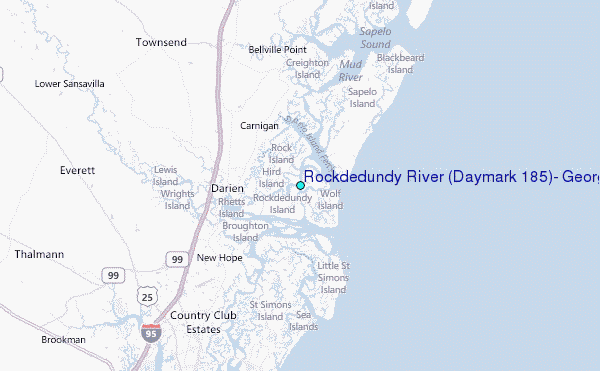
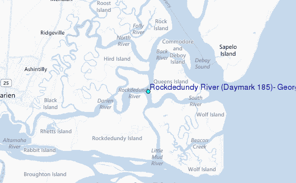
Choose Rockdedundy River (Daymark #185), Georgia Location Map Zoom:
| Contours: | Roads & Rivers: | Select a
tide station / surf break / city |
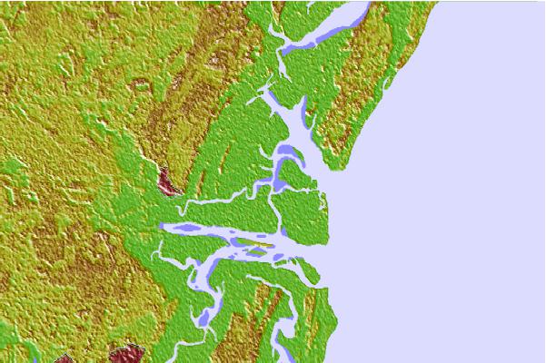

Use this relief map to navigate to tide stations, surf breaks and cities that are in the area of Rockdedundy River (Daymark #185), Georgia.
Other Nearby Locations' tide tables and tide charts to Rockdedundy River (Daymark #185), Georgia:
click location name for more details
 Surf breaks close to Rockdedundy River (Daymark #185), Georgia:
|
||
|---|---|---|
| Closest surf break | Sea Island | 14 mi |
| Second closest surf break | Goulds Inlet | 15 mi |
| Third closest surf break | St Simons Island | 16 mi |
| Fourth closest surf break | Coastguard/St Simons | 17 mi |
| Fifth closest surf break | 5th and 7th Streets | 20 mi |


 Nearest
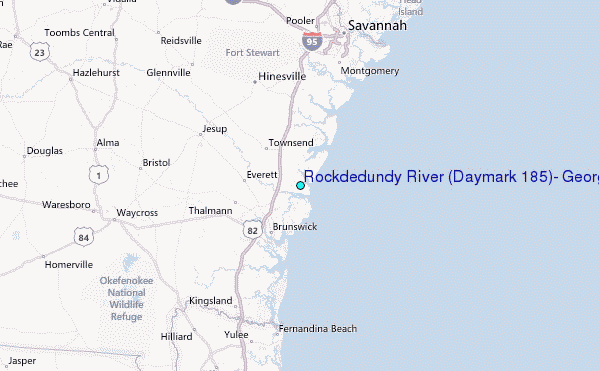