
| Distance / Altitude | Location | Report Date / Time | Live Weather | Wind | Gusts | Temp. | Visibility | Cloud |
|---|---|---|---|---|---|---|---|---|
| 74 km SW / 352 m | Ciudad Del Carmen Airport (Mexico) | 2026-07-09 13:45 local (2026/07/09 19:45 GMT) | Dry and partly cloudy | light winds from the E (13 km/h at 100) | 34°C | 11 | few broken | |
| 99 km SSW / 1 m | lightning 27km NE of Palizada (Mexico) | 2026-07-09 15:18 local (2026/07/09 21:18 GMT) | Thunderstorm | (- km/h at -) | — | |||
| 119 km NE / 313 m | Campeche Airport/Ing. Alberto Acuña Ongay International Airport (Mexico) | 2026-07-09 13:45 local (2026/07/09 19:45 GMT) | Dry and partly cloudy | light winds from the E (11 km/h at 100) | 35°C | 8 | scattered scattered | |
| 180 km S / 61 m | Palenque International Airport (Mexico) | 2026-07-09 14:40 local (2026/07/09 20:40 GMT) | Dry and partly cloudy | light winds from the ESE (19 km/h at 110) | 33°C | 14 | scattered broken | |
| 203 km SW / 311 m | Villahermosa Airport (Mexico) | 2026-07-09 14:47 local (2026/07/09 20:47 GMT) | Dry and partly cloudy | moderate winds from the NE (28 km/h at 50) | 36°C | 11 | scattered broken | |
| 204 km SW / 10 m | Dos Montes wx (Mexico) | 2026-07-09 14:13 local (2026/07/09 20:13 GMT) | dry | wind obs. (6 kph from 116 degs) was rejected (- km/h at -) | 35°C | - | - - 0 | |
| 213 km SW / 10 m | Centro Delegación Dos wx (Mexico) | 2026-07-09 14:01 local (2026/07/09 20:01 GMT) | dry | light winds from the NNE (11 km/h at 26) | 35°C | - | - - 0 | |
| 233 km E / 100 m | lightning 62km N of Nicolas Bravo (Mexico) | 2026-07-09 13:34 local (2026/07/09 19:34 GMT) | Thunderstorm | (- km/h at -) | — | |||
| 238 km E / 111 m | lightning 41km SW of Chunhuhub (Mexico) | 2026-07-09 14:19 local (2026/07/09 20:19 GMT) | Thunderstorm | (- km/h at -) | — | |||
| 239 km ENE / 107 m | lightning 23km SSW of Tzucacab (Mexico) | 2026-07-09 14:04 local (2026/07/09 20:04 GMT) | Thunderstorm | (- km/h at -) | — |
| Contours: | Roads & Rivers: | Select a
tide station / surf break / city |
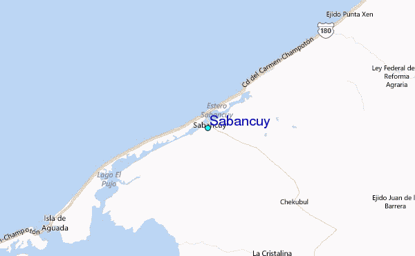
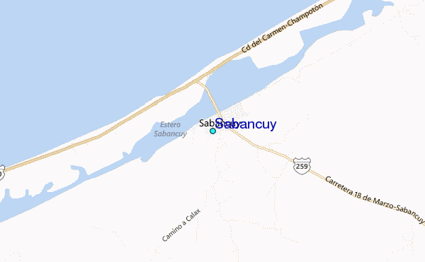
Use this relief map to navigate to tide stations, surf breaks and cities that are in the area of Sabancuy.
Other Nearby Locations' tide tables and tide charts to Sabancuy:
click location name for more details
 Surf breaks close to Sabancuy:
|
||
|---|---|---|
| Closest surf break | San Pedro South Reef Pass | 224 mi |
| Second closest surf break | San Pedro North Reef Pass | 224 mi |
| Third closest surf break | East Point Long Cay | 227 mi |
| Fourth closest surf break | Rocky Point | 228 mi |
| Fifth closest surf break | Puerto Arista | 277 mi |


 Nearest
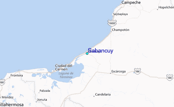