
| Distance / Altitude | Location | Report Date / Time | Live Weather | Wind | Gusts | Temp. | Visibility | Cloud |
|---|---|---|---|---|---|---|---|---|
| 26 km NNE / 0 m | lightning 25km NNE of Runaway Bay (Jamaica) | 2026-07-09 12:32 local (2026/07/09 17:32 GMT) | Thunderstorm | (- km/h at -) | — | |||
| 71 km NE / 0 m | lightning 55km N of Port Maria (Jamaica) | 2026-07-09 15:18 local (2026/07/09 20:18 GMT) | Thunderstorm | (- km/h at -) | — | |||
| 73 km SE / 191 m | Kingston/Norman Manley International Airport (Jamaica) | 2026-07-09 14:00 local (2026/07/09 19:00 GMT) | - | fresh winds from the ESE (31 km/h at 120) | 33°C | |||
| 73 km WSW / 193 m | Sangster/Montego Bay Airport (Jamaica) | 2026-07-09 14:00 local (2026/07/09 19:00 GMT) | - | fresh winds from the ENE (31 km/h at 60) | 31°C | 10.0 | few few | |
| 226 km NE / 209 m | Santiago De Cuba Airport (Cuba) | 2026-07-09 13:50 local (2026/07/09 18:50 GMT) | - | moderate winds from the SE.(Wind varies from 100 to 170 degs) (26 km/h at 130) | 32°C | 9.0 | few | |
| 236 km W / 0 m | lightning 155km NW of Lucea (Jamaica) | 2026-07-09 13:03 local (2026/07/09 18:03 GMT) | Thunderstorm | (- km/h at -) | — | |||
| 250 km E / 0 m | lightning 44km W of Les Irois (Haiti) | 2026-07-09 15:05 local (2026/07/09 20:05 GMT) | Thunderstorm | (- km/h at -) | — | |||
| 254 km ESE / 0 m | lightning 135km E of Dalvey (Jamaica) | 2026-07-09 14:18 local (2026/07/09 19:18 GMT) | Thunderstorm | (- km/h at -) | — | |||
| 260 km WNW / 0 m | lightning 170km SW of Santa Cruz del Sur (Cuba) | 2026-07-09 12:33 local (2026/07/09 17:33 GMT) | Thunderstorm | (- km/h at -) | — | |||
| 262 km ESE / 0 m | lightning 138km SSW of Tiburon (Haiti) | 2026-07-09 14:04 local (2026/07/09 19:04 GMT) | Thunderstorm | (- km/h at -) | — |
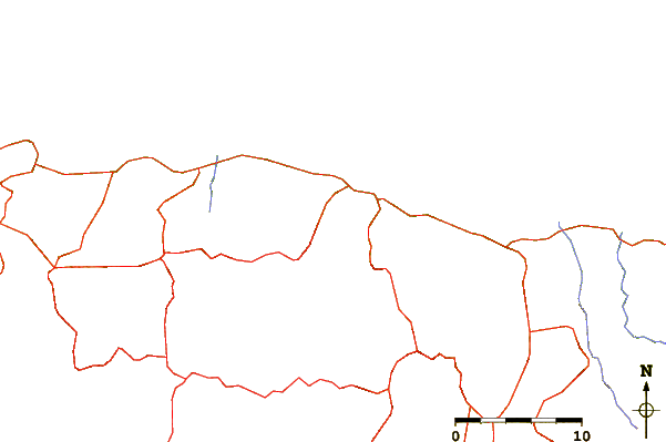
| Contours: | Roads & Rivers: | Select a
tide station / surf break / city |
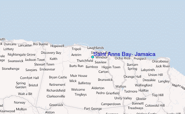
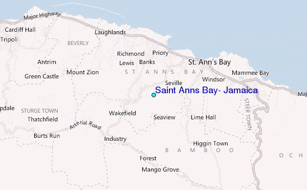
Use this relief map to navigate to tide stations, surf breaks and cities that are in the area of Saint Anns Bay, Jamaica.
Other Nearby Locations' tide tables and tide charts to Saint Anns Bay, Jamaica:
click location name for more details
 Surf breaks close to Saint Anns Bay, Jamaica:
|
||
|---|---|---|
| Closest surf break | Runaway Bay | 7 mi |
| Second closest surf break | Discovery Bay | 12 mi |
| Third closest surf break | Peenie Wally | 41 mi |
| Fourth closest surf break | Lighthouse 2 | 45 mi |
| Fifth closest surf break | Zoo (Bull Bay) | 47 mi |


 Nearest
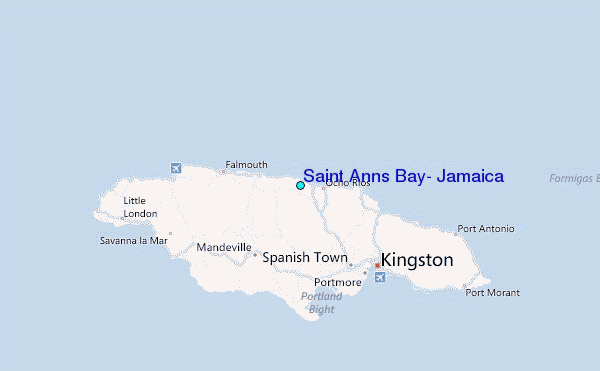