
| Distance / Altitude | Location | Report Date / Time | Live Weather | Wind | Gusts | Temp. | Visibility | Cloud |
|---|---|---|---|---|---|---|---|---|
| 6 km W / 10 m | St Lunaire (France) | 2026-07-03 05:00 local (2026/07/03 03:00 GMT) | - | moderate winds from the NNE (26 km/h at 12) | 17°C | - | - - 0 | |
| 6 km S / 59 m | Dinard/Pleurtuit Saint Malo Airport (France) | 2026-07-03 04:00 local (2026/07/03 02:00 GMT) | no report | light winds from the S (18 km/h at 190) | 19°C | 13 | - - - | |
| 8 km S / 217 m | Dinard/Pleurtuit Saint Malo Airport (France) | 2026-07-03 04:30 local (2026/07/03 02:30 GMT) | - | light winds from the NW (7 km/h at 320) | — | 0.0 | ||
| 10 km SW / 14 m | Lancieux (France) | 2026-07-03 05:00 local (2026/07/03 03:00 GMT) | - | light winds from the N (19 km/h at 9) | 16°C | - | - - 0 | |
| 19 km S / 72 m | Dinan (France) | 2026-07-03 03:11 local (2026/07/03 01:11 GMT) | dry | calm (3 km/h at 0) | 19°C | - | - - 0 | |
| 40 km SW / 57 m | Lamballe wx (France) | 2026-07-03 03:07 local (2026/07/03 01:07 GMT) | dry | calm (0 km/h at 333) | 13°C | - | - - 0 | |
| 51 km NE / 6 m | Ass Nautique Hautais (France) | 2026-07-03 05:00 local (2026/07/03 03:00 GMT) | - | light winds from the NNE (9 km/h at 14) | 14°C | - | - - 0 | |
| 56 km WSW / 112 m | AANB PLERIN (France) | 2026-07-03 05:00 local (2026/07/03 03:00 GMT) | - | light winds from the NNW (7 km/h at 348) | 13°C | - | - - 0 | |
| 57 km WSW / 86 m | Pordic (France) | 2026-07-03 03:02 local (2026/07/03 01:02 GMT) | dry | light winds from the NW (8 km/h at 319) | 14°C | - | - - 0 | |
| 58 km WSW / 20 m | St-Quay Port d'Armor (France) | 2026-07-03 05:00 local (2026/07/03 03:00 GMT) | - | moderate winds from the W (20 km/h at 279) | 14°C | - | - - 0 |
| Contours: | Roads & Rivers: | Select a
tide station / surf break / city |
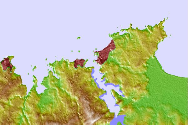
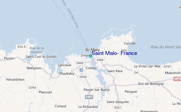
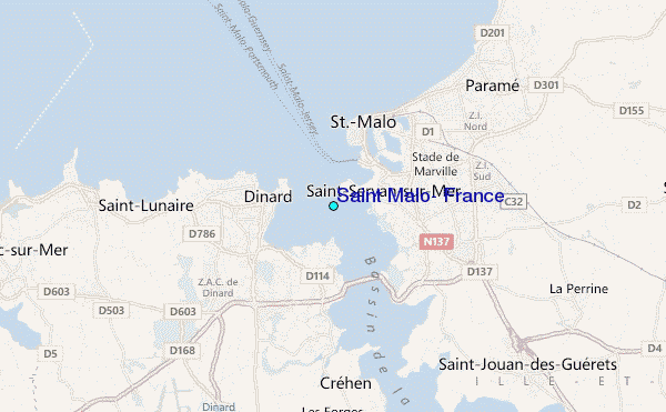
Use this relief map to navigate to tide stations, surf breaks and cities that are in the area of Saint Malo, France.
Other Nearby Locations' tide tables and tide charts to Saint Malo, France:
click location name for more details
 Surf breaks close to Saint Malo, France:
|
||
|---|---|---|
| Closest surf break | Le Sillon | 3 mi |
| Second closest surf break | La Garde Guerin | 4 mi |
| Third closest surf break | Longchamps | 4 mi |
| Fourth closest surf break | Dame Jouanne | 5 mi |
| Fifth closest surf break | Fremur | 6 mi |


 Nearest
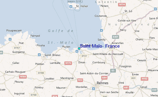