
| Distance / Altitude | Location | Report Date / Time | Live Weather | Wind | Gusts | Temp. | Visibility | Cloud |
|---|---|---|---|---|---|---|---|---|
| 61 km ENE / 48 m | ST Lawrence- Nfld (Canada) | 2026-07-26 06:30 local (2026/07/26 09:00 GMT) | no report | light winds from the SW (14 km/h at 220) | 12°C | - | - | |
| 71 km NNE / 60 m | Sagona Island- Nfld (Canada) | 2026-07-26 07:30 local (2026/07/26 10:00 GMT) | no report | moderate winds from the SSW (22 km/h at 200) | 11°C | - | - | |
| 71 km NNE / 13 m | Sagona Island Airport (Newfoundland) | 2026-07-26 06:30 local (2026/07/26 09:00 GMT) | - | light winds from the ESE (9 km/h at 110) | — | 0.0 | ||
| 113 km S / 430 m | ST Pierre-France Airport (Newfoundland) | 2026-07-26 07:00 local (2026/07/26 09:30 GMT) | - | calm (4 km/h at 1) | — | 0.0 | ||
| 122 km N / 1 m | Saint Albans (Canada) | 2026-07-26 07:30 local (2026/07/26 10:00 GMT) | no report | wind obs. (7 kph from 290 degs) was rejected (- km/h at -) | 11°C | - | - - - | |
| 134 km ENE / 27 m | Marticot Island- Nfld (Canada) | 2026-07-26 07:30 local (2026/07/26 10:00 GMT) | no report | light winds from the SW (11 km/h at 220) | 9°C | - | - - - | |
| 143 km WNW / 11 m | Burgeo (Canada) | 2026-07-26 06:30 local (2026/07/26 09:00 GMT) | no report | wind obs. (14 kph from 80 degs) was rejected (- km/h at -) | 13°C | - | - - - | |
| 168 km S / 15 m | SHIP2940 (Marine) | 2026-07-26 05:30 local (2026/07/26 08:00 GMT) | - (- km/h at -) | — | - km | |||
| 168 km S / 3 m | SHIP292 (Marine) | 2026-07-26 05:30 local (2026/07/26 08:00 GMT) | - (- km/h at -) | 12°C | - | |||
| 168 km S / 3 m | SHIP1206 (Marine) | 2026-07-26 05:30 local (2026/07/26 08:00 GMT) | - (- km/h at -) | 12°C | - |
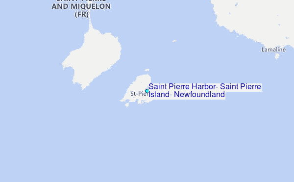
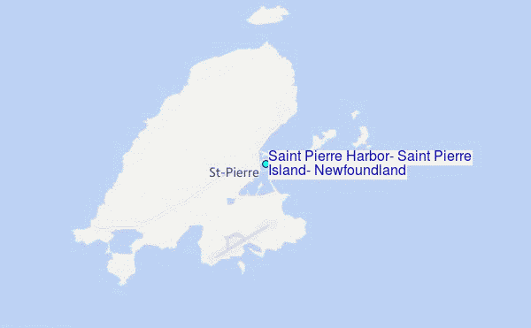
Choose Saint Pierre Harbor, Saint Pierre Island, Newfoundland Location Map Zoom:
| Contours: | Roads & Rivers: | Select a
tide station / surf break / city |
Use this relief map to navigate to tide stations, surf breaks and cities that are in the area of Saint Pierre Harbor, Saint Pierre Island, Newfoundland.
Other Nearby Locations' tide tables and tide charts to Saint Pierre Harbor, Saint Pierre Island, Newfoundland:
click location name for more details
 Surf breaks close to Saint Pierre Harbor, Saint Pierre Island, Newfoundland:
|
||
|---|---|---|
| Closest surf break | Kennington Cove | 196 mi |
| Second closest surf break | Ingonish Beach | 200 mi |
| Third closest surf break | Michaud Point | 232 mi |
| Fourth closest surf break | Martinique | 367 mi |
| Fifth closest surf break | Lawrencetown Left Point | 376 mi |


 Nearest
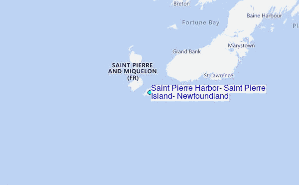