
| Distance / Altitude | Location | Report Date / Time | Live Weather | Wind | Gusts | Temp. | Visibility | Cloud |
|---|---|---|---|---|---|---|---|---|
| 9 km S / 218 m | Saipan International Airport (Micronesia) | 2026-07-07 17:54 local (2026/07/07 07:54 GMT) | - | fresh winds from the SE (31 km/h at 140) | 28°C | 0.0 | ||
| 10 km WNW / 3 m | Tanapag Buoy- Saipan (Marine) | 2026-07-07 20:00 local (2026/07/07 10:00 GMT) | - (- km/h at -) | 29°C | - | |||
| 201 km S / 217 m | Mariana/Andersen Airport (Guam) | 2026-07-07 19:40 local (2026/07/07 09:40 GMT) | Dry and cloudy | fresh winds from the SSE (31 km/h at 160) | 28°C | 16 | overcast | |
| 214 km S / 36 m | Tamuning (Guam) | 2026-07-07 20:18 local (2026/07/07 10:18 GMT) | dry | light winds from the S (14 km/h at 173) | 28°C | - | - - 0 | |
| 220 km S / 3 m | BUOY-PGBP7 (Marine) | 2026-07-07 19:48 local (2026/07/07 09:48 GMT) | moderate winds from the S (21 km/h at 180) | — | - | |||
| 226 km S / 3 m | BUOY-APRP7 (Marine) | 2026-07-07 19:48 local (2026/07/07 09:48 GMT) | light winds from the S (13 km/h at 170) | 28°C | - | |||
| 227 km S / 218 m | Agana- Guam Airport (Guam) | 2026-07-07 18:54 local (2026/07/07 08:54 GMT) | Dry and partly cloudy | moderate winds from the SSE (22 km/h at 150) | 28°C | 16 | broken | |
| 227 km S / 73 m | Windward Hills wx (Guam) | 2026-07-07 20:12 local (2026/07/07 10:12 GMT) | dry | light winds from the SSW (8 km/h at 202) | 27°C | - | - - 0 | |
| 229 km SSW / 15 m | SHIP2592 (Marine) | 2026-07-07 18:00 local (2026/07/07 08:00 GMT) | - (- km/h at -) | — | - km | |||
| 229 km SSW / 3 m | SHIP4854 (Marine) | 2026-07-07 18:00 local (2026/07/07 08:00 GMT) | - (- km/h at -) | 27°C | - |
| Contours: | Roads & Rivers: | Select a
tide station / surf break / city |
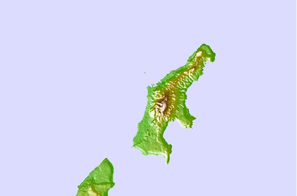
Use this relief map to navigate to tide stations, surf breaks and cities that are in the area of Saipan Harbor, Saipan Island.
Other Nearby Locations' tide tables and tide charts to Saipan Harbor, Saipan Island:
click location name for more details
 Surf breaks close to Saipan Harbor, Saipan Island:
|
||
|---|---|---|
| Closest surf break | Tank Beach | 7 mi |
| Second closest surf break | Bird Island | 9 mi |
| Third closest surf break | Ricks Reef | 134 mi |
| Fourth closest surf break | Boat Basin Lefts | 135 mi |
| Fifth closest surf break | Boat Basin Rights | 135 mi |


 Nearest