
| Distance / Altitude | Location | Report Date / Time | Live Weather | Wind | Gusts | Temp. | Visibility | Cloud |
|---|---|---|---|---|---|---|---|---|
| 2 km WSW / 203 m | San Jose Airport (Guatemala) | 2026-07-09 12:00 local (2026/07/09 18:00 GMT) | Dry and partly cloudy | light winds from the E (7 km/h at 90) | 25°C | 10.0 | scattered broken | |
| 78 km NNE / 1470 m | Guatemala/La Aurora Airport (Guatemala) | 2026-07-09 12:00 local (2026/07/09 18:00 GMT) | Dry and partly cloudy | fresh winds from the N (30 km/h at 360) | 25°C | 10.0 | few broken | |
| 80 km ESE / 452 m | Acajutla/Sonsonate Airport (El Salvador) | 2026-07-09 11:50 local (2026/07/09 17:50 GMT) | - | light winds from the S (15 km/h at 180) | 35°C | 10.0 | few | |
| 82 km NNE / 1725 m | El Palmar (Mexico) | 2026-07-09 12:05 local (2026/07/09 18:05 GMT) | dry | light winds from the ENE (6 km/h at 65) | 22°C | - | - - 0 | |
| 83 km NNE / 1500 m | Guatemala (Guatemala) | 2026-07-09 13:29 local (2026/07/09 19:29 GMT) | - | calm (0 km/h at 113) | 26°C | - | - - 0 | |
| 117 km ENE / 850 m | La Esperanza Airport (Honduras) | 2026-07-09 12:00 local (2026/07/09 18:00 GMT) | Dry and partly cloudy | light winds from the NE (19 km/h at 50) | 23°C | 10.0 | broken | |
| 117 km WNW / 367 m | Retalhuleu Airport/ (Guatemala) | 2026-07-09 13:00 local (2026/07/09 19:00 GMT) | Dry and partly cloudy | light winds from the SSE (11 km/h at 160) | 35°C | 10.0 | broken | |
| 123 km WNW / 1410 m | Guatemala (Guatemala) | 2026-07-09 13:25 local (2026/07/09 19:25 GMT) | dry | calm (0 km/h at 194) | 22°C | - | - - 0 | |
| 124 km WNW / 1400 m | Guatemala (Guatemala) | 2026-07-09 13:00 local (2026/07/09 19:00 GMT) | dry | calm (0 km/h at 5) | 22°C | - | - - 0 | |
| 124 km WNW / 950 m | Guatemala (Guatemala) | 2026-07-09 13:24 local (2026/07/09 19:24 GMT) | dry | calm (0 km/h at 67) | — | - | - - 0 |
| Contours: | Roads & Rivers: | Select a
tide station / surf break / city |
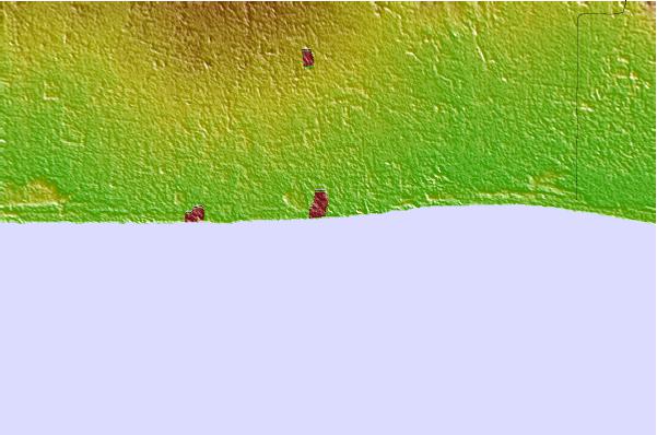
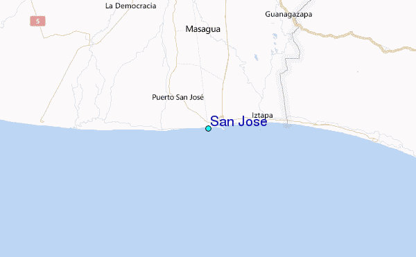
Use this relief map to navigate to tide stations, surf breaks and cities that are in the area of San Jose.
Other Nearby Locations' tide tables and tide charts to San Jose:
click location name for more details
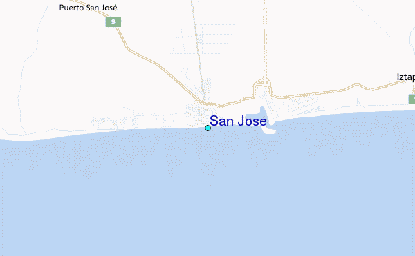
 Surf breaks close to San Jose:
|
||
|---|---|---|
| Closest surf break | Puerto San Jose | 0 mi |
| Second closest surf break | Chulamar | 4 mi |
| Third closest surf break | La Barra | 6 mi |
| Fourth closest surf break | La Barrita | 6 mi |
| Fifth closest surf break | Iztapa | 7 mi |


 Nearest
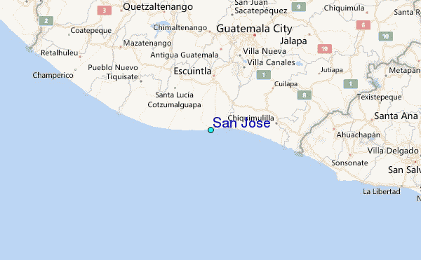