
| Distance / Altitude | Location | Report Date / Time | Live Weather | Wind | Gusts | Temp. | Visibility | Cloud |
|---|---|---|---|---|---|---|---|---|
| 160 km S / 271 m | São Tomé International Airport (Sao Tome/principe) | 2026-07-09 23:00 local (2026/07/09 23:00 GMT) | Dry and partly cloudy | calm (4 km/h at 180) | 25°C | 10.0 | scattered broken | |
| 258 km ESE / 218 m | Libreville/Leon M'Ba Airport (Gabon) | 2026-07-10 00:00 local (2026/07/10 00:00 GMT) | no report | wind obs. (7 kph from 140 degs) was rejected (- km/h at -) | 25°C | 10 | scattered - - | |
| 267 km E / 560 m | Bata (Rio Muni) (Equatorial Guinea) | 2026-07-10 00:00 local (2026/07/10 00:00 GMT) | no report | light winds from the S (15 km/h at 180) | 29°C | 8 | - | |
| 267 km E / 554 m | Bata Airport (Equatorial Guinea) | 2026-07-09 23:00 local (2026/07/09 23:00 GMT) | Dry and partly cloudy | light winds from the SSE (15 km/h at 150) | 25°C | 10.0 | scattered | |
| 278 km NNE / 611 m | Malabo/Fernando Poo Airport (Equatorial Guinea) | 2026-07-10 00:00 local (2026/07/10 00:00 GMT) | - | light winds from the SW (11 km/h at 220) | — | 10 | scattered - - | |
| 298 km SSE / 33 m | Port Gentil (Gabon) | 2026-07-10 00:00 local (2026/07/10 00:00 GMT) | - | light winds from the SSW (19 km/h at 200) | — | 8 | few broken - | |
| 298 km SSE / 33 m | Port Gentil Airport (Gabon) | 2026-07-10 00:00 local (2026/07/10 00:00 GMT) | - | light winds from the SSW (19 km/h at 200) | — | 8 | few broken - | |
| 364 km NE / 1 m | lightning 12km WSW of Dibombari (Cameroon) | 2026-07-09 23:51 local (2026/07/09 23:51 GMT) | Thunderstorm | (- km/h at -) | — | |||
| 366 km NE / 209 m | Douala Airport (Cameroon) | 2026-07-09 23:00 local (2026/07/09 23:00 GMT) | Thunderstorm - | calm (4 km/h at 1) | 25°C | 6.0 | scattered broken few | |
| 366 km NE / 209 m | Douala Airport (Cameroon) | 2026-07-09 23:00 local (2026/07/09 23:00 GMT) | Thunderstorm - | calm (4 km/h at 1) | 25°C | 6.0 | scattered broken few |
| Contours: | Roads & Rivers: | Select a
tide station / surf break / city |
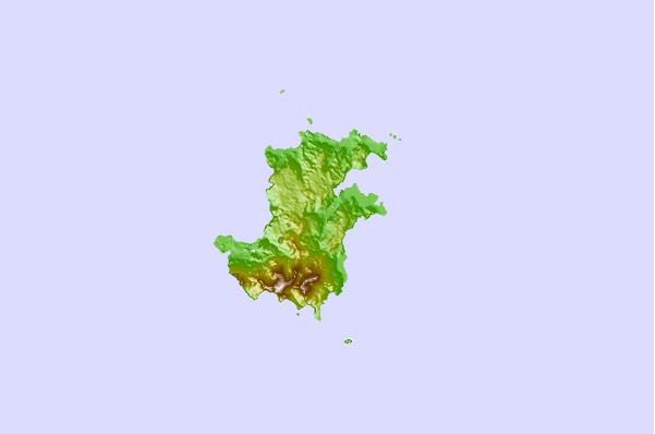
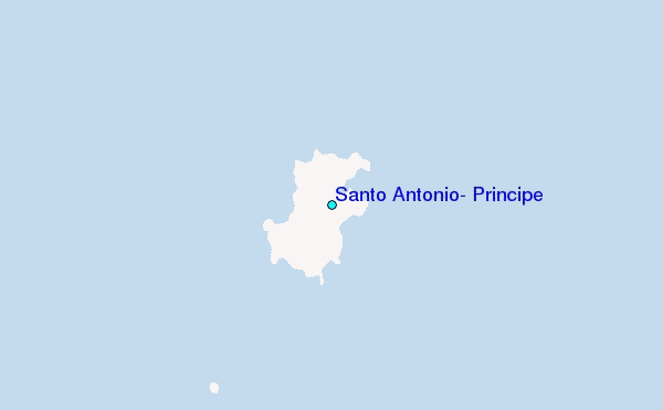
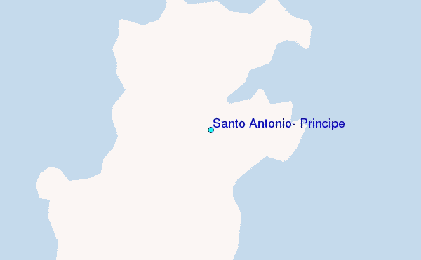
Use this relief map to navigate to tide stations, surf breaks and cities that are in the area of Santo Antonio, Principe.
Other Nearby Locations' tide tables and tide charts to Santo Antonio, Principe:
click location name for more details
 Surf breaks close to Santo Antonio, Principe:
|
||
|---|---|---|
| Closest surf break | Ferme aux Crocos | 152 mi |
| Second closest surf break | Ngombe | 160 mi |
| Third closest surf break | Gueque | 162 mi |
| Fourth closest surf break | Palplanche | 180 mi |
| Fifth closest surf break | Cap Lopez | 180 mi |


 Nearest