
| Distance / Altitude | Location | Report Date / Time | Live Weather | Wind | Gusts | Temp. | Visibility | Cloud |
|---|---|---|---|---|---|---|---|---|
| 82 km WNW / 646 m | Sao Jose Dos Campos (Aero) (Brazil) | 2026-07-09 18:00 local (2026/07/09 21:00 GMT) | Dry and partly cloudy | calm (0 km/h at 0) | 21°C | 7.0 | no significant cloud - - | |
| 87 km N / 586 m | Taubate Airport (base) (Brazil) | 2026-07-09 17:00 local (2026/07/09 20:00 GMT) | - | light winds from the NNE (6 km/h at 20) | — | 0.0 | ||
| 91 km WSW / 331 m | Santos Air Force Base Airport (Brazil) | 2026-07-09 17:00 local (2026/07/09 20:00 GMT) | - | wind obs. (9 kph from 140 degs) was rejected (- km/h at -) | — | 0.0 | ||
| 93 km WSW / 1 m | Vicente de Carvalho wx (Brazil) | 2026-07-09 16:20 local (2026/07/09 19:20 GMT) | dry | wind obs. (11 kph from 140 degs) was rejected (- km/h at -) | 20°C | - | - - 0 | |
| 95 km WSW / 2 m | Santos wx (Brazil) | 2026-07-09 16:19 local (2026/07/09 19:19 GMT) | dry | calm (2 km/h at 45) | 19°C | - | - - 0 | |
| 118 km W / 709 m | Guarulhos Airport (Brazil) | 2026-07-09 17:00 local (2026/07/09 20:00 GMT) | Haze - | light winds from the SE (9 km/h at 130) | 21°C | 5.0 | no significant cloud | |
| 118 km N / 375 m | Guaratingueta Military Base (Brazil) | 2026-07-09 17:00 local (2026/07/09 20:00 GMT) | Dry and partly cloudy | wind obs. (6 kph from 30 degs) was rejected (- km/h at -) | — | 0.0 | few overcast overcast | |
| 120 km N / 1582 m | Campos DO Jordao (86872 -0) (Brazil) | 2026-07-09 16:00 local (2026/07/09 19:00 GMT) | - | wind obs. (7 kph from 340 degs) was rejected (- km/h at -) | — | - | - - - | |
| 127 km WSW / 776 m | Sao Paulo (Brazil) | 2026-07-09 16:46 local (2026/07/09 19:46 GMT) | dry | calm (2 km/h at 22) | 23°C | - | - - 0 | |
| 128 km WSW / 703 m | São Paulo Congonhas Airport (Brazil) | 2026-07-09 17:00 local (2026/07/09 20:00 GMT) | Dry and partly cloudy | calm (4 km/h at 20) | — | 0.0 | broken broken broken |
| Contours: | Roads & Rivers: | Select a
tide station / surf break / city |
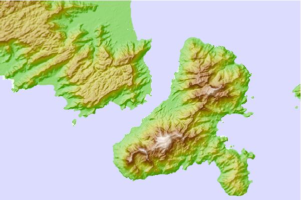
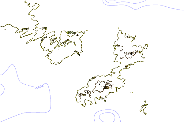
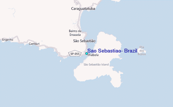
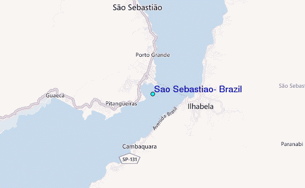
Use this relief map to navigate to tide stations, surf breaks and cities that are in the area of Sao Sebastiao, Brazil.
Other Nearby Locations' tide tables and tide charts to Sao Sebastiao, Brazil:
click location name for more details
 Surf breaks close to Sao Sebastiao, Brazil:
|
||
|---|---|---|
| Closest surf break | Praia do Guaeca | 4 mi |
| Second closest surf break | Praia dos Castelhanos (Ilha Bela) | 7 mi |
| Third closest surf break | Bonete (Ilha Bela) | 8 mi |
| Fourth closest surf break | Canto Bravo (Ilha Bela) | 8 mi |
| Fifth closest surf break | Maresias | 9 mi |


 Nearest
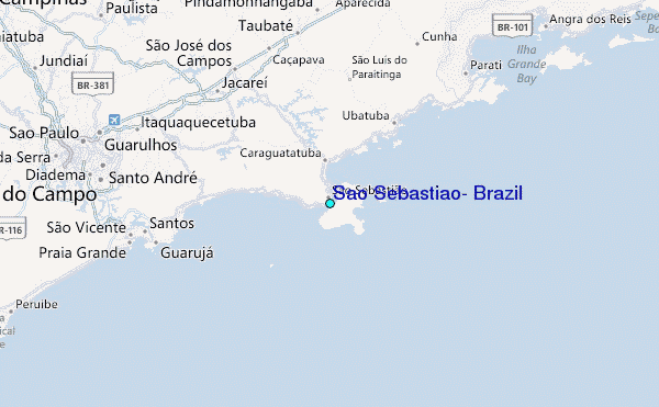