
| Distance / Altitude | Location | Report Date / Time | Live Weather | Wind | Gusts | Temp. | Visibility | Cloud |
|---|---|---|---|---|---|---|---|---|
| 11 km SSW / 5 m | Eyrarbakki (Iceland) | 2026-07-02 03:00 local (2026/07/02 03:00 GMT) | no report | wind obs. (17 kph from 140 degs) was rejected (- km/h at -) | 9°C | - | - | |
| 21 km N / 101 m | Selfoss (Israel) | 2026-07-02 01:10 local (2026/07/02 01:10 GMT) | dry | light winds from the S (14 km/h at 171) | 7°C | - | - - 0 | |
| 44 km W / 139 m | Kopavogur (Israel) | 2026-07-02 02:35 local (2026/07/02 02:35 GMT) | dry | light winds from the SW (13 km/h at 224) | 7°C | - | - - 0 | |
| 47 km W / 23 m | Kópavogur wx (Iceland) | 2026-07-02 01:28 local (2026/07/02 01:28 GMT) | - | - (- km/h at ) | 7°C | - | - - 0 | |
| 48 km W / 216 m | Reykjavik Airport (Iceland) | 2026-07-02 02:00 local (2026/07/02 02:00 GMT) | Dry and partly cloudy | moderate winds from the SW (28 km/h at 230) | 8°C | 10.0 | scattered | |
| 49 km W / 53 m | Reykjavik Airport (Iceland) | 2026-07-02 03:00 local (2026/07/02 03:00 GMT) | no report | wind obs. (9 kph from 110 degs) was rejected (- km/h at -) | 9°C | - | - - - | |
| 69 km SSE / 124 m | Vestmannaeyjar Lighthouse (Iceland) | 2026-07-02 03:00 local (2026/07/02 03:00 GMT) | no report | wind obs. (20 kph from 120 degs) was rejected (- km/h at -) | 8°C | - | - | |
| 78 km WSW / 54 m | Keflavíkurflugvöllir (Iceland) | 2026-07-02 03:00 local (2026/07/02 03:00 GMT) | rain | - (- km/h at -) | — | 25 | - | |
| 79 km WSW / 218 m | Keflavik Airport (Iceland) | 2026-07-02 02:30 local (2026/07/02 02:30 GMT) | Dry and partly cloudy | moderate winds from the SW (26 km/h at 230) | 8°C | 10.0 | broken broken | |
| 80 km WSW / 15 m | Skotdeild Keflavikur (Iceland) | 2026-07-02 03:00 local (2026/07/02 03:00 GMT) | - | near gales from the SW (52 km/h at 233) | — | - | - - 0 |
| Contours: | Roads & Rivers: | Select a
tide station / surf break / city |
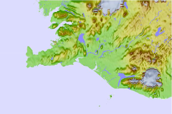
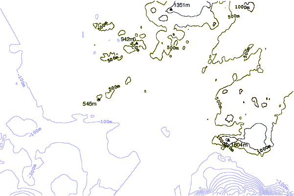
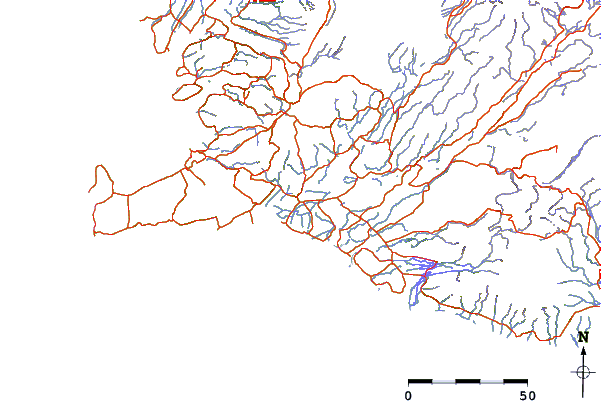
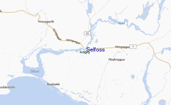
Use this relief map to navigate to tide stations, surf breaks and cities that are in the area of Selfoss.
Other Nearby Locations' tide tables and tide charts to Selfoss:
click location name for more details
 Surf breaks close to Selfoss:
|
||
|---|---|---|
| Closest surf break | Þorlákshöfn or Porlackshofn | 12 mi |
| Second closest surf break | Hafnarfjordur | 32 mi |
| Third closest surf break | Grotta | 35 mi |
| Fourth closest surf break | Grindavik Lighthouse ( Hopsnesta) | 44 mi |
| Fifth closest surf break | Grindavik Antenas | 45 mi |


 Nearest
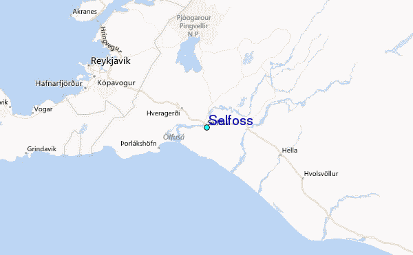