
| Distance / Altitude | Location | Report Date / Time | Live Weather | Wind | Gusts | Temp. | Visibility | Cloud |
|---|---|---|---|---|---|---|---|---|
| 19 km SW / 36 m | Bogalusa Carr Field (Louisiana) | 2026-06-08 19:35 local (2026/06/09 00:35 GMT) | Clear | light winds from the S (11 km/h at 170) | 28°C | 16 | ||
| 30 km SSE / 58 m | Caesar wx (United States) | 2026-06-08 20:33 local (2026/06/09 01:33 GMT) | dry | calm (0 km/h at 144) | 24°C | - | - - 0 | |
| 48 km NE / 83 m | Lamar Pines Mobile Home Community wx (United States) | 2026-06-08 20:22 local (2026/06/09 01:22 GMT) | dry | calm (0 km/h at 104) | 26°C | - | - - 0 | |
| 50 km NW / 81 m | Columbia-Marion County Airport (Mississippi) (Mississippi) | 2026-06-08 19:35 local (2026/06/09 00:35 GMT) | Clear | calm (0 km/h at 0) | 28°C | 16 | ||
| 54 km ESE / 79 m | Perry wx (United States) | 2026-06-08 20:30 local (2026/06/09 01:30 GMT) | dry | calm (0 km/h at 263) | 24°C | - | - - 0 | |
| 56 km NNE / 110 m | Hattiesburg (Mississippi) | 2026-06-08 20:42 local (2026/06/09 01:42 GMT) | dry | calm (0 km/h at 90) | 24°C | - | - - 0 | |
| 59 km SSE / 391 m | Bay St Louis Airport (Mississippi) | 2026-06-08 18:50 local (2026/06/08 23:50 GMT) | Clear | light winds from the SE (9 km/h at 140) | 27°C | 16 | ||
| 60 km NE / 219 m | Hattiesburg Airport (Mississippi) | 2026-06-08 18:53 local (2026/06/08 23:53 GMT) | Clear | light winds from the S (9 km/h at 180) | 28°C | 16 | ||
| 61 km S / 6 m | Noth Forest wx (United States) | 2026-06-08 20:05 local (2026/06/09 01:05 GMT) | dry | calm (0 km/h at 0) | 26°C | - | - - 0 | |
| 63 km S / 5 m | Slidell (Louisiana) | 2026-06-08 20:05 local (2026/06/09 01:05 GMT) | dry | calm (0 km/h at 98) | 27°C | - | - - 0 |
Choose Shell Beach, Lake Borgne, Louisiana (sub) Location Map Zoom:
| Contours: | Roads & Rivers: | Select a
tide station / surf break / city |
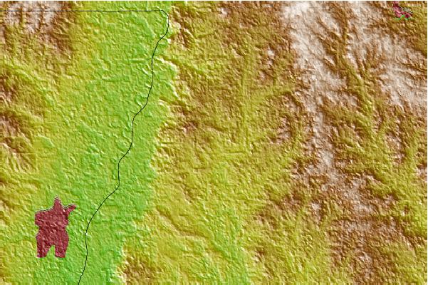
Use this relief map to navigate to tide stations, surf breaks and cities that are in the area of Shell Beach, Lake Borgne, Louisiana (sub).
Other Nearby Locations' tide tables and tide charts to Shell Beach, Lake Borgne, Louisiana (sub):
click location name for more details
 Surf breaks close to Shell Beach, Lake Borgne, Louisiana (sub):
|
||
|---|---|---|
| Closest surf break | Chandeleur Islands | 86 mi |
| Second closest surf break | Dauphin Island Pier | 104 mi |
| Third closest surf break | West Pass | 123 mi |
| Fourth closest surf break | Terry s Cove | 131 mi |
| Fifth closest surf break | Alabama Point | 132 mi |


 Nearest