
| Distance / Altitude | Location | Report Date / Time | Live Weather | Wind | Gusts | Temp. | Visibility | Cloud |
|---|---|---|---|---|---|---|---|---|
| 40 km SSW / 38 m | Hang Nadim Airport (Indonesia) | 2026-07-10 02:30 local (2026/07/09 18:30 GMT) | Dry and partly cloudy | calm (4 km/h at 200) | 24°C | 10.0 | few scattered few | |
| 45 km WSW / 15 m | SHIP2277 (Marine) | 2026-07-10 02:00 local (2026/07/09 18:00 GMT) | - (- km/h at -) | — | - km | |||
| 48 km WSW / 218 m | Singapore-Changi Airport (Singapore) | 2026-07-10 03:00 local (2026/07/09 19:00 GMT) | no report | light winds from the SSE (13 km/h at 160) | 30°C | 10.0 | few broken - | |
| 48 km SSE / 18 m | Raja Haji Fisabilillah International Airport (Indonesia) | 2026-07-10 02:30 local (2026/07/09 18:30 GMT) | Dry and partly cloudy | calm (2 km/h at 1) | 25°C | 10.0 | few broken broken | |
| 54 km WSW / 171 m | Paya Lebar Airport (Singapore) | 2026-07-10 02:00 local (2026/07/09 18:00 GMT) | Dry and partly cloudy | light winds from the S (6 km/h at 180) | 27°C | 10.0 | few broken | |
| 45 km WSW / 3 m | SHIP5186 (Marine) | 2026-07-10 02:00 local (2026/07/09 18:00 GMT) | - (- km/h at -) | 28°C | - | |||
| 45 km NE / 3 m | SHIP4911 (Marine) | 2026-07-10 03:00 local (2026/07/09 19:00 GMT) | - (- km/h at -) | 28°C | - | |||
| 45 km WSW / 15 m | SHIP6439 (Marine) | 2026-07-10 02:00 local (2026/07/09 18:00 GMT) | - (- km/h at -) | — | - km | |||
| 45 km NE / 15 m | SHIP5842 (Marine) | 2026-07-10 03:00 local (2026/07/09 19:00 GMT) | - (- km/h at -) | — | - km | |||
| 47 km SW / 15 m | SHIP1765 (Marine) | 2026-07-10 02:00 local (2026/07/09 18:00 GMT) | - (- km/h at -) | — | - km |
| Contours: | Roads & Rivers: | Select a
tide station / surf break / city |
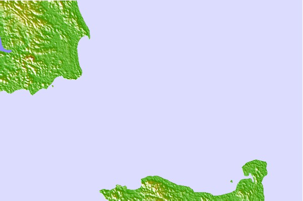
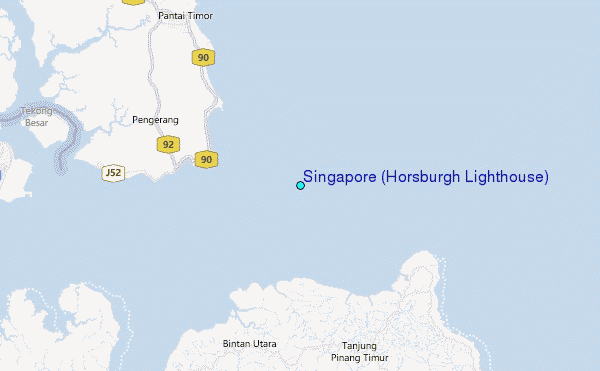
Use this relief map to navigate to tide stations, surf breaks and cities that are in the area of Singapore (Horsburgh Lighthouse).
Other Nearby Locations' tide tables and tide charts to Singapore (Horsburgh Lighthouse):
click location name for more details
 Surf breaks close to Singapore (Horsburgh Lighthouse):
|
||
|---|---|---|
| Closest surf break | Tioman Island | 101 mi |
| Second closest surf break | Cherating | 205 mi |
| Third closest surf break | Kijal | 218 mi |
| Fourth closest surf break | Kelulut (Marang) | 277 mi |
| Fifth closest surf break | Batu Buruk | 289 mi |


 Nearest
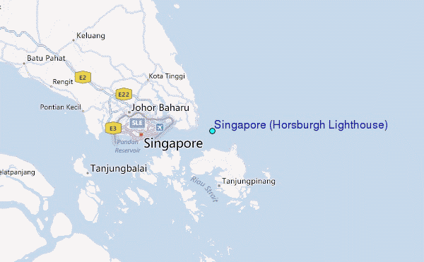