
| Distance / Altitude | Location | Report Date / Time | Live Weather | Wind | Gusts | Temp. | Visibility | Cloud |
|---|---|---|---|---|---|---|---|---|
| 34 km ENE / 20 m | Syamsudin Noor International Airport (Indonesia) | 2026-07-10 03:30 local (2026/07/09 19:30 GMT) | Light rain | calm (2 km/h at 360) | 22°C | 5.0 | scattered | |
| 370 km NE / 3 m | Sepinggan Airport (Indonesia) | 2026-07-10 03:30 local (2026/07/09 19:30 GMT) | Dry and partly cloudy | moderate winds from the WSW.(Wind varies from 200 to 330 degs) (22 km/h at 250) | 26°C | 10.0 | scattered - - | |
| 461 km S / 2 m | Juanda Airport (Indonesia) | 2026-07-10 03:30 local (2026/07/09 19:30 GMT) | Haze - | calm (4 km/h at 260) | 23°C | 4.0 | few | |
| 576 km S / 216 m | Bali International Airport (Indonesia) | 2026-07-10 03:30 local (2026/07/09 19:30 GMT) | Dry and partly cloudy | moderate winds from the SE (24 km/h at 130) | 26°C | 10.0 | scattered | |
| 585 km ESE / 217 m | Hasanuddin/Ujung Airport (Indonesia) | 2026-07-10 03:30 local (2026/07/09 19:30 GMT) | - | calm (4 km/h at 210) | 23°C | 8.0 | few | |
| 591 km SSW / 5 m | Ahmad Yani International Airport (Indonesia) | 2026-07-10 03:30 local (2026/07/09 19:30 GMT) | Dry and partly cloudy | calm (4 km/h at 1) | 24°C | 7.0 | broken | |
| 592 km SSW / 152 m | Bukitsari wx (Indonesia) | 2026-07-10 03:44 local (2026/07/09 19:44 GMT) | - | - (- km/h at ) | 27°C | - | - - 0 | |
| 592 km SSW / 152 m | Bukitsari wx (Indonesia) | 2026-07-10 04:07 local (2026/07/09 20:07 GMT) | - | - (- km/h at ) | 24°C | - | - - 0 | |
| 607 km SSE / 97 m | Bandara Airport (Indonesia) | 2026-07-10 03:30 local (2026/07/09 19:30 GMT) | - | calm (0 km/h at 0) | 19°C | 7.0 | few | |
| 632 km NW / 214 m | Simanggang Airport (Malaysia) | 2026-07-10 03:00 local (2026/07/09 19:00 GMT) | - | calm (4 km/h at 1) | 26°C |
| Contours: | Roads & Rivers: | Select a
tide station / surf break / city |
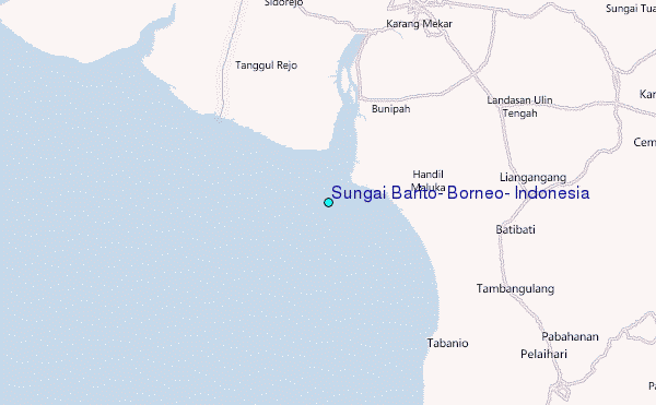
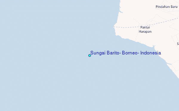
Use this relief map to navigate to tide stations, surf breaks and cities that are in the area of Sungai Barito, Borneo, Indonesia.
Other Nearby Locations' tide tables and tide charts to Sungai Barito, Borneo, Indonesia:
click location name for more details
 Surf breaks close to Sungai Barito, Borneo, Indonesia:
|
||
|---|---|---|
| Closest surf break | Medewi | 337 mi |
| Second closest surf break | Balian | 343 mi |
| Third closest surf break | Gili Air-Pertama | 349 mi |
| Fourth closest surf break | Tanjung Kucur | 350 mi |
| Fifth closest surf break | Padangbai | 351 mi |


 Nearest
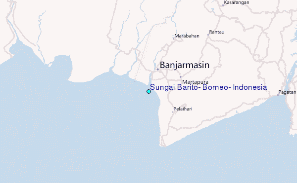