
| Distance / Altitude | Location | Report Date / Time | Live Weather | Wind | Gusts | Temp. | Visibility | Cloud |
|---|---|---|---|---|---|---|---|---|
| 92 km SSW / 3 m | Sepinggan Airport (Indonesia) | 2026-07-10 05:30 local (2026/07/09 21:30 GMT) | Dry and partly cloudy | wind obs. (11 kph from 250 degs) was rejected (- km/h at -) | 25°C | 9.0 | scattered - - | |
| 430 km SSW / 20 m | Syamsudin Noor International Airport (Indonesia) | 2026-07-10 05:30 local (2026/07/09 21:30 GMT) | Dry and cloudy | calm (2 km/h at 130) | 22°C | 7.0 | overcast | |
| 446 km N / 50 m | Juwata Airport (Indonesia) | 2026-07-10 05:30 local (2026/07/09 21:30 GMT) | - | light winds from the SSW (13 km/h at 210) | 28°C | 8.0 | few | |
| 530 km NNE / 0 m | lightning 58km S of Semporna (Malaysia) | 2026-07-10 04:19 local (2026/07/09 20:19 GMT) | Thunderstorm | (- km/h at -) | — | |||
| 533 km SSE / 217 m | Hasanuddin/Ujung Airport (Indonesia) | 2026-07-10 05:30 local (2026/07/09 21:30 GMT) | - | calm (4 km/h at 1) | 21°C | 8.0 | few | |
| 551 km N / 215 m | Tawau/Kalimantan Airport (Malaysia) | 2026-07-10 05:00 local (2026/07/09 21:00 GMT) | Dry and partly cloudy | calm (4 km/h at 1) | 24°C | 10.0 | few scattered | |
| 659 km WNW / 215 m | Bintulu Airport (Malaysia) | 2026-07-10 05:00 local (2026/07/09 21:00 GMT) | Dry and partly cloudy | wind obs. (7 kph from 100 degs) was rejected (- km/h at -) | 26°C | 10.0 | scattered | |
| 673 km SSE / 15 m | hy2c120E6S (Marine) | 2026-07-10 03:58 local (2026/07/09 19:58 GMT) | moderate winds from the ESE (24 km/h at 110) | — | - km | |||
| 680 km WNW / 213 m | Miri Airport (Malaysia) | 2026-07-10 05:00 local (2026/07/09 21:00 GMT) | Dry and partly cloudy | light winds from the S (6 km/h at 180) | 27°C | 10.0 | few scattered - | |
| 684 km NW / 215 m | Brunei International Airport (Malaysia) | 2026-07-10 05:30 local (2026/07/09 21:30 GMT) | Dry and partly cloudy | light winds from the SSW (6 km/h at 210) | 27°C | 10.0 | few broken |
| Contours: | Roads & Rivers: | Select a
tide station / surf break / city |
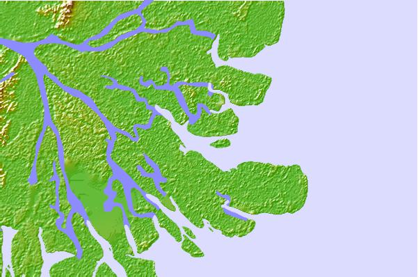
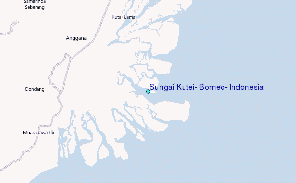
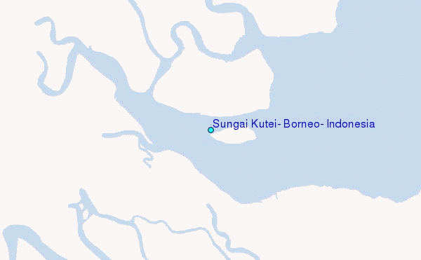
Use this relief map to navigate to tide stations, surf breaks and cities that are in the area of Sungai Kutei, Borneo, Indonesia.
Other Nearby Locations' tide tables and tide charts to Sungai Kutei, Borneo, Indonesia:
click location name for more details
 Surf breaks close to Sungai Kutei, Borneo, Indonesia:
|
||
|---|---|---|
| Closest surf break | Tanjung Batu | 431 mi |
| Second closest surf break | Berakas Beach | 432 mi |
| Third closest surf break | Tungku Beach or KM26 | 432 mi |
| Fourth closest surf break | Tanjung Aru Beach | 469 mi |
| Fifth closest surf break | Pulau Manukan | 473 mi |


 Nearest
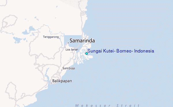