
| Distance / Altitude | Location | Report Date / Time | Live Weather | Wind | Gusts | Temp. | Visibility | Cloud |
|---|---|---|---|---|---|---|---|---|
| 29 km NW / 38 m | King Island Airport (Australia) | 2026-06-19 10:00 local (2026/06/19 00:00 GMT) | no report | light winds from the SSE (9 km/h at 160) | 6°C | - | - | |
| 86 km SE / 87 m | Cape Grim (Australia) | 2026-06-19 11:00 local (2026/06/19 01:00 GMT) | no report | wind obs. (11 kph from 180 degs) was rejected (- km/h at -) | 8°C | - | - - - | |
| 123 km SE / 9 m | Smithton Aerodrome (Australia) | 2026-06-19 10:00 local (2026/06/19 00:00 GMT) | no report | light winds from the S (9 km/h at 180) | 3°C | - | - | |
| 147 km NW / 83 m | Cape Otway Lighthouse (Australia) | 2026-06-19 11:00 local (2026/06/19 01:00 GMT) | no report | wind obs. (13 kph from 40 degs) was rejected (- km/h at -) | 9°C | - | - - - | |
| 151 km SE / 344 m | Luncheon Hill (Forestry) (Australia) | 2026-06-19 11:00 local (2026/06/19 01:00 GMT) | no report | light winds from the SSE (9 km/h at 150) | 5°C | - | - - - | |
| 177 km ESE / 12 m | Burnie Airport (Wynyard) (Australia) | 2026-06-19 11:00 local (2026/06/19 01:00 GMT) | no report | wind obs. (11 kph from 260 degs) was rejected (- km/h at -) | 4°C | - | - - - | |
| 186 km N / 95 m | Aireys Inlet (Australia) | 2026-06-19 11:00 local (2026/06/19 01:00 GMT) | no report | calm (2 km/h at 110) | 10°C | - | - - - | |
| 187 km NNE / 15 m | SHIP6239 (Marine) | 2026-06-19 09:00 local (2026/06/18 23:00 GMT) | strong winds from the N (50.4 km/h at 360) | 15°C | - km | |||
| 187 km NNE / 15 m | SHIP2947 (Marine) | 2026-06-19 09:00 local (2026/06/18 23:00 GMT) | strong winds from the N (50.4 km/h at 360) | 15°C | - km | |||
| 187 km NNE / 15 m | SHIP4901 (Marine) | 2026-06-19 09:00 local (2026/06/18 23:00 GMT) | strong winds from the N (50.4 km/h at 360) | 15°C | - km |
| Contours: | Roads & Rivers: | Select a
tide station / surf break / city |
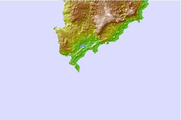
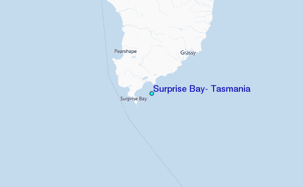
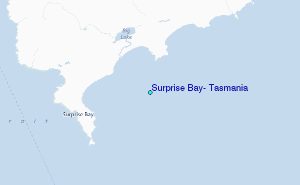
Use this relief map to navigate to tide stations, surf breaks and cities that are in the area of Surprise Bay, Tasmania.
Other Nearby Locations' tide tables and tide charts to Surprise Bay, Tasmania:
click location name for more details
 Surf breaks close to Surprise Bay, Tasmania:
|
||
|---|---|---|
| Closest surf break | King Island - Narracoopa Beach | 19 mi |
| Second closest surf break | Greens Point Beach | 64 mi |
| Third closest surf break | Mount Cameron | 64 mi |
| Fourth closest surf break | Lighthouse Beach | 65 mi |
| Fifth closest surf break | Nettley Bay Point | 65 mi |


 Nearest
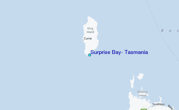