
| Distance / Altitude | Location | Report Date / Time | Live Weather | Wind | Gusts | Temp. | Visibility | Cloud |
|---|---|---|---|---|---|---|---|---|
| 20 km SE / 3 m | BUOY-CDRF1 (Marine) | 2026-05-23 13:00 local (2026/05/23 17:00 GMT) | light winds from the SSE (17 km/h at 150) | 27°C | - | |||
| 21 km SE / 3 m | BUOY-CKYF1 (Marine) | 2026-05-23 12:48 local (2026/05/23 16:48 GMT) | light winds from the SSE (18 km/h at 160) | — | - | |||
| 25 km ESE / 13 m | lightning 27km S of Chiefland (United States) | 2026-05-23 10:31 local (2026/05/23 14:31 GMT) | Thunderstorm | (- km/h at -) | — | |||
| 30 km N / 219 m | Cross City Airport (Florida) | 2026-05-23 12:35 local (2026/05/23 16:35 GMT) | Clear | light winds from the SSE (13 km/h at 150) | 30°C | 16 | ||
| 47 km SSE / 0 m | lightning 38km WSW of Inglis (United States) | 2026-05-23 10:48 local (2026/05/23 14:48 GMT) | Thunderstorm | (- km/h at -) | — | |||
| 48 km ENE / 30 m | lightning 7km SSW of Bronson (United States) | 2026-05-23 10:45 local (2026/05/23 14:45 GMT) | Thunderstorm | (- km/h at -) | — | |||
| 49 km E / 14 m | lightning 11km W of Williston Highlands (United States) | 2026-05-23 10:45 local (2026/05/23 14:45 GMT) | Thunderstorm | (- km/h at -) | — | |||
| 59 km S / 0 m | lightning 41km W of Homosassa (United States) | 2026-05-23 10:48 local (2026/05/23 14:48 GMT) | Thunderstorm | (- km/h at -) | — | |||
| 67 km E / 23 m | Williston Municipal Airport (Florida) (Florida) | 2026-05-23 12:15 local (2026/05/23 16:15 GMT) | Dry and partly cloudy | wind obs. (6 kph from 40 degs) was rejected (- km/h at -) | 25°C | 11 | broken | |
| 73 km SE / 3 m | Crystal River Airport (Florida) (Florida) | 2026-05-23 12:35 local (2026/05/23 16:35 GMT) | Dry and partly cloudy | light winds from the SSE (7 km/h at 150) | 26°C | 11 | scattered scattered broken |
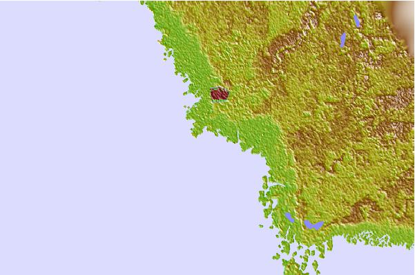
| Contours: | Roads & Rivers: | Select a
tide station / surf break / city |

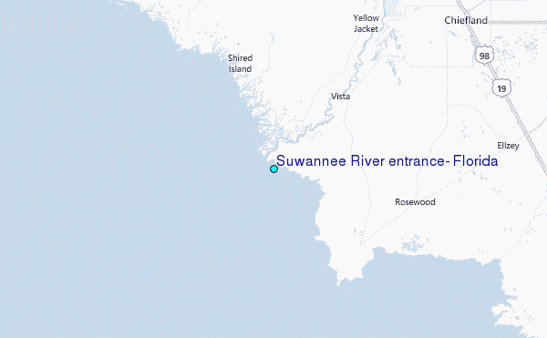
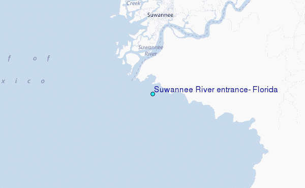
Use this relief map to navigate to tide stations, surf breaks and cities that are in the area of Suwannee River entrance, Florida.
Other Nearby Locations' tide tables and tide charts to Suwannee River entrance, Florida:
click location name for more details
 Surf breaks close to Suwannee River entrance, Florida:
|
||
|---|---|---|
| Closest surf break | Anclote Island | 78 mi |
| Second closest surf break | Honeymoon Island | 83 mi |
| Third closest surf break | Clearwater Pass | 93 mi |
| Fourth closest surf break | Sand Key Park | 94 mi |
| Fifth closest surf break | Clearwater Beach | 94 mi |


 Nearest
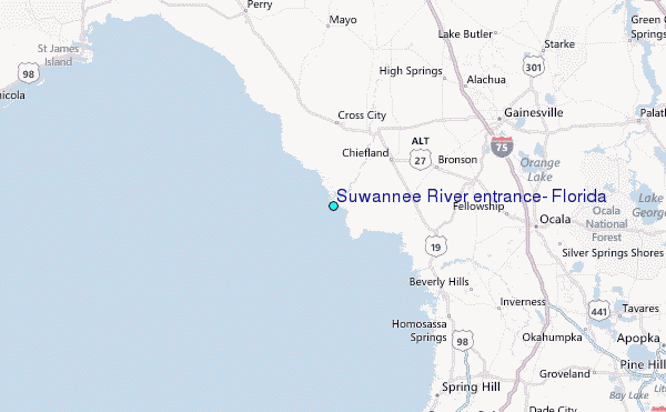