
| Distance / Altitude | Location | Report Date / Time | Live Weather | Wind | Gusts | Temp. | Visibility | Cloud |
|---|---|---|---|---|---|---|---|---|
| 3 km WNW / 275 m | Tampico/General Francisco Javier Mina International Airpor Airport (Mexico) | 2026-07-09 14:48 local (2026/07/09 20:48 GMT) | Dry and partly cloudy | light winds from the N (11 km/h at 350) | 29°C | 8 | few scattered broken | |
| 26 km N / 11 m | El Ensayo wx (Mexico) | 2026-07-09 14:02 local (2026/07/09 20:02 GMT) | dry | moderate winds from the E (21 km/h at 86) | 27°C | - | - - 0 | |
| 172 km NW / 21 m | Soto LA Marina- Tamps. (Mexico) | 2026-07-09 15:00 local (2026/07/09 21:00 GMT) | no report | wind obs. (18 kph from 330 degs) was rejected (- km/h at -) | 26°C | 2000 | - - - | |
| 198 km SSE / 283 m | Poca Rica New Airport (Mexico) | 2026-07-09 15:43 local (2026/07/09 21:43 GMT) | Dry and cloudy | calm (0 km/h at 0) | 28°C | 10 | few overcast | |
| 199 km WNW / 189 m | Ciudad Victoria Airport (Mexico) | 2026-07-09 15:40 local (2026/07/09 21:40 GMT) | Dry and partly cloudy | light winds from the E (19 km/h at 100) | 31°C | 16 | scattered broken | |
| 223 km SW / 1945 m | lightning 27km W of Jalpan (Mexico) | 2026-07-09 16:19 local (2026/07/09 22:19 GMT) | Thunderstorm | (- km/h at -) | — | |||
| 246 km S / 2214 m | Tulancingo (Mexico) | 2026-07-09 15:00 local (2026/07/09 21:00 GMT) | no report | calm (4 km/h at 140) | 16°C | 3000 | - - - | |
| 248 km S / 2181 m | Tulancingo (Mexico) | 2026-07-09 15:41 local (2026/07/09 21:41 GMT) | - | light winds from the NE (9 km/h at 40) | — | 11 | few - - | |
| 252 km S / 2067 m | lightning 5km N of Zacatlan (Mexico) | 2026-07-09 15:46 local (2026/07/09 21:46 GMT) | Thunderstorm | (- km/h at -) | — | |||
| 267 km S / 2075 m | lightning 8km N of Tetepango (Mexico) | 2026-07-09 16:19 local (2026/07/09 22:19 GMT) | Thunderstorm | (- km/h at -) | — |
| Contours: | Roads & Rivers: | Select a
tide station / surf break / city |
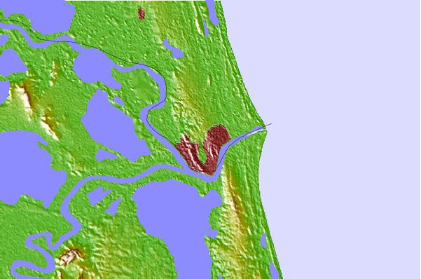
Use this relief map to navigate to tide stations, surf breaks and cities that are in the area of Tampico, Veracruz, Mexico.
Other Nearby Locations' tide tables and tide charts to Tampico, Veracruz, Mexico:
click location name for more details
 Surf breaks close to Tampico, Veracruz, Mexico:
|
||
|---|---|---|
| Closest surf break | Boca Chica | 268 mi |
| Second closest surf break | Cove | 269 mi |
| Third closest surf break | South Padre Island | 269 mi |
| Fourth closest surf break | Port Isabel | 272 mi |
| Fifth closest surf break | Port Mansfield Jetty | 301 mi |


 Nearest