
| Distance / Altitude | Location | Report Date / Time | Live Weather | Wind | Gusts | Temp. | Visibility | Cloud |
|---|---|---|---|---|---|---|---|---|
| 65 km SSE / 101 m | Pamijen Lor wx (Indonesia) | 2026-07-10 02:26 local (2026/07/09 19:26 GMT) | - | - (- km/h at ) | 24°C | - | - - 0 | |
| 94 km ESE / 2039 m | Dieng Kulon wx (Indonesia) | 2026-07-10 02:22 local (2026/07/09 19:22 GMT) | - | wind obs. (32 kph from 92 degs) was rejected (- km/h at -) | — | - | - - 0 | |
| 121 km ESE / 1394 m | Gunungmalang wx (Indonesia) | 2026-07-10 02:07 local (2026/07/09 19:07 GMT) | dry | calm (2 km/h at 17) | 15°C | - | - - 0 | |
| 140 km E / 5 m | Ahmad Yani International Airport (Indonesia) | 2026-07-10 01:30 local (2026/07/09 18:30 GMT) | Dry and partly cloudy | light winds from the ESE.(Wind varies from 090 to 150 degs) (7 km/h at 120) | 25°C | 8.0 | no cloud | |
| 145 km E / 152 m | Bukitsari wx (Indonesia) | 2026-07-10 02:44 local (2026/07/09 19:44 GMT) | - | - (- km/h at ) | 27°C | - | - - 0 | |
| 145 km E / 152 m | Bukitsari wx (Indonesia) | 2026-07-10 02:47 local (2026/07/09 19:47 GMT) | - | - (- km/h at ) | 24°C | - | - - 0 | |
| 171 km WSW / 796 m | Srigunting wx (Indonesia) | 2026-07-10 01:46 local (2026/07/09 18:46 GMT) | - | light winds from the SE (14 km/h at 127) | 25°C | - | - - 0 | |
| 174 km WSW / 820 m | Kalidam wx (Indonesia) | 2026-07-10 02:10 local (2026/07/09 19:10 GMT) | - | calm (0 km/h at 0) | — | - | - - 0 | |
| 241 km WSW / 481 m | Genteng wx (Indonesia) | 2026-07-10 02:34 local (2026/07/09 19:34 GMT) | - | calm (0 km/h at 0) | — | - | - - 0 | |
| 257 km W / 25 m | Halim Perdanakus Airport (Indonesia) | 2026-07-10 01:00 local (2026/07/09 18:00 GMT) | - | wind obs. (6 kph from 250 degs) was rejected (- km/h at -) | 24°C | 7.0 | few |
| Contours: | Roads & Rivers: | Select a
tide station / surf break / city |
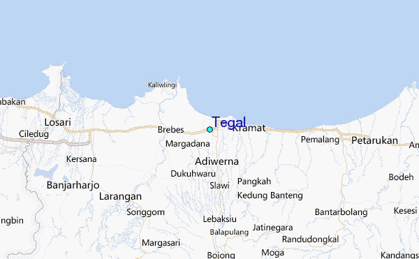
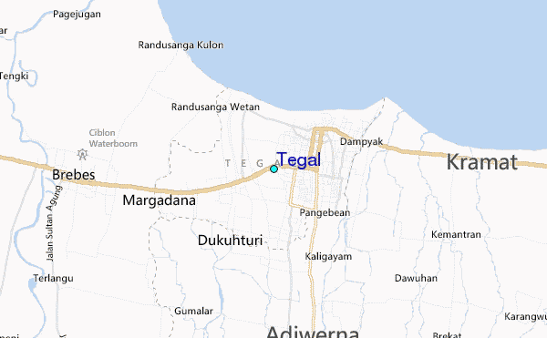
Use this relief map to navigate to tide stations, surf breaks and cities that are in the area of Tegal.
Other Nearby Locations' tide tables and tide charts to Tegal:
click location name for more details
 Surf breaks close to Tegal:
|
||
|---|---|---|
| Closest surf break | Karang Nini | 63 mi |
| Second closest surf break | Batu Mandi | 67 mi |
| Third closest surf break | Batu Hiu | 70 mi |
| Fourth closest surf break | Batu Karas | 75 mi |
| Fifth closest surf break | Keusik Luhur | 78 mi |


 Nearest
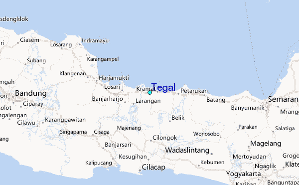