
| Distance / Altitude | Location | Report Date / Time | Live Weather | Wind | Gusts | Temp. | Visibility | Cloud |
|---|---|---|---|---|---|---|---|---|
| 4 km SW / 1 m | Jolly Roger Travel Park wx (United States) | 2026-07-27 04:01 local (2026/07/27 08:01 GMT) | dry | wind obs. (6 kph from 9 degs) was rejected (- km/h at -) | 29°C | - | - - 0 | |
| 9 km NE / 3 m | BUOY-LONF1 (Marine) | 2026-07-27 05:50 local (2026/07/27 09:50 GMT) | calm (5 km/h at 340) | 29°C | - | |||
| 13 km SW / 5 m | Marathon (Florida) | 2026-07-27 06:11 local (2026/07/27 10:11 GMT) | dry | calm (5 km/h at 337) | 29°C | - | - - 0 | |
| 14 km SW / 217 m | Marathon Airport (Florida) | 2026-07-27 05:39 local (2026/07/27 09:39 GMT) | Thunderstorm - in the vicinity | light winds from the WNW (6 km/h at 290) | 29°C | 16 | few | |
| 15 km SW / 2 m | Castle Rock (Colorado) | 2026-07-27 05:36 local (2026/07/27 09:36 GMT) | dry | light winds from the WNW (8 km/h at 285) | 30°C | - | - - 0 | |
| 18 km SSW / 0 m | lightning 9km ESE of Marathon (United States) | 2026-07-27 06:31 local (2026/07/27 10:31 GMT) | Thunderstorm | (- km/h at -) | — | |||
| 20 km SW / 3 m | BUOY-VCAF1 (Marine) | 2026-07-27 05:48 local (2026/07/27 09:48 GMT) | light winds from the NW (9 km/h at 320) | 30°C | - | |||
| 21 km ENE / 1 m | Marathon (Florida) | 2026-07-27 05:49 local (2026/07/27 09:49 GMT) | dry | - (- km/h at ) | — | - | - - 0 | |
| 24 km NE / 3 m | BUOY-PKYF1 (Marine) | 2026-07-27 05:00 local (2026/07/27 09:00 GMT) | - (- km/h at -) | — | - | |||
| 24 km NNE / 3 m | BUOY-LRKF1 (Marine) | 2026-07-27 05:00 local (2026/07/27 09:00 GMT) | - (- km/h at -) | — | - |
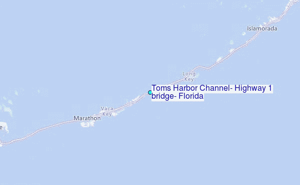
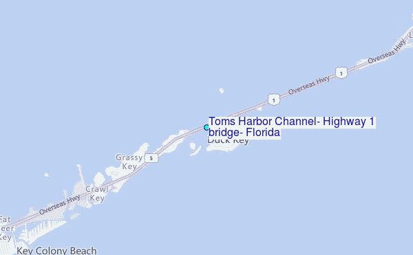
Choose Toms Harbor Channel, Highway 1 bridge, Florida Location Map Zoom:
| Contours: | Roads & Rivers: | Select a
tide station / surf break / city |

Use this relief map to navigate to tide stations, surf breaks and cities that are in the area of Toms Harbor Channel, Highway 1 bridge, Florida.
Other Nearby Locations' tide tables and tide charts to Toms Harbor Channel, Highway 1 bridge, Florida:
click location name for more details
 Surf breaks close to Toms Harbor Channel, Highway 1 bridge, Florida:
|
||
|---|---|---|
| Closest surf break | South Beach (Miami) | 85 mi |
| Second closest surf break | Fifth Street (Miami) | 85 mi |
| Third closest surf break | 21st Street (Miami) | 86 mi |
| Fourth closest surf break | Dunes Hotel (Miami) | 88 mi |
| Fifth closest surf break | Harbor House | 93 mi |


 Nearest
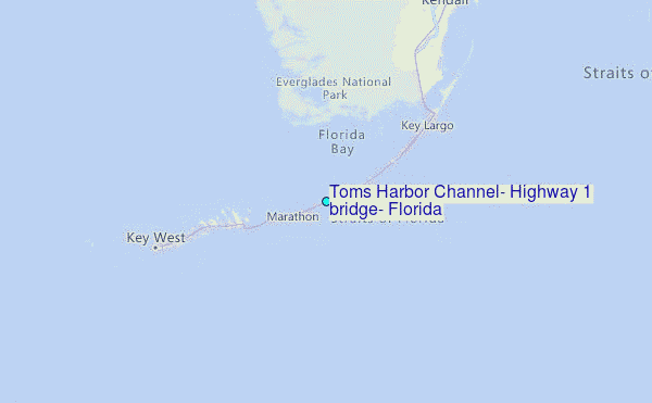