
| Distance / Altitude | Location | Report Date / Time | Live Weather | Wind | Gusts | Temp. | Visibility | Cloud |
|---|---|---|---|---|---|---|---|---|
| 433 km SSW / 192 m | Pohnpei Airport (Micronesia) | 2026-07-10 05:57 local (2026/07/09 17:57 GMT) | Dry and cloudy | calm (0 km/h at 0) | 26°C | 24 | broken overcast overcast | |
| 752 km E / 215 m | Kwajalein/buchol Airport (Marshall Islands) | 2026-07-10 06:40 local (2026/07/09 18:40 GMT) | Clear | light winds from the S (9 km/h at 190) | 28°C | 16 | scattered scattered broken | |
| 752 km E / 3 m | BUOY-KWJP8 (Marine) | 2026-07-10 07:00 local (2026/07/09 19:00 GMT) | - (- km/h at -) | — | - | |||
| 945 km S / 7 m | Cassidy International Airport (Kiribati) | 2026-07-10 06:00 local (2026/07/09 18:00 GMT) | Dry and partly cloudy | calm (4 km/h at 1) | 29°C | 10.0 | scattered | |
| 973 km W / 0 m | lightning (Micronesia) | 2026-07-10 05:03 local (2026/07/09 17:03 GMT) | Thunderstorm | (- km/h at -) | — | |||
| 1035 km SW / 211 m | Weno Island/Chuuk International Airport (Micronesia) | 2026-07-10 05:51 local (2026/07/09 17:51 GMT) | Dry and cloudy | light winds from the NNE (13 km/h at 30) | 29°C | 24 | few scattered overcast | |
| 1165 km ESE / 208 m | Majuro Atoll Airport (Marshall Islands) | 2026-07-10 05:50 local (2026/07/09 17:50 GMT) | Dry and partly cloudy | light winds from the W (9 km/h at 270) | 28°C | 24 | few scattered broken | |
| 1185 km ESE / 3 m | Kalo- Majuro- Marshall Islands (Marine) | 2026-07-10 06:30 local (2026/07/09 18:30 GMT) | - (- km/h at -) | 26°C | - | |||
| 1206 km ESE / 3 m | BUOY-52216 (Marine) | 2026-07-10 07:00 local (2026/07/09 19:00 GMT) | - (- km/h at -) | 27°C | - | |||
| 1217 km NNE / 3 m | BUOY-WAKP8 (Marine) | 2026-07-10 07:00 local (2026/07/09 19:00 GMT) | light winds from the ESE (13 km/h at 110) | 28°C | - |
| Contours: | Roads & Rivers: | Select a
tide station / surf break / city |
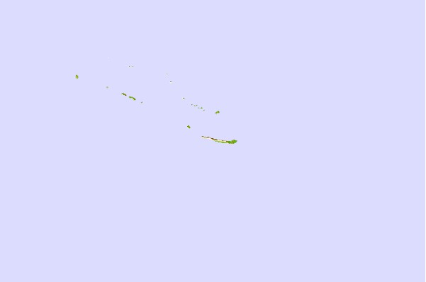
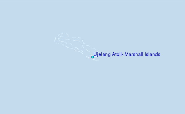
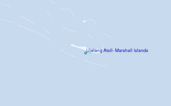
Use this relief map to navigate to tide stations, surf breaks and cities that are in the area of Ujelang Atoll, Marshall Islands.
Other Nearby Locations' tide tables and tide charts to Ujelang Atoll, Marshall Islands:
click location name for more details
 Surf breaks close to Ujelang Atoll, Marshall Islands:
|
||
|---|---|---|
| Closest surf break | Sidedish | 335 mi |
| Second closest surf break | Walung | 335 mi |
| Third closest surf break | Naa | 998 mi |
| Fourth closest surf break | Simberi Island | 1055 mi |
| Fifth closest surf break | Bird Island | 1090 mi |


 Nearest