
| Distance / Altitude | Location | Report Date / Time | Live Weather | Wind | Gusts | Temp. | Visibility | Cloud |
|---|---|---|---|---|---|---|---|---|
| 178 km SW / 3 m | BUOY-52214 (Marine) | 2026-07-10 04:00 local (2026/07/09 19:00 GMT) | - (- km/h at -) | — | - | |||
| 194 km SW / 205 m | Yap Island Airport (Micronesia) | 2026-07-10 02:51 local (2026/07/09 17:51 GMT) | Dry and partly cloudy | light winds from the N (7 km/h at 1) | 27°C | 19 | few scattered broken | |
| 321 km NW / 0 m | lightning (Palau) | 2026-07-10 04:49 local (2026/07/09 19:49 GMT) | Thunderstorm | (- km/h at -) | — | |||
| 543 km ENE / 0 m | lightning 124km SSW of Merizo (Guam) | 2026-07-10 02:04 local (2026/07/09 17:04 GMT) | Thunderstorm | (- km/h at -) | — | |||
| 646 km NE / 15 m | SHIP6966 (Marine) | 2026-07-10 02:00 local (2026/07/09 17:00 GMT) | - (- km/h at -) | — | - km | |||
| 645 km NE / 15 m | SHIP1850 (Marine) | 2026-07-10 04:00 local (2026/07/09 19:00 GMT) | - (- km/h at -) | — | - km | |||
| 645 km NE / 3 m | SHIP6206 (Marine) | 2026-07-10 02:00 local (2026/07/09 17:00 GMT) | - (- km/h at -) | 28°C | - | |||
| 645 km NE / 15 m | SHIP3206 (Marine) | 2026-07-10 03:00 local (2026/07/09 18:00 GMT) | - (- km/h at -) | — | - km | |||
| 645 km NE / 3 m | SHIP4743 (Marine) | 2026-07-10 04:00 local (2026/07/09 19:00 GMT) | - (- km/h at -) | 26°C | - | |||
| 645 km NE / 15 m | SHIP7519 (Marine) | 2026-07-10 02:00 local (2026/07/09 17:00 GMT) | - (- km/h at -) | — | - km |
| Contours: | Roads & Rivers: | Select a
tide station / surf break / city |
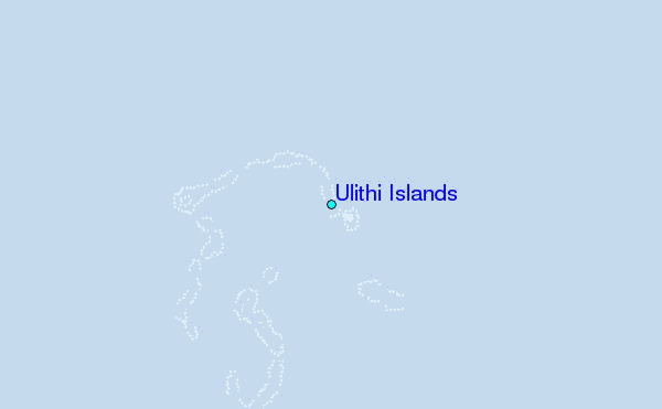
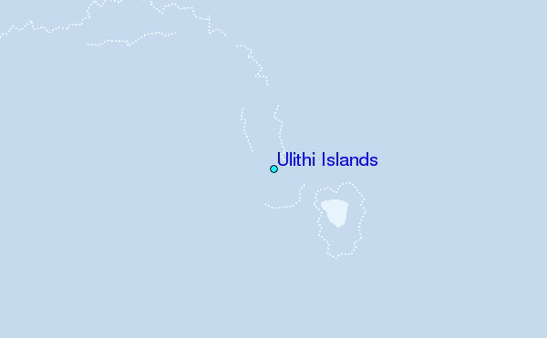
Use this relief map to navigate to tide stations, surf breaks and cities that are in the area of Ulithi Islands.
Other Nearby Locations' tide tables and tide charts to Ulithi Islands:
click location name for more details
 Surf breaks close to Ulithi Islands:
|
||
|---|---|---|
| Closest surf break | Melekeok (Babelthuap) | 392 mi |
| Second closest surf break | Threes | 400 mi |
| Third closest surf break | Tubeys/Point Death | 400 mi |
| Fourth closest surf break | Umatac | 400 mi |
| Fifth closest surf break | Point Perfection | 401 mi |


 Nearest