
| Distance / Altitude | Location | Report Date / Time | Live Weather | Wind | Gusts | Temp. | Visibility | Cloud |
|---|---|---|---|---|---|---|---|---|
| 6 km NNE / 217 m | Wallops Island Airport (Virginia) | 2026-06-23 17:36 local (2026/06/23 21:36 GMT) | - | light winds from the N (17 km/h at 10) | 22°C | 0.0 | ||
| 35 km S / 3 m | BUOY-WAHV2 (Marine) | 2026-06-23 18:00 local (2026/06/23 22:00 GMT) | light winds from the NNE (9 km/h at 20) | 22°C | - | |||
| 36 km SSE / 0 m | lightning 39km E of Onancock (United States) | 2026-06-23 17:33 local (2026/06/23 21:33 GMT) | Thunderstorm | (- km/h at -) | — | |||
| 37 km SSW / 217 m | Melfa/Accomack County Airport (Virginia) | 2026-06-23 17:35 local (2026/06/23 21:35 GMT) | Light rain | light winds from the NNE (15 km/h at 20) | 21°C | 11 | overcast | |
| 38 km NE / 0 m | lightning 21km E of Snow Hill (United States) | 2026-06-23 16:17 local (2026/06/23 20:17 GMT) | Thunderstorm | (- km/h at -) | — | |||
| 43 km NE / 0 m | lightning 19km SE of Berlin (United States) | 2026-06-23 16:17 local (2026/06/23 20:17 GMT) | Thunderstorm | (- km/h at -) | — | |||
| 47 km S / 0 m | lightning 36km E of Exmore (United States) | 2026-06-23 18:32 local (2026/06/23 22:32 GMT) | Thunderstorm | (- km/h at -) | — | |||
| 50 km N / 218 m | Salisbury Airport (Maryland) | 2026-06-23 17:01 local (2026/06/23 21:01 GMT) | Light rain | light winds from the N (19 km/h at 350) | 21°C | 16 | broken broken overcast | |
| 53 km SW / 0 m | lightning 28km ENE of Kilmarnock (United States) | 2026-06-23 16:16 local (2026/06/23 20:16 GMT) | Thunderstorm | (- km/h at -) | — | |||
| 58 km NE / 217 m | Ocean City Airport (Maryland) | 2026-06-23 17:39 local (2026/06/23 21:39 GMT) | Light rain | moderate winds from the NE (20 km/h at 40) | 21°C | 11 | broken overcast |
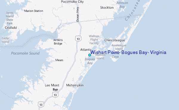
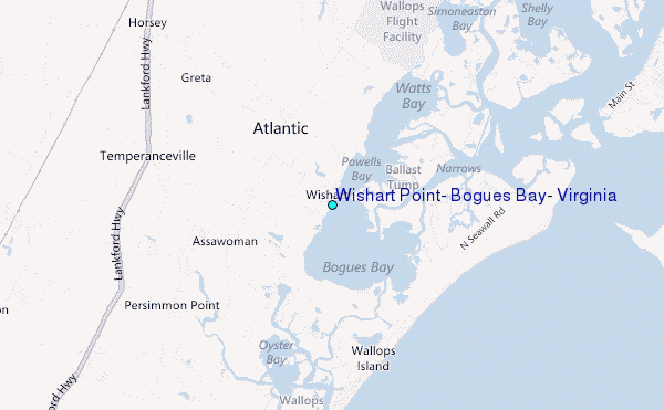
Choose Wishart Point, Bogues Bay, Virginia Location Map Zoom:
| Contours: | Roads & Rivers: | Select a
tide station / surf break / city |
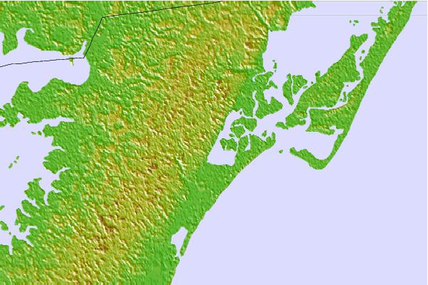
Use this relief map to navigate to tide stations, surf breaks and cities that are in the area of Wishart Point, Bogues Bay, Virginia.
Other Nearby Locations' tide tables and tide charts to Wishart Point, Bogues Bay, Virginia:
click location name for more details
 Surf breaks close to Wishart Point, Bogues Bay, Virginia:
|
||
|---|---|---|
| Closest surf break | Out Front | 8 mi |
| Second closest surf break | Chincoteague | 9 mi |
| Third closest surf break | Assateague | 30 mi |
| Fourth closest surf break | Outside Shoals | 36 mi |
| Fifth closest surf break | North Assateague (The Wedge) | 37 mi |


 Nearest
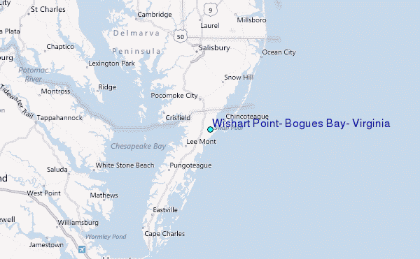