
| Distance / Altitude | Location | Report Date / Time | Live Weather | Wind | Gusts | Temp. | Visibility | Cloud |
|---|---|---|---|---|---|---|---|---|
| 15 km NW / 322 m | Pangnirtung Airport (N.w. Territories) | 2026-05-06 09:00 local (2026/05/06 13:00 GMT) | Dry and partly cloudy | fresh winds from the ENE.(Wind varies from 030 to 110 degs) (31 km/h at 60) | 8°C | 24 | broken broken | |
| 15 km NW / 23 m | Pangnirtung-NU (Canada) | 2026-05-06 08:00 local (2026/05/06 12:00 GMT) | - | calm (4 km/h at 130) | — | - | - no observation - | |
| 185 km NNE / 6 m | Qikiqtarjuaq Airport (Canada) | 2026-05-06 10:00 local (2026/05/06 14:00 GMT) | no report | calm (4 km/h at 20) | -1°C | - | - - - | |
| 188 km NNE / 707 m | Broughton Island Airport (N.w. Territories) | 2026-05-06 09:00 local (2026/05/06 13:00 GMT) | - | light winds from the ENE (6 km/h at 70) | -7°C | 24 | few few broken | |
| 287 km S / 217 m | Frobisher/Iqaluit Airport (N.w. Territories) | 2026-05-06 09:00 local (2026/05/06 13:00 GMT) | Dry and partly cloudy | strong winds from the ESE (43 km/h at 110) | 4°C | 48 | broken broken | |
| 288 km S / 34 m | Iqaluit (Canada) | 2026-05-06 10:00 local (2026/05/06 14:00 GMT) | no report | calm (4 km/h at 150) | 2°C | - | - | |
| 408 km S / 180 m | Lake Harbour Airport (N.w. Territories) | 2026-05-06 09:00 local (2026/05/06 13:00 GMT) | Dry and partly cloudy | fresh winds from the ENE (37 km/h at 70) | 4°C | 24 | broken broken broken | |
| 510 km NW / 217 m | Cylde Airport (N.w. Territories) | 2026-05-06 09:00 local (2026/05/06 13:00 GMT) | Dry and partly cloudy | light winds from the NNW (17 km/h at 340) | -10°C | 24 | few broken broken | |
| 512 km NW / 26 m | Cylde Airport (Canada) | 2026-05-06 10:00 local (2026/05/06 14:00 GMT) | - | light winds from the N (14 km/h at 350) | — | - | - - - | |
| 540 km ENE / 8 m | Mittarfik Sisimiut (Holsteinsborg Lufthavn) (Greenland) | 2026-05-06 10:00 local (2026/05/06 14:00 GMT) | continuous light drizzle | wind obs. (7 kph from 270 degs) was rejected (- km/h at -) | 3°C | 19 | - |
| Contours: | Roads & Rivers: | Select a
tide station / surf break / city |
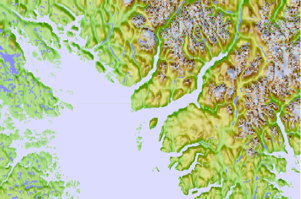
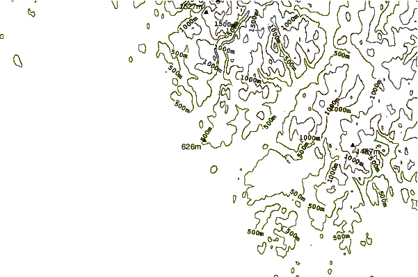
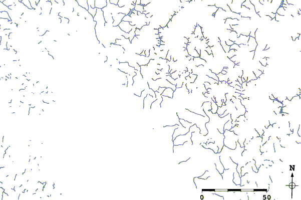
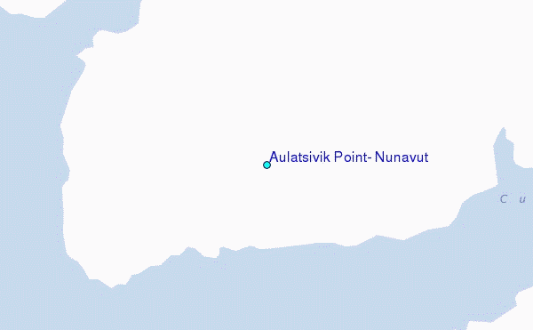
Use this relief map to navigate to tide stations, surf breaks and cities that are in the area of Aulatsivik Point, Nunavut.
Other Nearby Locations' tide tables and tide charts to Aulatsivik Point, Nunavut:
click location name for more details
 Surf breaks close to Aulatsivik Point, Nunavut:
|
||
|---|---|---|
| Closest surf break | Garur | 1235 mi |
| Second closest surf break | Hafnir | 1239 mi |
| Third closest surf break | Sandvik | 1245 mi |
| Fourth closest surf break | Grindavik Antenas | 1249 mi |
| Fifth closest surf break | Grindavik Lighthouse ( Hopsnesta) | 1250 mi |


 Nearest
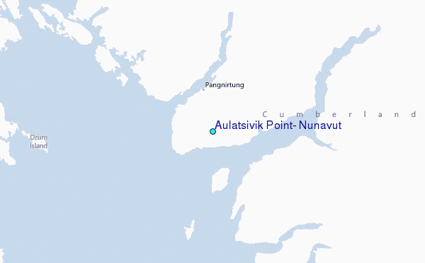