
| Distance / Altitude | Location | Report Date / Time | Live Weather | Wind | Gusts | Temp. | Visibility | Cloud |
|---|---|---|---|---|---|---|---|---|
| 38 km WNW / 217 m | Frobisher/Iqaluit Airport (N.w. Territories) | 2026-03-20 21:00 local (2026/03/21 00:00 GMT) | - | calm (4 km/h at 150) | -29°C | 48 | few few few | |
| 39 km WNW / 34 m | Iqaluit (Canada) | 2026-03-20 22:00 local (2026/03/21 01:00 GMT) | - | calm (4 km/h at 150) | — | - | - | |
| 316 km NNE / 23 m | Pangnirtung-NU (Canada) | 2026-03-20 22:00 local (2026/03/21 01:00 GMT) | - | calm (4 km/h at 130) | — | - | - no observation - | |
| 379 km SSW / 503 m | Parc National Des Pingualuit- Que (Canada) | 2026-03-20 22:00 local (2026/03/21 01:00 GMT) | - | wind obs. (22 kph from 240 degs) was rejected (- km/h at -) | — | - | - | |
| 425 km W / 217 m | Cape Dorset Airport (N.w. Territories) | 2026-03-20 21:00 local (2026/03/21 00:00 GMT) | Clear | light winds from the WSW (6 km/h at 250) | -23°C | 14 | ||
| 426 km W / 50 m | Cape Dorset Climate- NU (Canada) | 2026-03-20 22:00 local (2026/03/21 01:00 GMT) | - | moderate winds from the WSW (22 km/h at 250) | — | - | - - - | |
| 489 km NNE / 6 m | Qikiqtarjuaq Airport (Canada) | 2026-03-20 21:00 local (2026/03/21 00:00 GMT) | - | calm (4 km/h at 20) | — | - | - - - | |
| 493 km NNE / 707 m | Broughton Island Airport (N.w. Territories) | 2026-03-20 21:00 local (2026/03/21 00:00 GMT) | Clear | wind obs. (9 kph from 200 degs) was rejected (- km/h at -) | -28°C | 14 | ||
| 598 km S / 123 m | Kuujjuaq- Ua- Que (Canada) | 2026-03-20 22:00 local (2026/03/21 01:00 GMT) | - | - (- km/h at -) | — | - | - | |
| 600 km S / 216 m | Kuujjuaq Airport (Quebec) | 2026-03-20 21:00 local (2026/03/21 00:00 GMT) | - | light winds from the NNW (15 km/h at 340) | -23°C | 24 | few |
| Contours: | Roads & Rivers: | Select a
tide station / surf break / city |
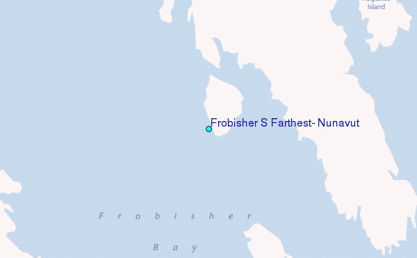
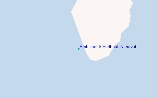
Use this relief map to navigate to tide stations, surf breaks and cities that are in the area of Frobisher S Farthest, Nunavut.
Other Nearby Locations' tide tables and tide charts to Frobisher S Farthest, Nunavut:
click location name for more details
 Surf breaks close to Frobisher S Farthest, Nunavut:
|
||
|---|---|---|
| Closest surf break | Ingonish Beach | 1201 mi |
| Second closest surf break | Marathon | 1235 mi |
| Third closest surf break | Kennington Cove | 1256 mi |
| Fourth closest surf break | Michaud Point | 1271 mi |
| Fifth closest surf break | Alona Bay | 1296 mi |


 Nearest
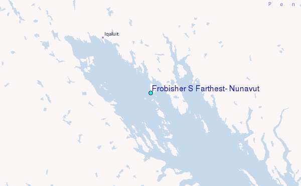