
| Distance / Altitude | Location | Report Date / Time | Live Weather | Wind | Gusts | Temp. | Visibility | Cloud |
|---|---|---|---|---|---|---|---|---|
| 156 km W / 78 m | Riohacha/Almirante Padilla Airport (Columbia) | 2025-12-25 03:00 local (2025/12/25 07:00 GMT) | - | calm (4 km/h at 110) | 24°C | |||
| 193 km SW / 95 m | Valledupar/Aeropuerto Alfonso López Pumarejo Airport (Columbia) | 2025-12-25 03:00 local (2025/12/25 07:00 GMT) | - | light winds from the ENE.(Wind varies from 040 to 110 degs) (11 km/h at 70) | — | 0.0 | ||
| 240 km NE / 169 m | Queen Beatrix Airport (Lesser Antilles) | 2025-12-25 03:00 local (2025/12/25 07:00 GMT) | - | light winds from the E (15 km/h at 80) | 26°C | 10.0 | ||
| 269 km ESE / 547 m | Barquisimeto Airport (Venezuela) | 2025-12-25 03:03 local (2025/12/25 07:03 GMT) | - | calm (2 km/h at 320) | — | 0.0 | - no observation - | |
| 286 km WSW / 3 m | SHIP5571 (Marine) | 2025-12-25 02:00 local (2025/12/25 06:00 GMT) | - (- km/h at -) | 27°C | - | |||
| 286 km WSW / 3 m | SHIP7523 (Marine) | 2025-12-25 02:00 local (2025/12/25 06:00 GMT) | - (- km/h at -) | 27°C | - | |||
| 286 km WSW / 3 m | SHIP2390 (Marine) | 2025-12-25 02:00 local (2025/12/25 06:00 GMT) | - (- km/h at -) | 27°C | - | |||
| 286 km WSW / 15 m | SHIP9218 (Marine) | 2025-12-25 02:00 local (2025/12/25 06:00 GMT) | - (- km/h at -) | — | - km | |||
| 286 km WSW / 15 m | SHIP5951 (Marine) | 2025-12-25 02:00 local (2025/12/25 06:00 GMT) | - (- km/h at -) | — | - km | |||
| 286 km WSW / 3 m | SHIP1401 (Marine) | 2025-12-25 02:00 local (2025/12/25 06:00 GMT) | - (- km/h at -) | 27°C | - |
| Contours: | Roads & Rivers: | Select a
tide station / surf break / city |
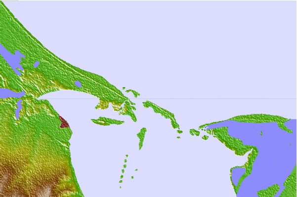
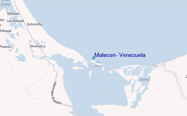
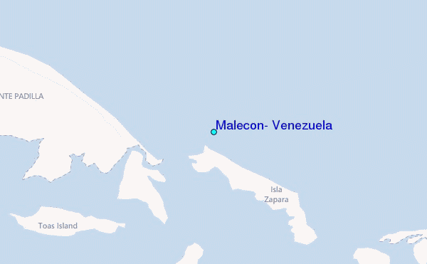
Use this relief map to navigate to tide stations, surf breaks and cities that are in the area of Malecon, Venezuela.
Other Nearby Locations' tide tables and tide charts to Malecon, Venezuela:
click location name for more details
 Surf breaks close to Malecon, Venezuela:
|
||
|---|---|---|
| Closest surf break | Cabo de la Vela | 93 mi |
| Second closest surf break | Playa Kasimesh | 93 mi |
| Third closest surf break | Dunas de Taroa | 100 mi |
| Fourth closest surf break | Punta Gallina | 101 mi |
| Fifth closest surf break | Palomino | 135 mi |


 Nearest
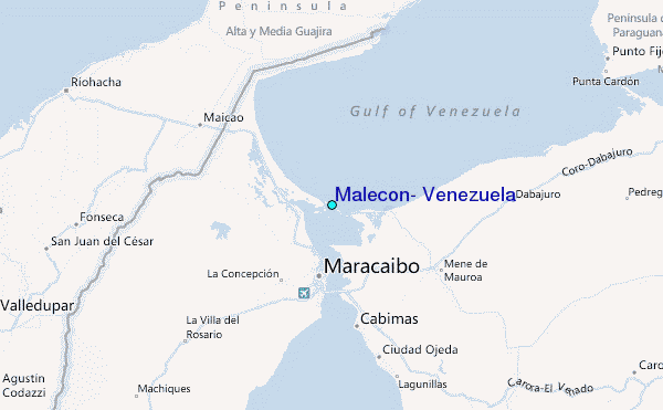