
| Distance / Altitude | Location | Report Date / Time | Live Weather | Wind | Gusts | Temp. | Visibility | Cloud |
|---|---|---|---|---|---|---|---|---|
| 50 km S / 384 m | Maracaibo/La Chinita Airport (Venezuela) | 2026-07-09 14:00 local (2026/07/09 18:00 GMT) | Dry and partly cloudy | calm (0 km/h at 110) | 33°C | 10.0 | broken | |
| 156 km W / 78 m | Riohacha/Almirante Padilla Airport (Columbia) | 2026-07-09 14:00 local (2026/07/09 18:00 GMT) | - | moderate winds from the ESE.(Wind varies from 080 to 140 degs) (26 km/h at 110) | 34°C | 10.0 | few | |
| 178 km ENE / 394 m | Paraguana/Josefa Camejo International Airport (Venezuela) | 2026-07-09 14:00 local (2026/07/09 18:00 GMT) | Dry and partly cloudy | moderate winds from the E (22 km/h at 90) | — | 10.0 | broken | |
| 193 km SW / 95 m | Valledupar/Aeropuerto Alfonso López Pumarejo Airport (Columbia) | 2026-07-09 14:00 local (2026/07/09 18:00 GMT) | Dry and partly cloudy | light winds from the S.(Wind varies from 120 to 220 degs) (11 km/h at 170) | 36°C | 10.0 | broken | |
| 214 km ENE / 384 m | Coro/Jose-Leonardo Chirinos Airport (Venezuela) | 2026-07-09 14:00 local (2026/07/09 18:00 GMT) | - | wind obs. (0 kph from 0 degs) was rejected (- km/h at -) | 34°C | 10.0 | few | |
| 239 km NE / 169 m | Queen Beatrix Airport (Lesser Antilles) | 2026-07-09 14:00 local (2026/07/09 18:00 GMT) | - | strong winds from the ESE.(Wind varies from 080 to 140 degs) (43 km/h at 110) | 32°C | 10.0 | few | |
| 269 km ESE / 547 m | Barquisimeto Airport (Venezuela) | 2026-07-09 14:00 local (2026/07/09 18:00 GMT) | Dry and partly cloudy | calm (0 km/h at 110) | 28°C | 10.0 | scattered broken - | |
| 288 km WSW / 96 m | Santa Marta/Simón Bolívar International Airport (Columbia) | 2026-07-09 14:00 local (2026/07/09 18:00 GMT) | Dry and partly cloudy | light winds from the SW.(Wind varies from 190 to 250 degs) (7 km/h at 230) | 31°C | 10.0 | few scattered | |
| 290 km WSW / 4 m | Gaira wx (Colombia) | 2026-07-09 15:44 local (2026/07/09 19:44 GMT) | dry | calm (3 km/h at 4) | 32°C | - | - - 0 | |
| 313 km ENE / 15 m | SHIP1747 (Marine) | 2026-07-09 14:00 local (2026/07/09 18:00 GMT) | - (- km/h at -) | — | - km |
| Contours: | Roads & Rivers: | Select a
tide station / surf break / city |
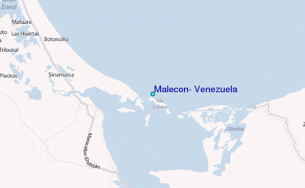
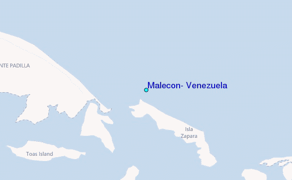
Use this relief map to navigate to tide stations, surf breaks and cities that are in the area of Malecon, Venezuela.
Other Nearby Locations' tide tables and tide charts to Malecon, Venezuela:
click location name for more details
 Surf breaks close to Malecon, Venezuela:
|
||
|---|---|---|
| Closest surf break | Cabo de la Vela | 93 mi |
| Second closest surf break | Playa Kasimesh | 93 mi |
| Third closest surf break | Dunas de Taroa | 100 mi |
| Fourth closest surf break | Punta Gallina | 101 mi |
| Fifth closest surf break | Palomino | 135 mi |


 Nearest
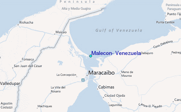